The Olympic Peninsula has been our home for the last couple of days, affording us the opportunity to continue our quest to visit all the NP’s in Washington. The last few days has been the second of the three – Olympic NP. Encompassing almost 1,500 square miles of the Olympic Peninsula, Olympic NP is made up of three distinct ecosystems – the rugged Pacific shore; temperate forest; and subalpine forest and wildflower meadows. Because of the park’s relatively unspoiled condition and outstanding scenery, the United Nations has declared Olympic both an international biosphere reserve and a World Heritage site.
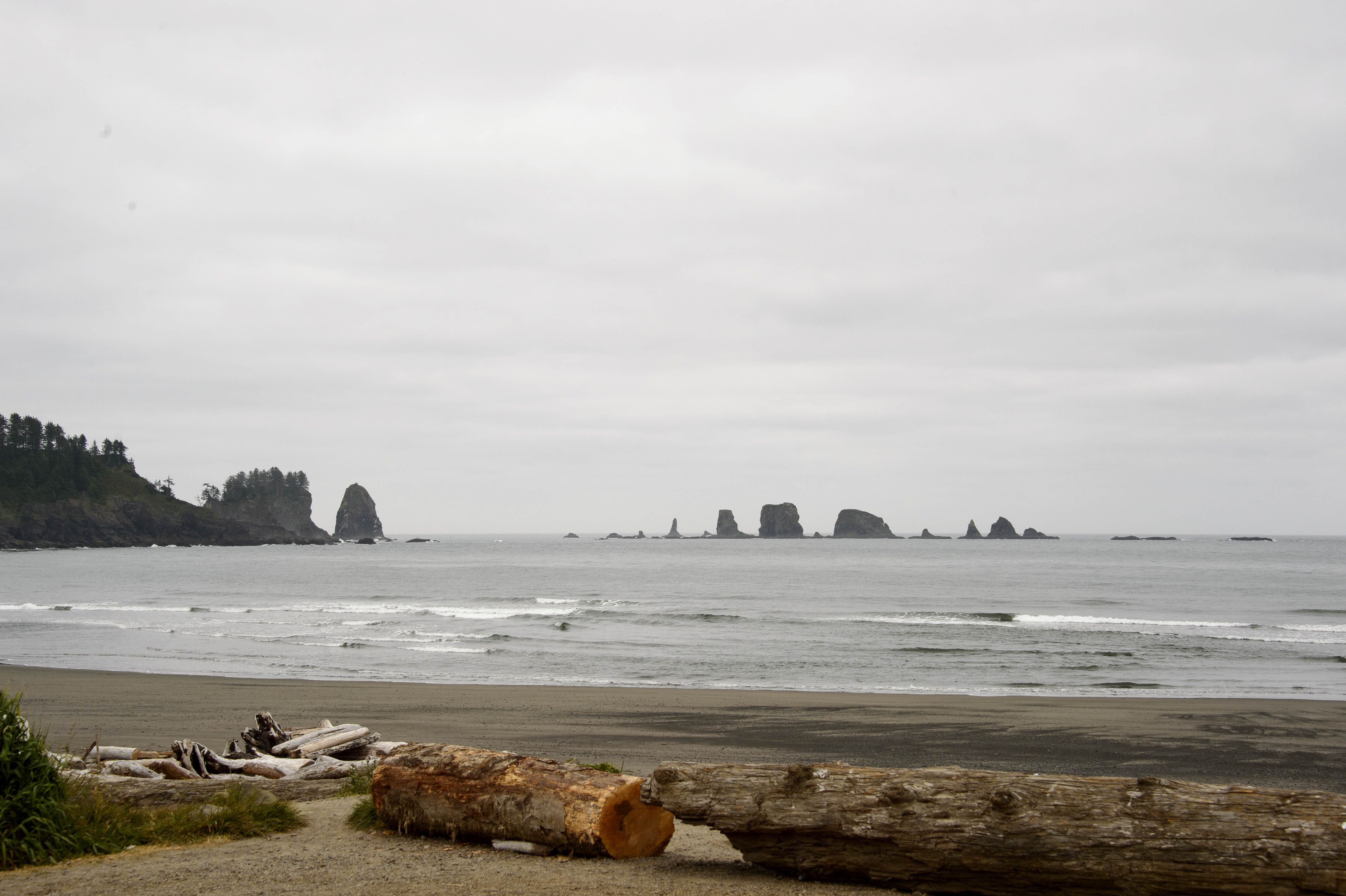
Olympic NP preserves over 60 miles of coastal wilderness. Rock outcroppings called sea stacks, isolated from the shoreline by erosion, pop up all along the coast. Driftwood also covers the beaches – originally toppled upriver in the forest and brought downstream to the sea. Each of these were included in our ‘picture’ out Magic’s front window – –
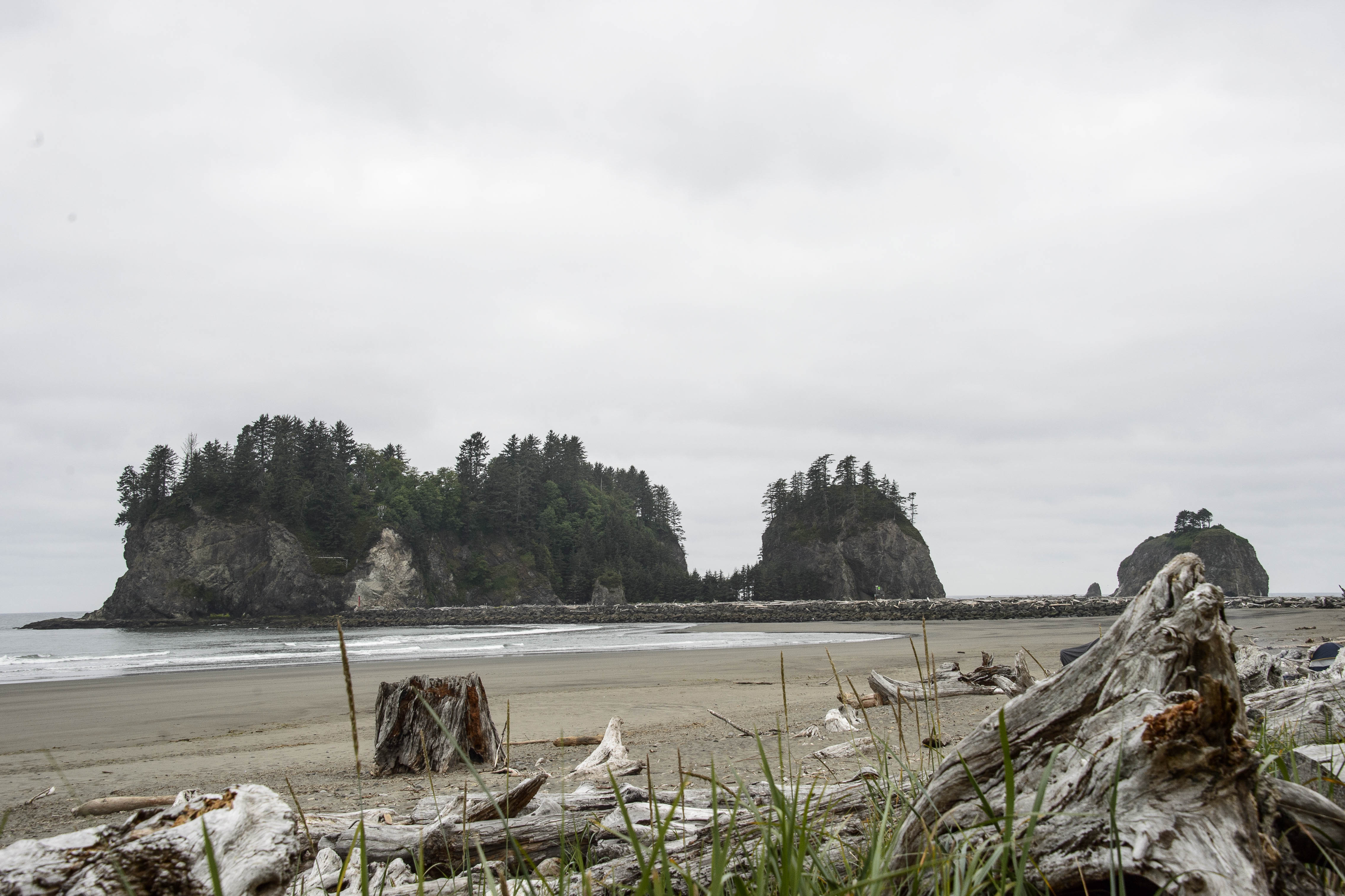
Sea Stacks and Driftwood out our Front Window
The second district – the temperate forest – grows along the coast and in ocean-facing valleys. These forests range from sea-level to almost 8,000 feet and receive from 40 to 240 inches of moisture annually. The unique character of these forests begin with ancient trees that took root 200 to 1,000 years ago. Fallen trunks provide habitat for myriad animals and ‘nurse logs’ for Sitka spruce, western hemlock and western red cedar. Aged giants, lined up in colonnades, stand on huge roots called stilts where their nurse log rotted away underneath.
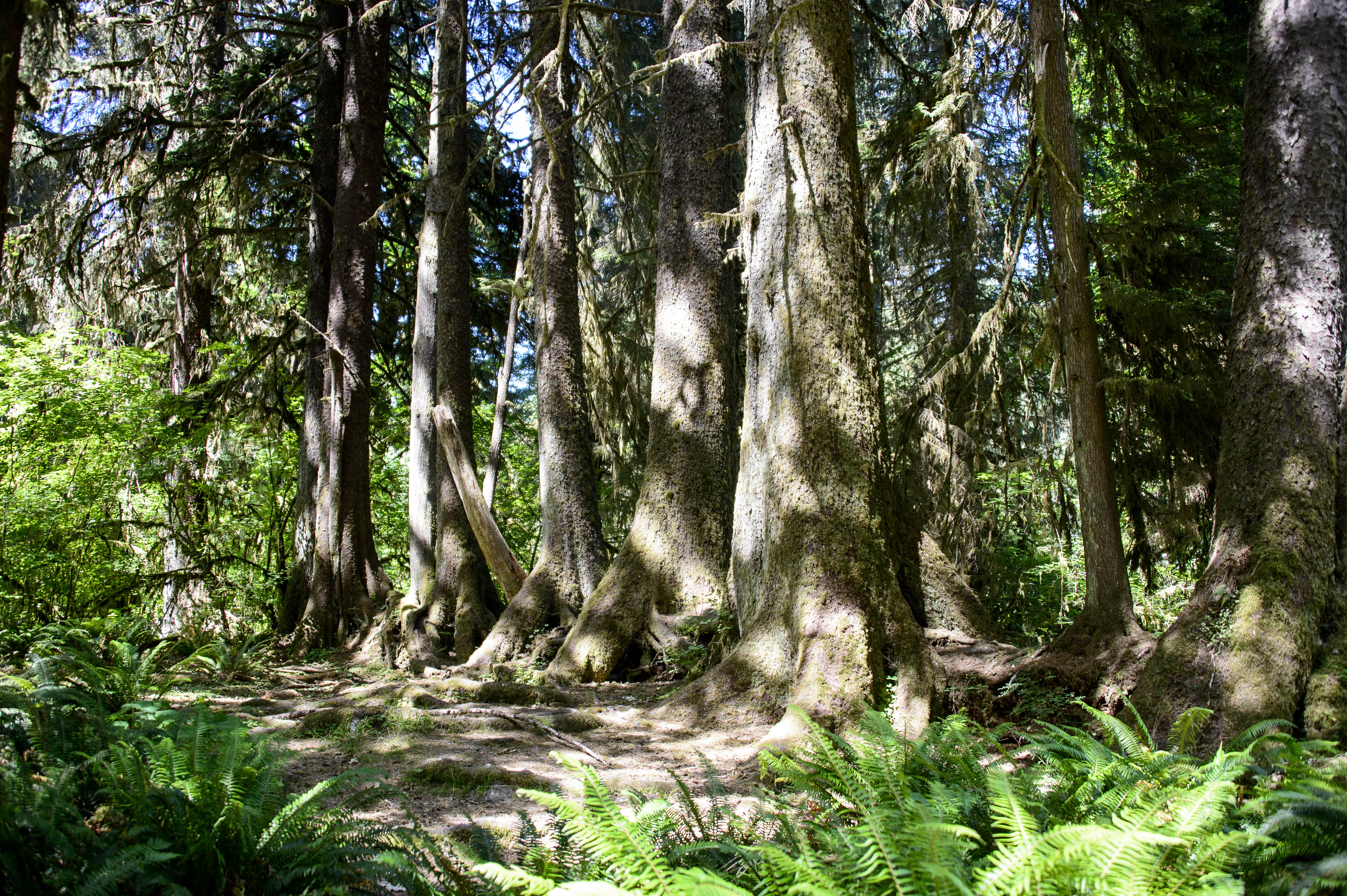
A Colonnade of Spruce that got their start on a Nurse Log with their Stilt Roots.
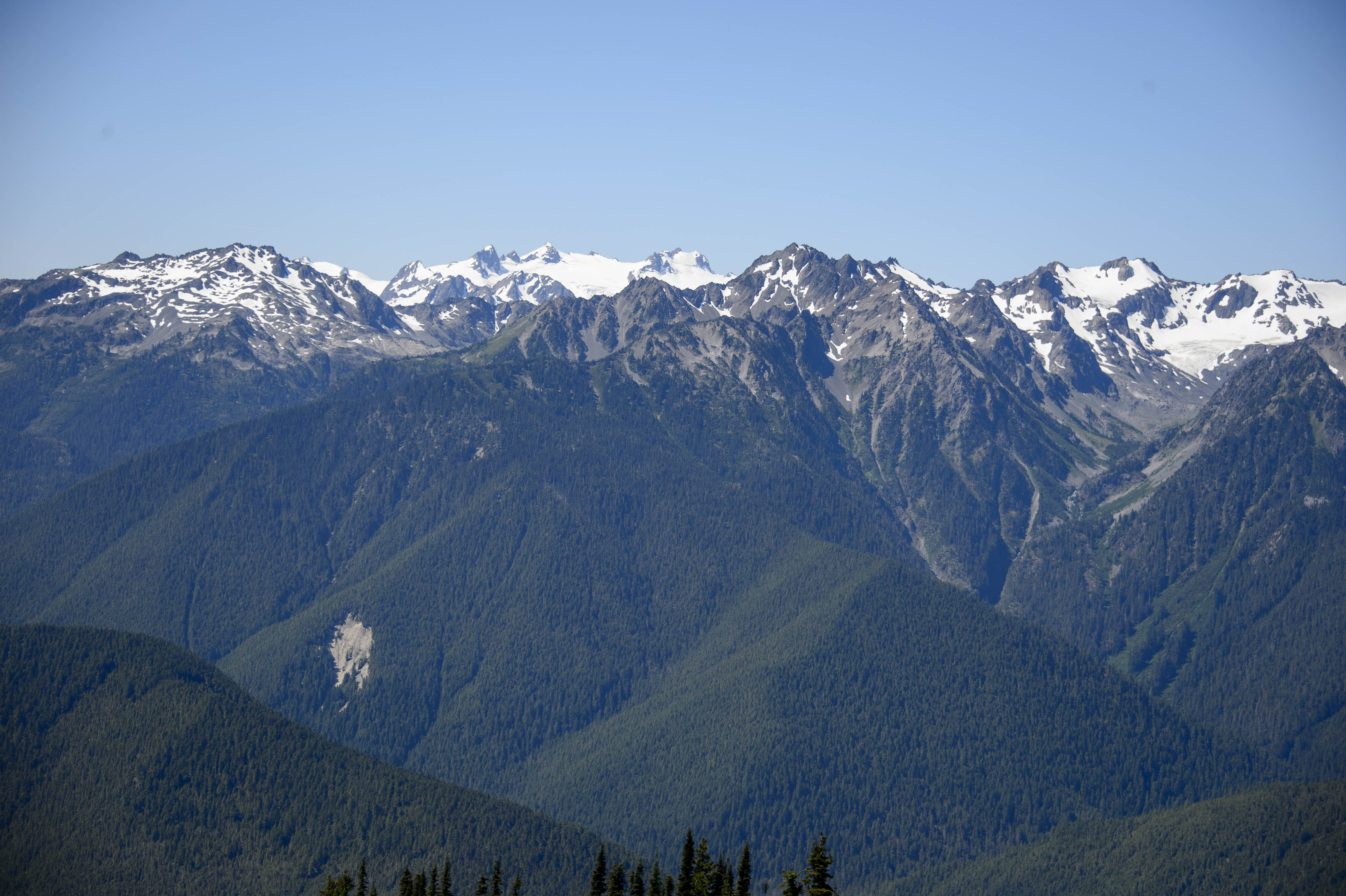
And the third district -subalpine forest and wildflower meadows. It is another beautiful, absolutely clear day – which is a rarity;-) This allowed unobstructed views of the Olympic Mountains to the south from Hurricane Ridge. Right smack in the middle of the range in the picture below is Mount Olympus, which carries 7 of Olympic’s 60 named glaciers. Its Blue Glacier, the primary glacier seen in the middle, can receive up to 100 feet of snow a year and flows downhill as much as 5 inches a day.
And the views to the north included the Strait of Juan de Fuca and Canada’s Vancouver Island – –
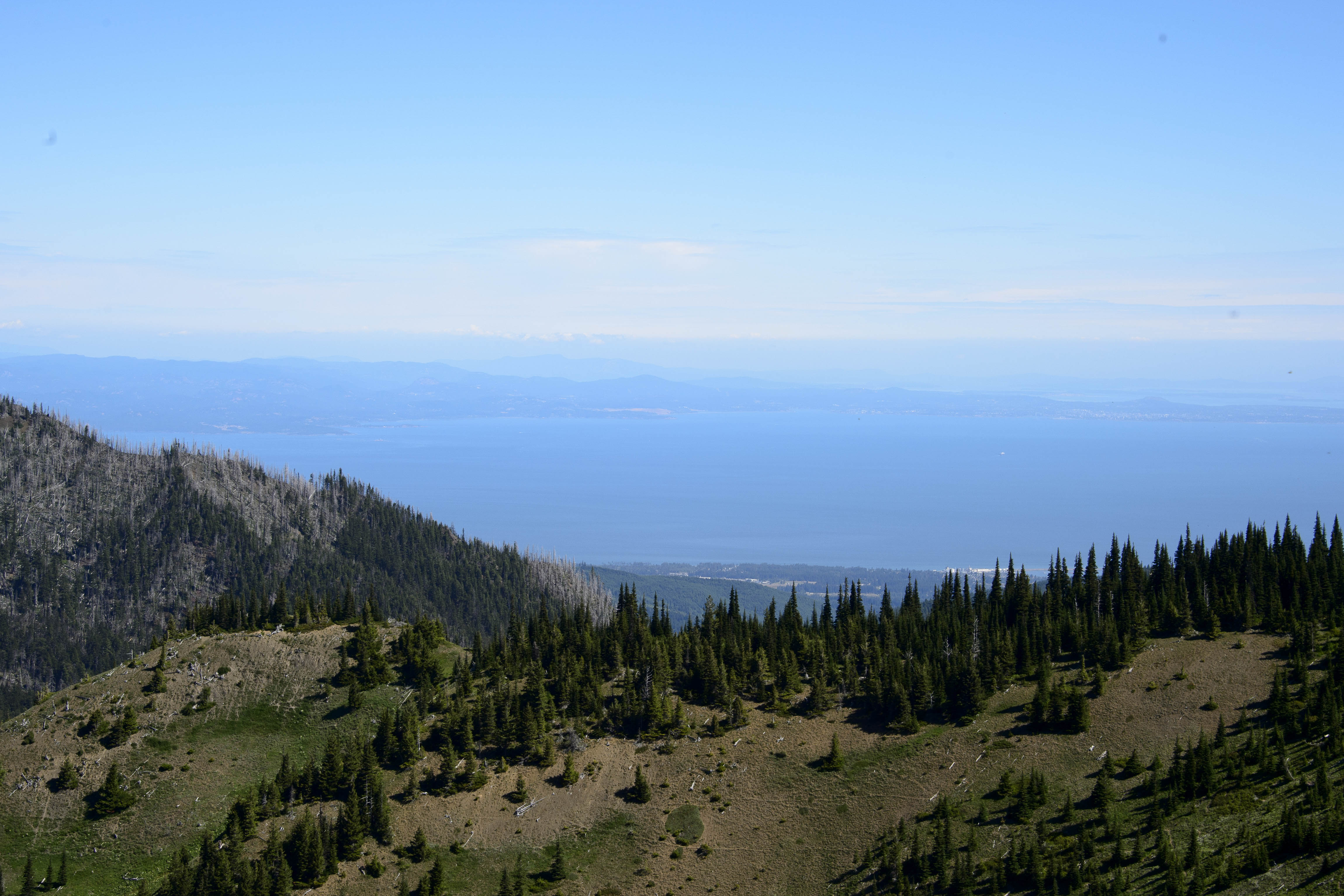
A hazy Vancouver Island across the Strait of Juan de Fuca.
We could not tell for sure if these mountains were used currently as a ski area in the winter – BUT, from the looks of the lift we REALLY hope not!! The ski patrol hut did not look too bad, though – –
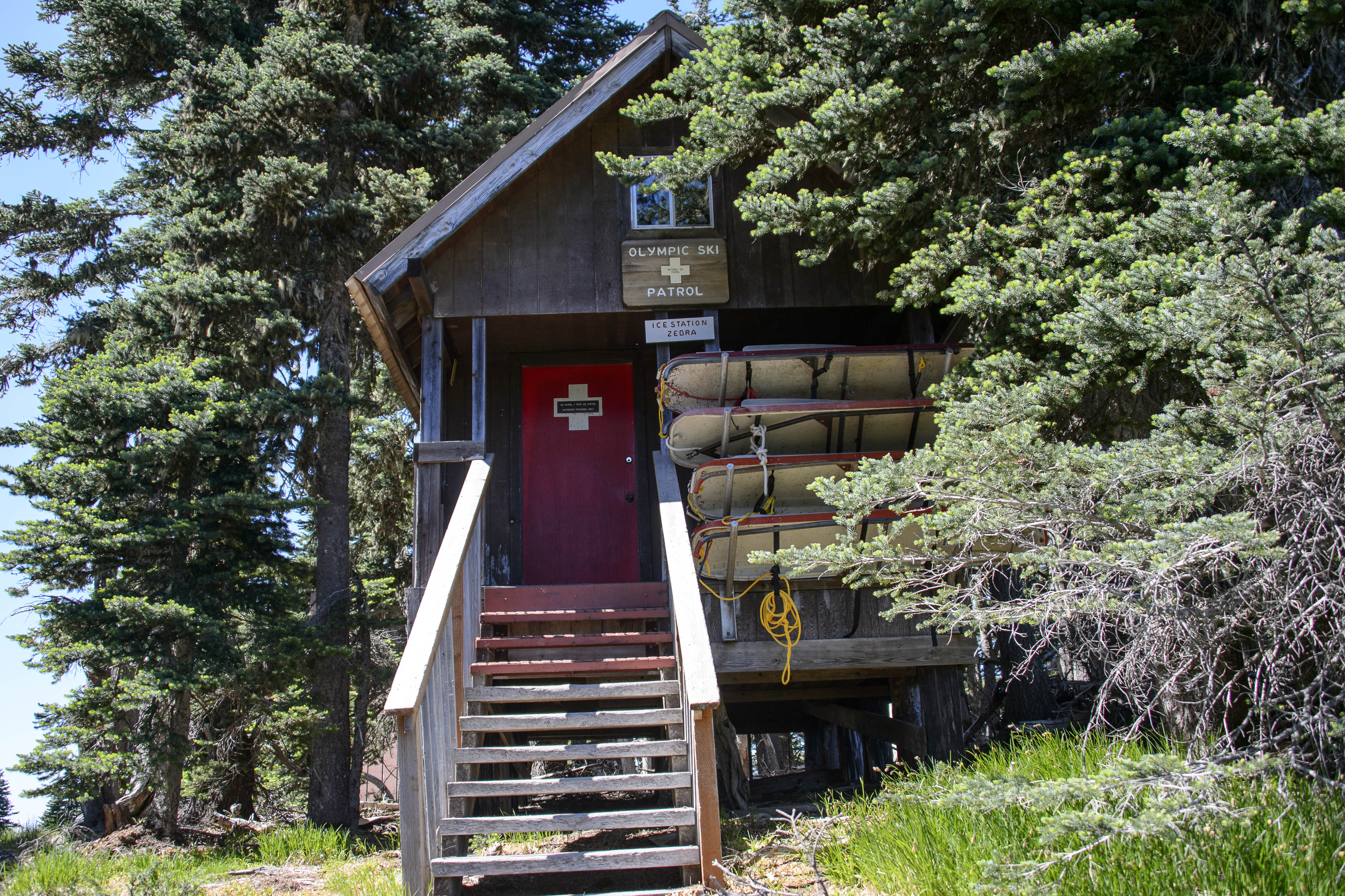
A “classic” ski patrol building on Hurricane Ridge.
The flowers here were not in as full bloom as at Mount Rainier but the meadows provided the perfect opportunity for one of those “Sound of Music” moments;-)
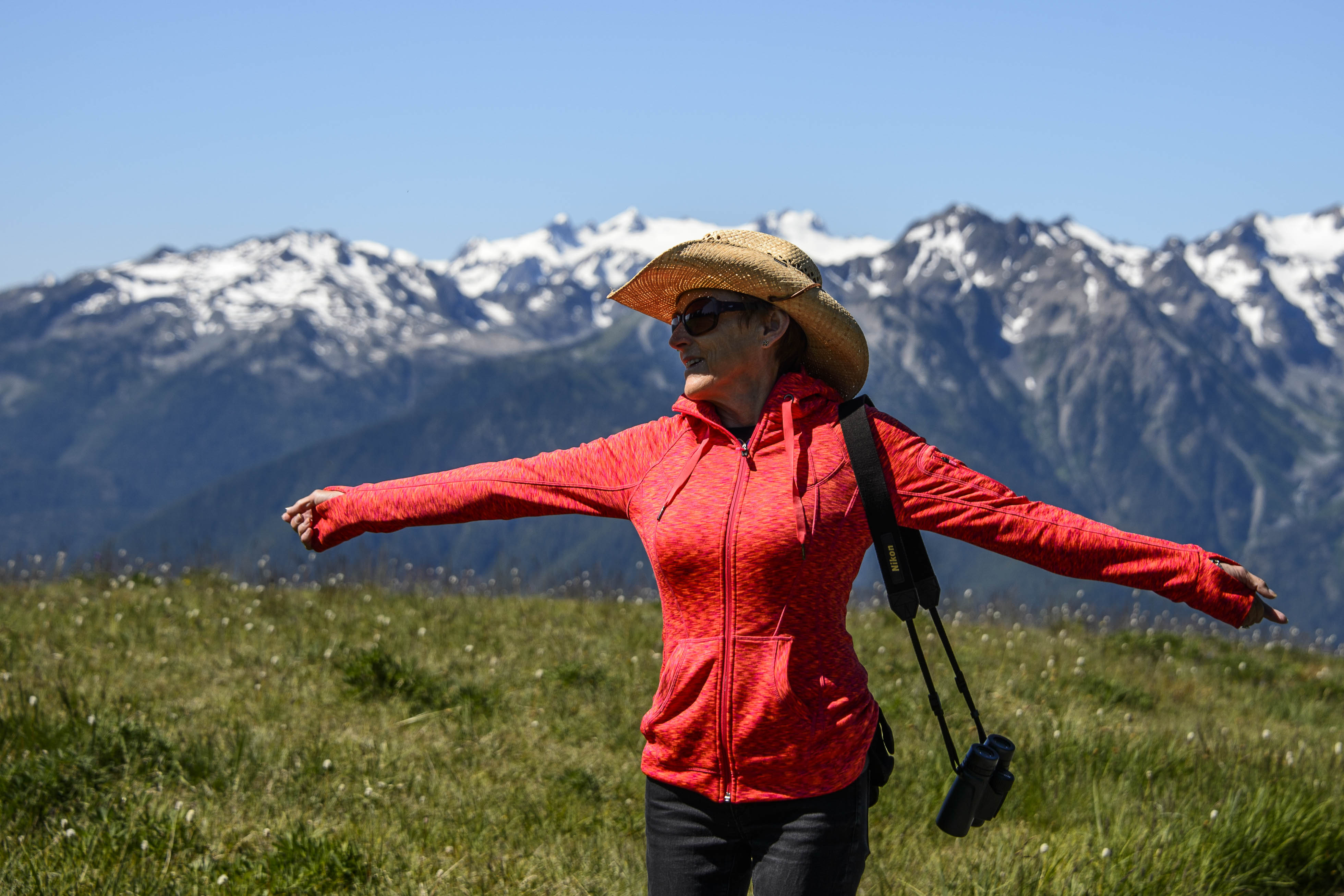
E with another impression of Julie Andrews (or is it Angela Merkel).
Time for lunch. Off to Lake Crescent Lodge – another of those wonderful NP lodges – sitting on the southern shore of Lake Crescent. The lake, carved by a glacier, is 600 feet deep and is known for its azure waters, which are crystal clear.
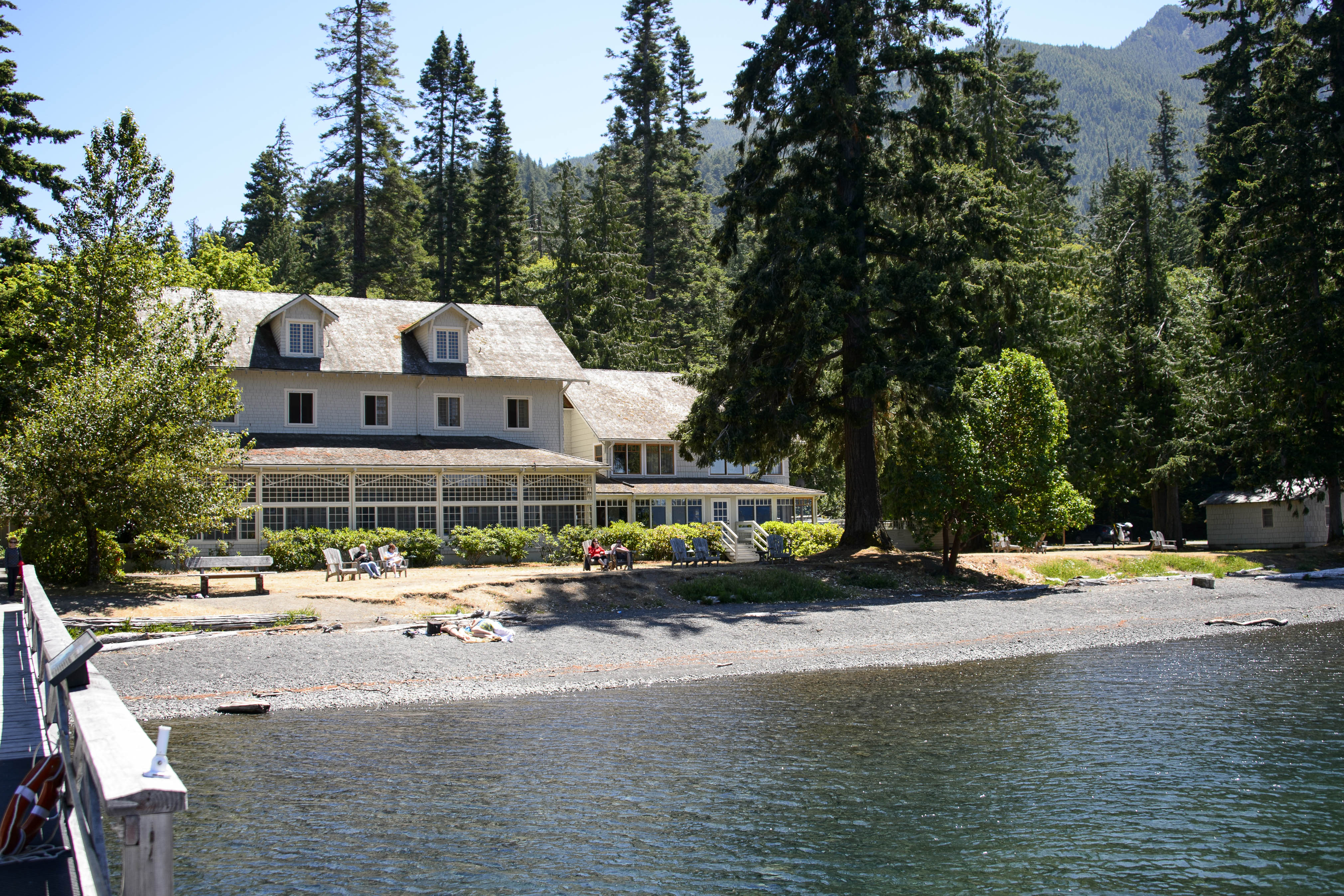
Lake Crescent Lodge – Celebrating its 100th Anniversary!
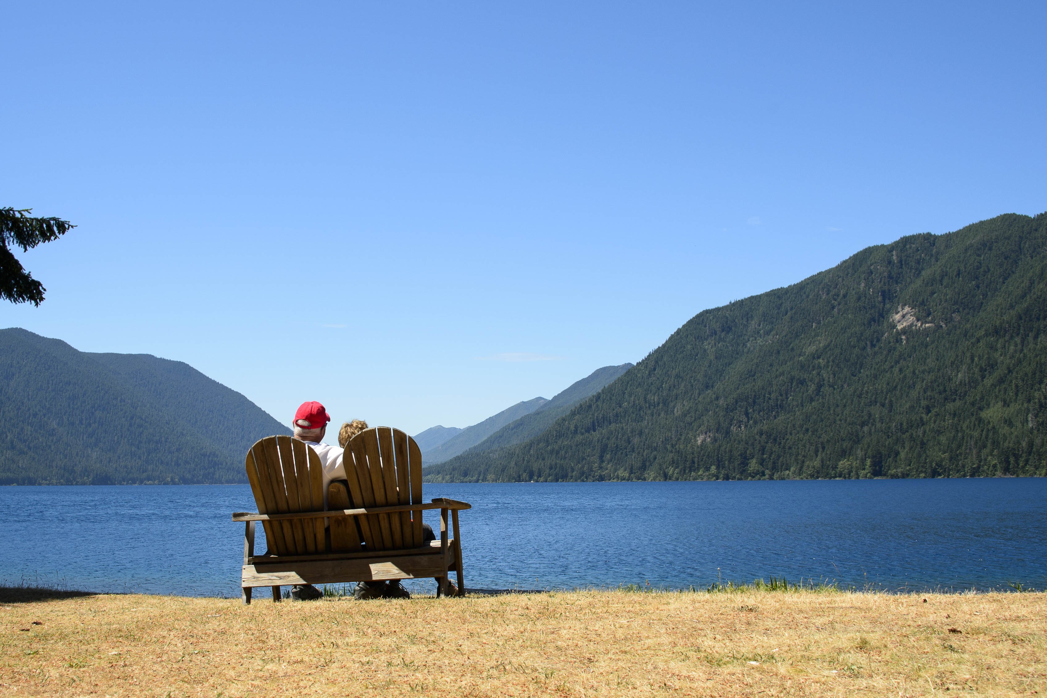
A comfortable location to enjoy the view after lunch.
After taking in the NP sights, we were off to Cape Flattery – the northwestern most point of the contiguous US. This point of land was named by James Cook on March 22, 1778 when he wrote “…there appeared to be a small opening which flattered us with the hopes of finding an harbour…On this account I called the point of land to the north of it Cape Flattery.” The hike to the point is beautiful through old forests to stunning views as far as Vancouver Island to the north.
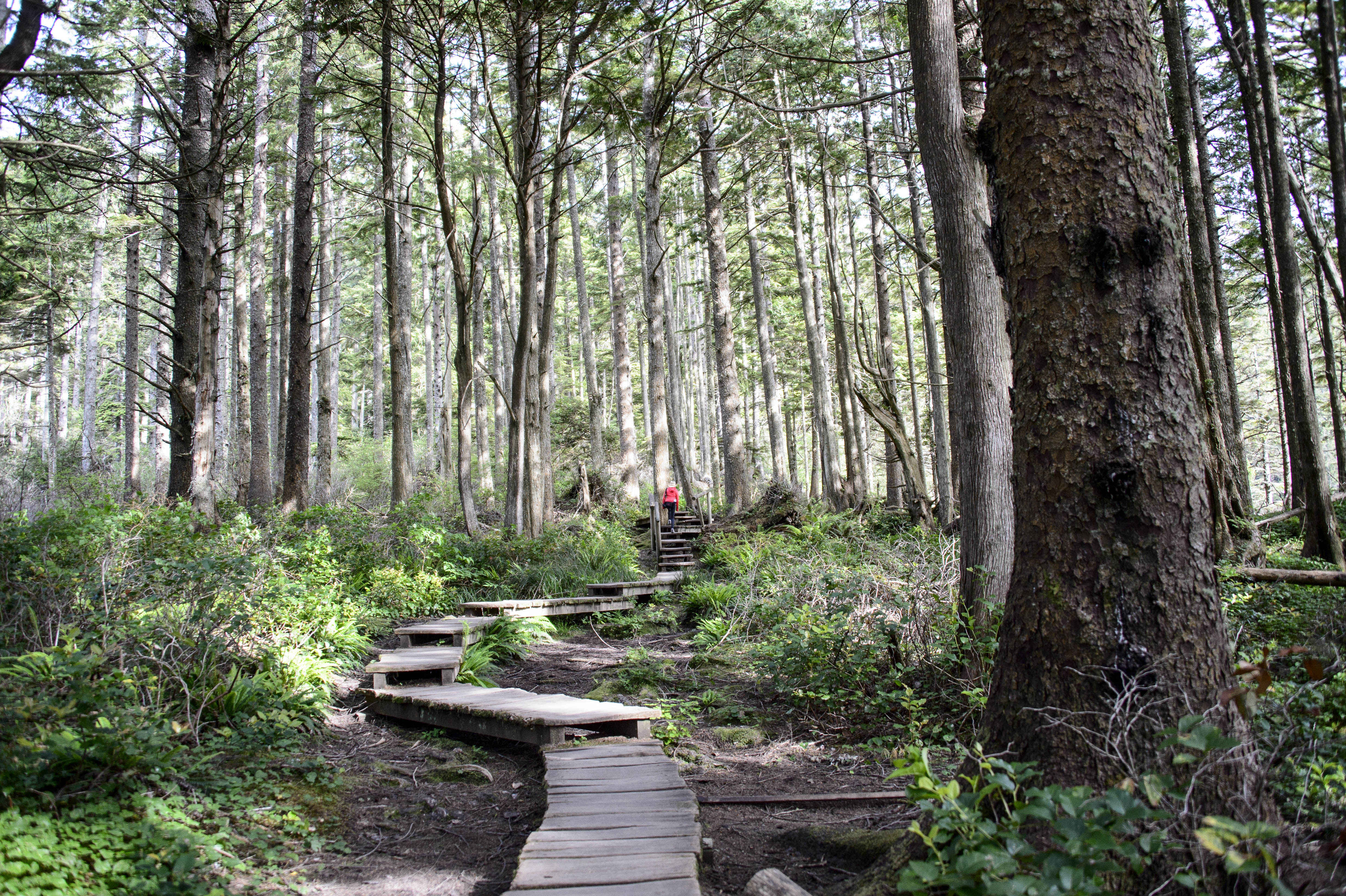
Many steps on the trail to the Point of Cape Flattery.
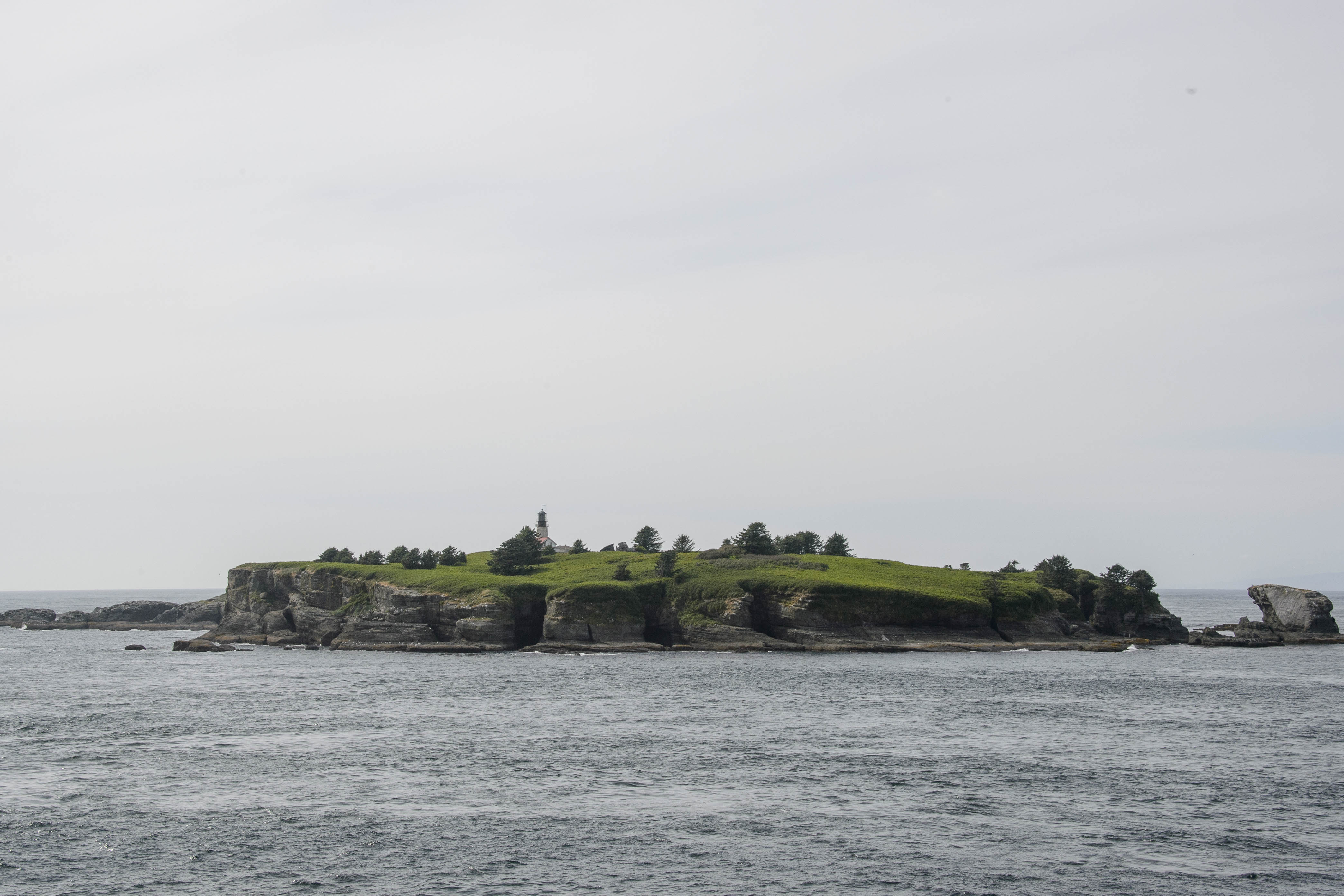
Cape Flattery Lighthouse.
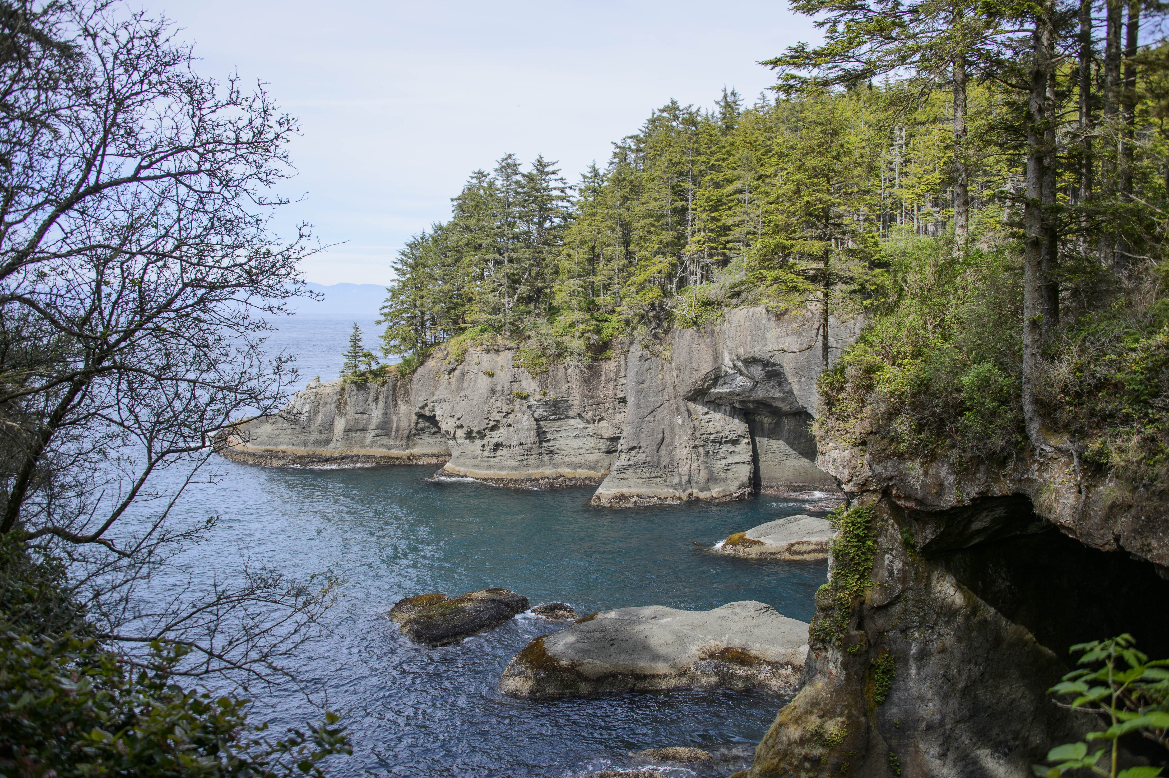
A cove below Cape Flattery with Vancouver Island in the background.
Well, as always, our adventures here must come to an end – as we have an important date on Friday!!!! Be sure to watch the US Open being held at Chambers Bay and see if you have any E & G sightings;-)!! We are soooooo excited.
E & G – off to tee it up????
