Flagstaff Pueblos and Other Sights

So – do you remember any of your American history from – probably grade school??  If so, you probably remember that we learned that not much ‘life’ existed in the area now known as Arizona until the Spanish rode in during the 1500’s!

Wrong!  Actually the earliest evidence of humans in the Southwest has been radiocarbondated at about 11,500 years ago – the Paleo Indians.  Now, I don’t intend to go through 12,000 years of ‘Arizona’ history, BUT – we can fast forward to the 1100 – 1200’s.  Several hundred years before the Spanish.

The dominant prehistoric cultures in Arizona and the region hit their developmental peak in the 1200’s, but were largely gone within 250 – 300 years.  There were five different groups of these cultures, but the ones we were ‘visiting’ in our travels this month included the Ancestral Puebloans of the Four Corners Area (in the prior post of the Navajo National Monument and the So. Utah sites) and the Sinagua (Seen-awa) – the ‘people without water’ from the area between Flagstaff and the Verde River, which are the subject of this post.

Our first stop is the Wupatki (Woo-pot-ki) National Monument, a 56 square mile area of several ancient pueblos populated by the ancestral Sinaguans but bearing elements of the Ancestral Puebloan traditions.

056 2016 05 24 b Wupatki001


The Wupatki ruin was heavily populated during the 1100s and grew into a three-story, 100 room pueblo with a ball court, kiva and a nearby spring.

057 2016 05 24 b Wupatki005

The residences.

058 2016 05 24 b Wupatki006


059 2016 05 24 b Wupatki007

Security guard?


This ball court showed influences of the Hohokam from the southern part of the state, which highlights the travel and trading among the groups.  It is believed that Wupatki was a regional center for trade and is validated by the various types of artifacts found in the pueblo.

062 2016 05 24 b Wupatki015

The Ballfield


2016 05 24 b Wupatki013

The Kiva.


We found several ‘details’ of the Pueblo VERY interesting – –

063 2016 05 24 b Wupatki018

Notice the decorative tile work on the back wall.


064 2016 05 24 b Wupatki019

Frank Lloyd Wrightish built-in “couches”?!?


Another one of the Pueblo ruins in the Wupatki complex – the Wukoki pueblo was built on a rock outcropping and was quite a building marvel.

065 2016 05 24 c Wukoki 002

The Wukoki Ruins were small but interesting.

066 2016 05 24 c Wukoki 003


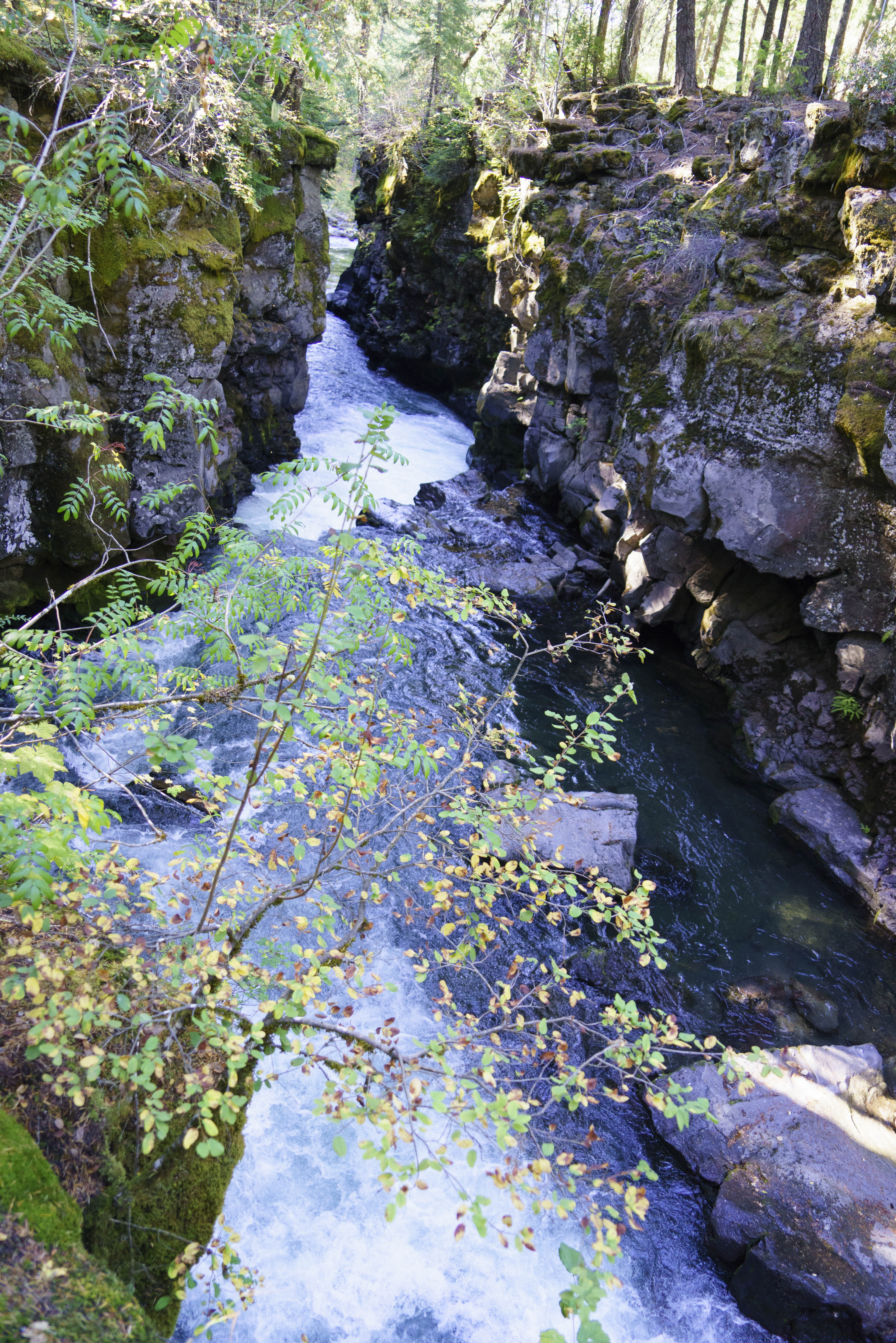
Just a bit to the south of the Wupatki complex is Walnut Canyon NM (We just love taking the pictures of these monument signs and comparing them from one Park or NM to the next.  We just can’t help ourselves;-)! ) – –

108 2016 06 08 a Walnut Cyn  001


Unlike the large, above-ground village at Wupatki – Walnut Canyon was made up of cliff dwellings.  The inhabitants here took advantage of natural recesses in the limestone walls to build their homes.  The Canyon is huge with approximately a 500′ vertical from the rim to the Walnut Creek on the canyon floor (thankfully the trail only descends about 185′) .  This allowed for many levels of dwellings in the canyon walls.

109 2016 06 08 a Walnut Cyn  002

This was a ‘high rise, multi-level’ development!

110 2016 06 08 a Walnut Cyn  023

111 2016 06 08 a Walnut Cyn  024


These Sinagua homes remained largely undisturbed until the 19th century.  In the 1880’s the railroad brought souvenir hunters to the ancient dwellings, which lead to theft and destruction;-(  This was one of the better preserved/reconstructed ‘homes’.

113 2016 06 08 a Walnut Cyn  016

These cliff dwellings were occupied for little more than 100 years.  Again, why these people left is not clear, but by 1250 they moved to new villages a few miles southeast along Anderson Mesa.

Investigating the Flagstaff area proved to be quite a bit of fun for the two of us – as E had not spent any time here for 45 years (since graduating from NAU) and Gary had never spent much time here.  We loved the Pueblos – but, for those not into such things there is lots more to see.

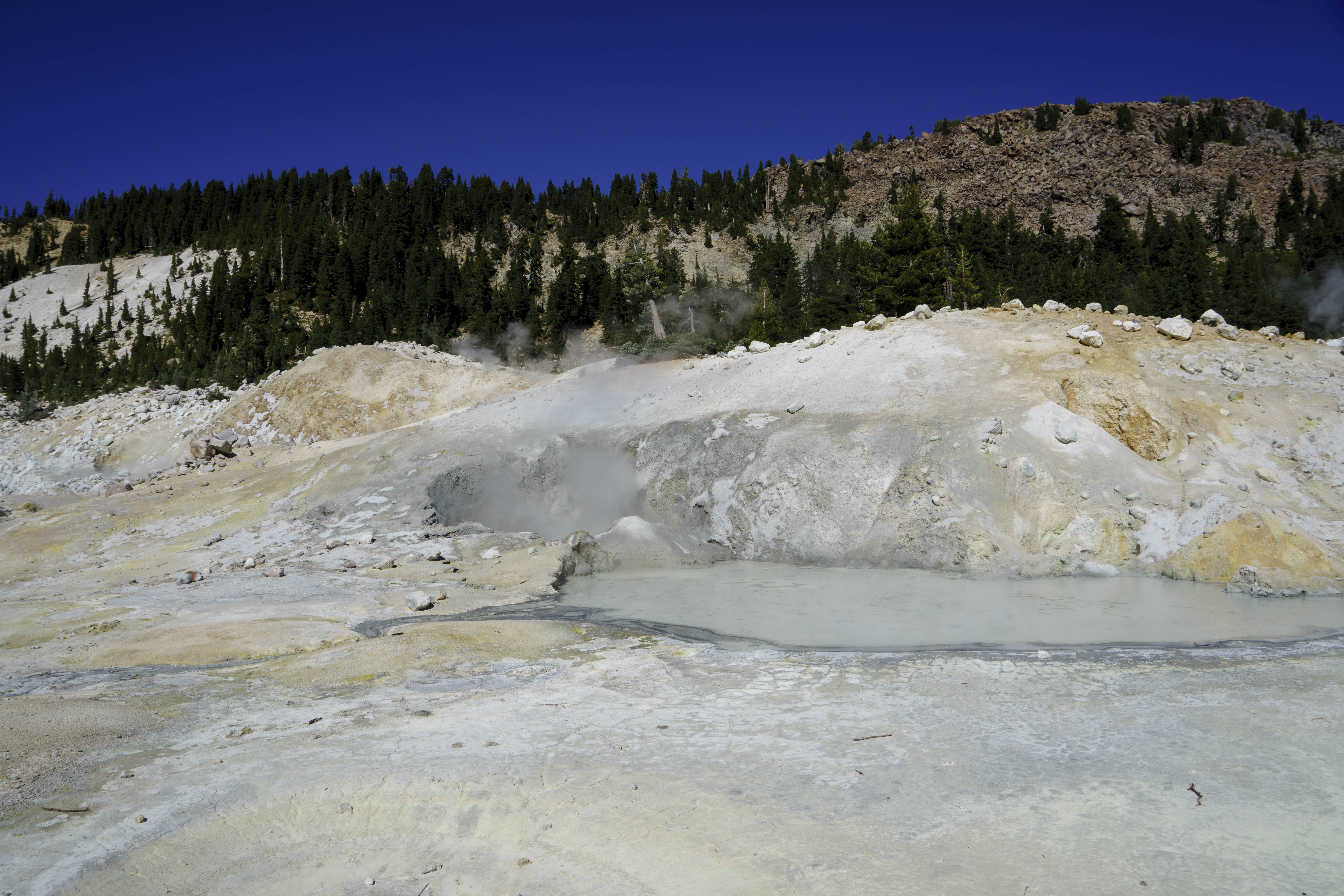
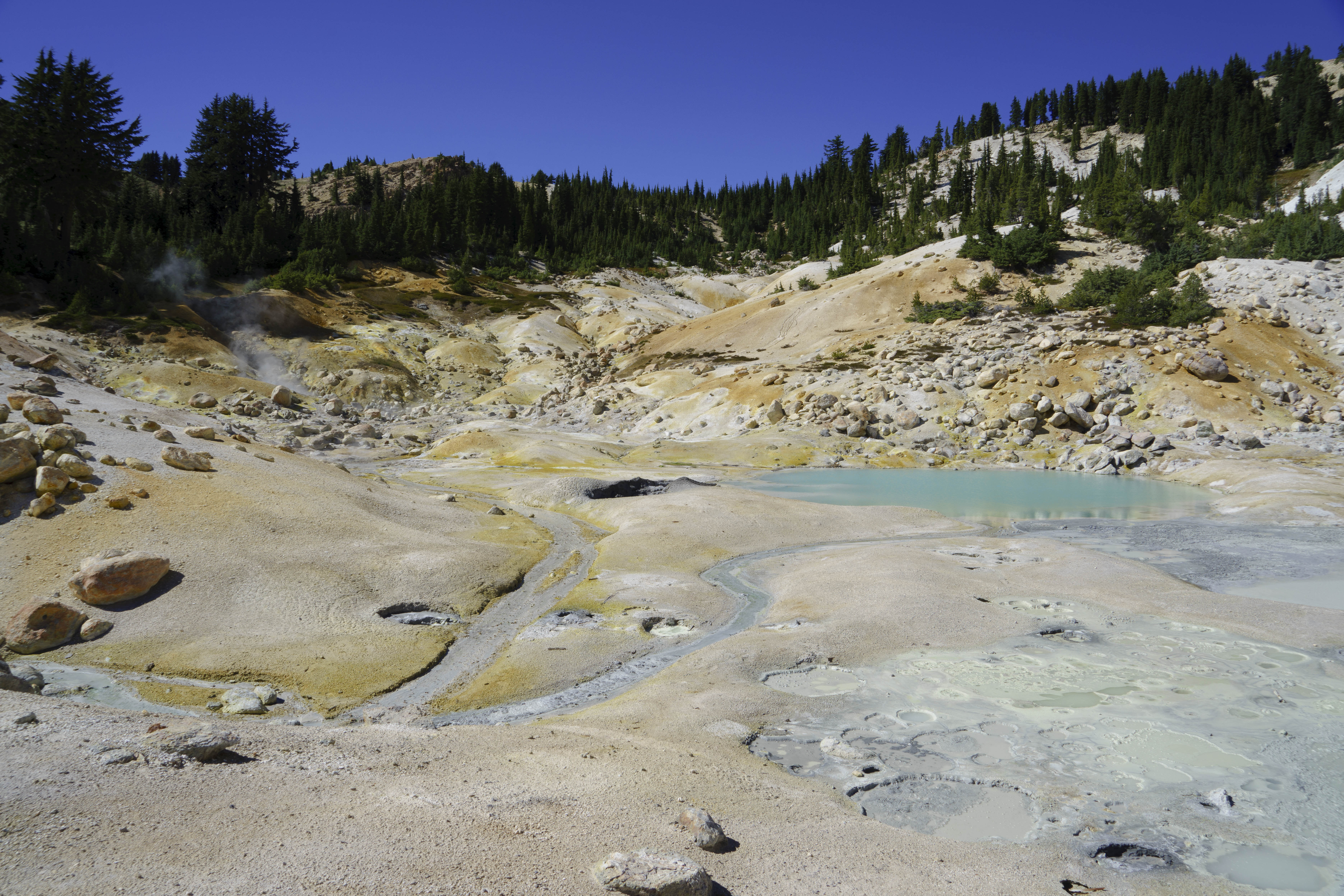
Sunset Crater Volcano NM for example.  Sunset Crater is a 1,000 foot volcanic cinder cone – the most recent volcanic creation in the 6 million years of volcanic activity in the 2,200 sq. mile region called the San Francisco Volcanic Field.  The ancient people we have been talking about above would have seen this last eruption which took place in about 1064.

052 2016 05 24 a Sunset Crater 001

The Lava Flow Trail took us across the lava flows and gave great looks at the cinder cone, which even today – 900+ years later –  has no growth on it – –

054 2016 05 24 a Sunset Crater 013

055 2016 05 24 a Sunset Crater 018

Which one is the oldest?


There is also the Old Town area of Flagstaff, which includes the Northern Arizona Campus – E’s alma mater.  Every old campus has that “Old Main” building which defines the University.

115 2016 06 08 b Riordan 007

Old Main


Even the County Courthouse has that same ‘look’ – –

050 2016 05 23 Flag Dwtn 001

Coconino County Courthouse


The Historic walking tour took us past the 1889 Santa Fe Depot, Saloon Row, The Weatherford Hotel (1898), the Monte Vista Hotel (1926) and the Babbitt Brothers Building (1888), which helped us find the best Thai restaurant around directly across from Babbitt’s Sporting Goods;-)

051 2016 05 23 Flag Dwtn 003

Babbitts..a well known name in Arizona.


Riordan Mansion State Historic Park is also in the old part of Flagstaff adjacent to the NAU campus.  This house was built in 1904 for two Riordan families – brothers who owned the logging business and developed many of the other businesses in town as well as many services such as the hospital.  The house is approximately 13,000 sq. ft. – 6,000 on each side for each family with a 1,000 sq. ft. common living room in the middle.

114 2016 06 08 b Riordan 003

The Riordan Mansion


Perhaps the most interesting and educational outing was the Lowell Observatory.  Percival Lowell established this observatory in 1894 with the intent of searching for evidence of life on Mars.  He ordered the telescope from Alvan Clark & Sons in Massachusetts.  The telescope was built in 1896 and moved to the Observatory.  Not only was it utilized to study Mars, but it was used extensively to map the Moon during the 60’s.  Representatives from NASA and the astronauts who landed on the Moon spent a lot of time at the Lowell Observatory studying this mapping and the Moon before the moon landing, as the mapping completed here determined where the Rover landed.

This dome houses the Clark Telescope and is the oldest standing building at the observatory.

067 2016 05 24 d Lowell Obs 004

The Clark Telescope at the Lowell Observatory is more than 100 years old. 


Can you believe that the dome is NOT attached to this building in any way.  It rests on 1954 Ford tires, which were determined to be the best ‘fit’ for the job!

070 2016 05 24 d Lowell Obs 007

The dome rotates on 1954 Ford truck tires. They even have the original Ford hub caps.


While we didn’t help with any mapping of the Moon or searching for life on Mars, we did check out Jupiter with this bad boy;-)

2016 05 24 d Lowell Obs 018

We went back after dark and were able to view Jupiter and 3 of its moons.

071 2016 05 24 d Lowell Obs 020


The Lowell Observatory also houses the Pluto Telescope, which is a 13 inch astrograph used to discover Pluto in 1930!

118 2016 05 24 d Lowell Obs 015

McCallister Telescope.


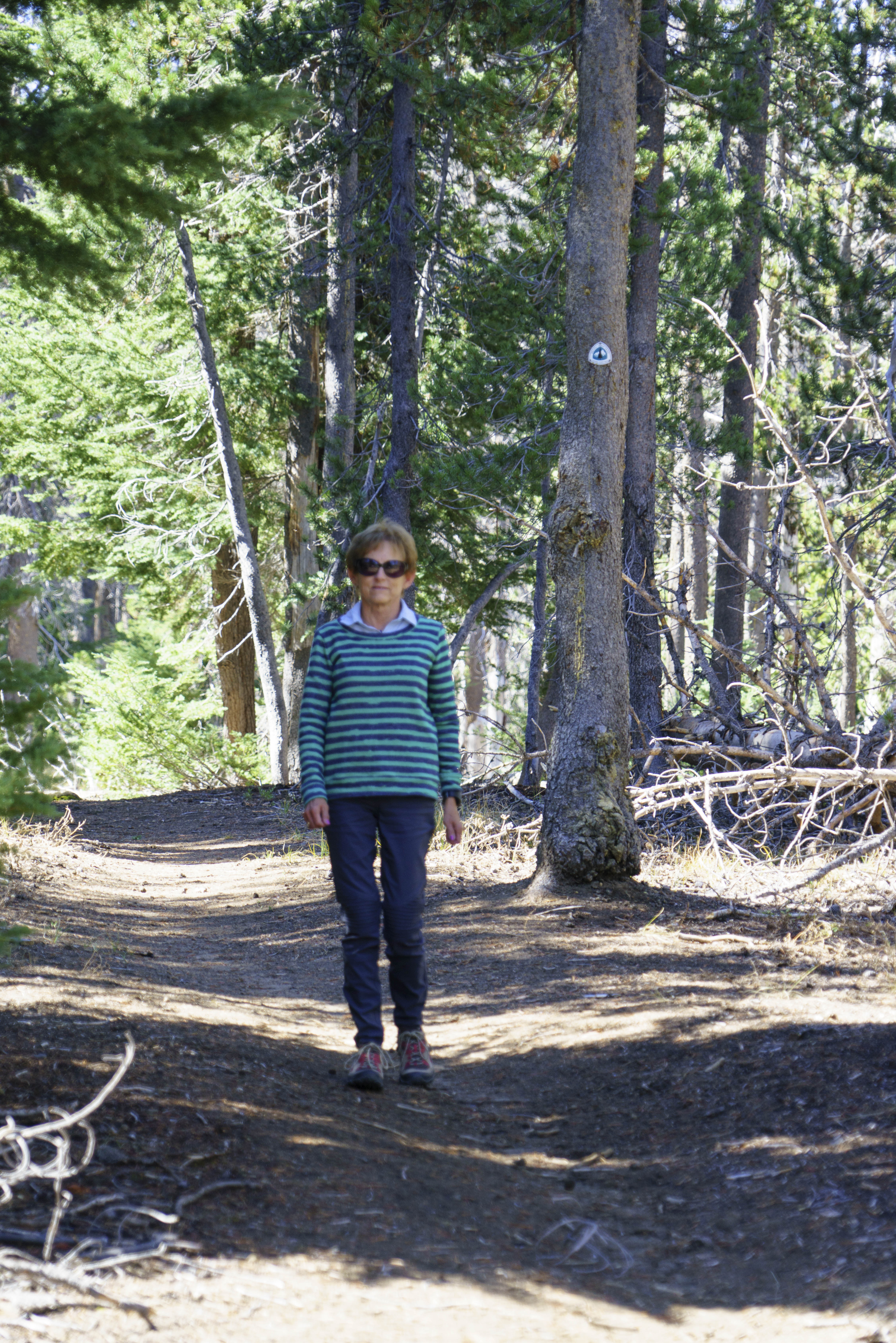
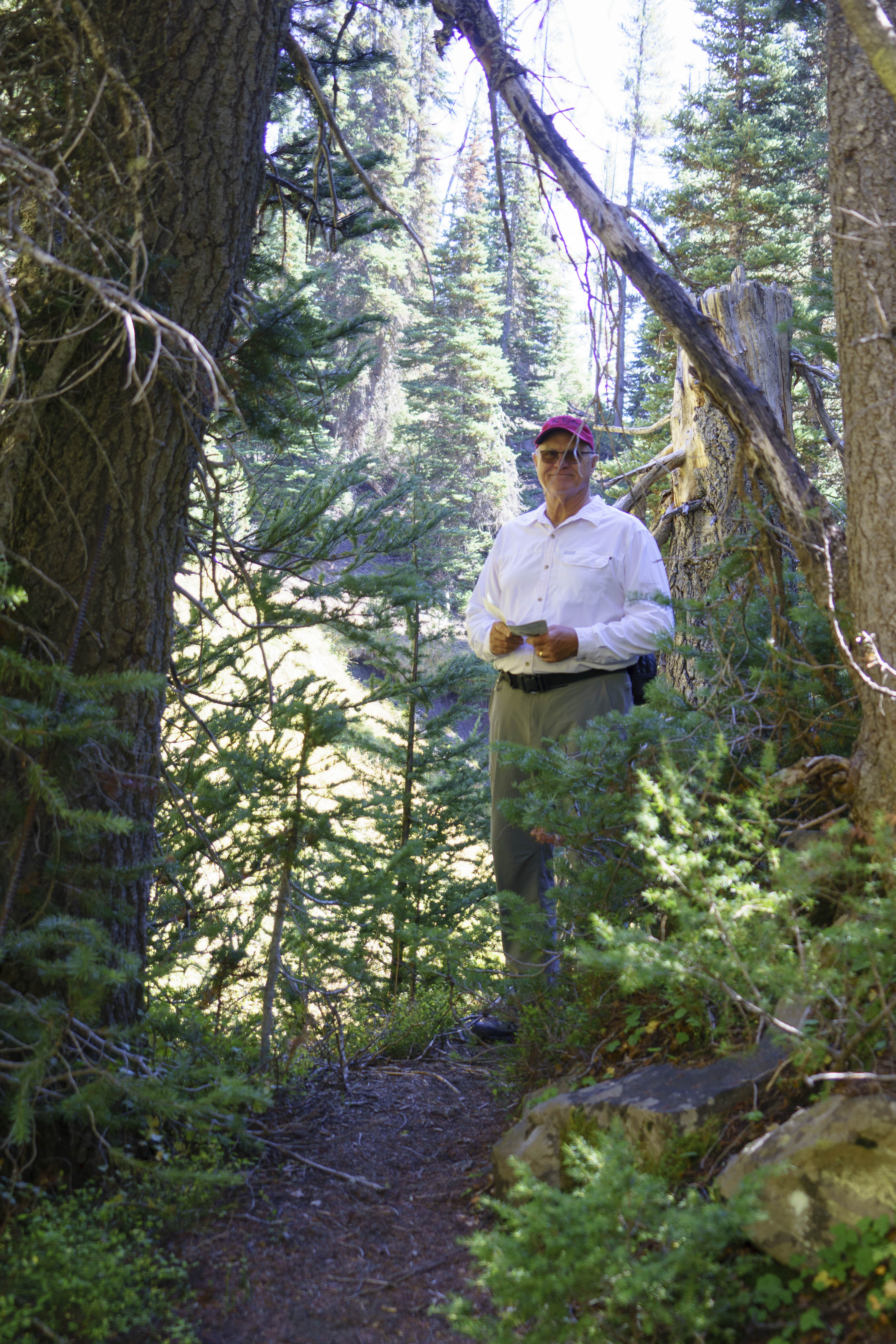
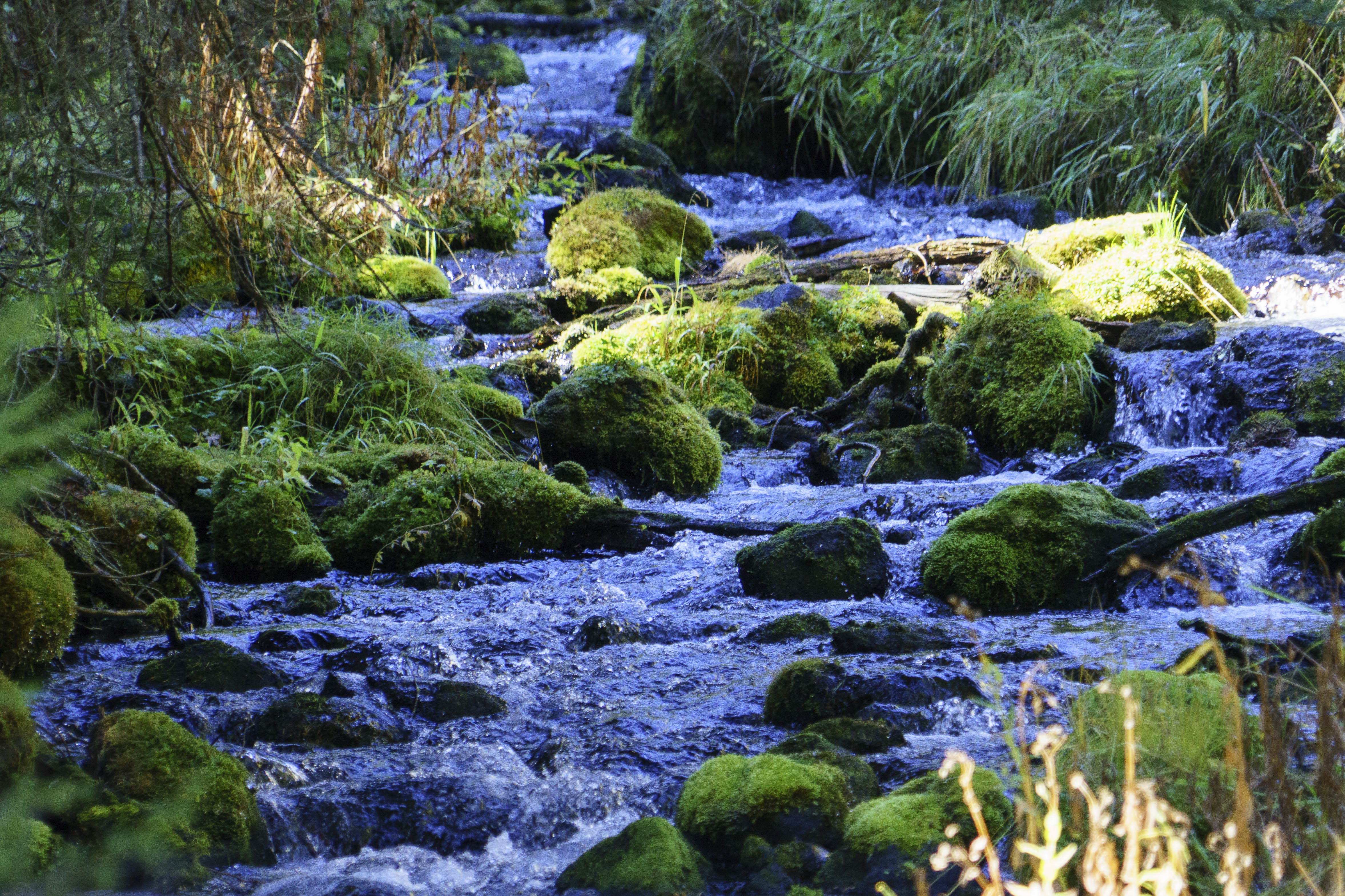
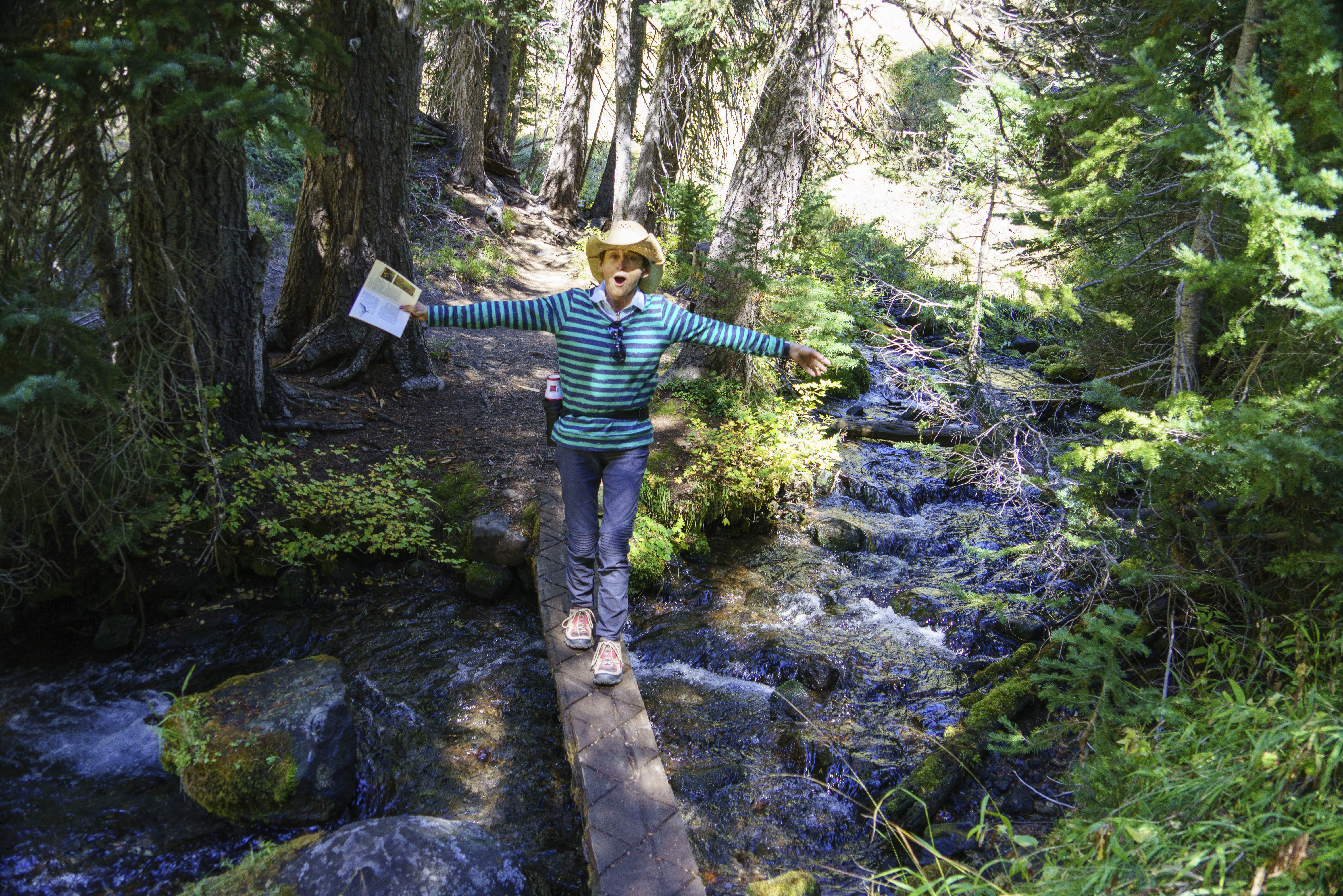
Flagstaff is much like Park City when it comes to hiking.  There are way more trails than we could ever investigate.  The Kachina Peaks trail had a lot of appeal as it is thru the trees and at about 9,000′, quite cool and with stunning views.  So – we were off – –

073 2016 05 25 Kachina hike 005

The Kachina Trail – near the Snow Bowl on Mt. Humphries (the highest point in AZ).


077 2016 05 25 Kachina hike 009

That is the domed stadium on the campus of NAU in the center of the photograph.


078 2016 05 25 Kachina hike 010

We almost didn’t find this part of the trail. Gary took a wrong turn. Thank goodness the gadget head had downloaded the trail map


After two weeks of exploring, a return trip to Phoenix was in order.  The timing was set to coincide with the closing of the Stradivarius exhibit at the Musical Instrument Museum and all the special activities set for the closing week-end.  Even Mom, Dorthy, enjoyed the exhibit.

116 2016 06 05 MIM Strad 002

Dorthy and E with the 1789 Stradivarius.


Our return trip also coincided with the hottest days so far in Phoenix!!!!!!

117 2016 06 03 Temp 120

Holy Crap!!!!!!!


It was a short stay  – we got the heck out of town and back to a little cooler weather in Flagstaff as fast as we could;-)

WOW – that was a lot to cover!  Hope you aren’t all worn out reading this.

E & G – will try to be shorter next time.


In Search of Ancient Puebloan Ruins

After a couple of nights in Flagstaff, AZ (which will be discussed in the next posting), we were off to meet up with friends from Park City to explore some of the ancient pueblo ruins in southern Utah.

But – first a turn-off that had been passed up many times in previous trips called to us.  At the end of Hwy 564, just west of Kayenta, is The Navajo National Monument protecting the Betatakin Ruins.  This was the home of the prehistoric Puebloan Ancestors who built Tsegi Phase villages within the natural sandstone alcoves of the canyons and who were the same people of the cliff dwellings at Mesa Verde, Chaco Canyon (both seen on prior trips), Wupatki and Walnut Canyon (next post).   These resilient Ancestral Puebloans paved the way for current Native American groups in the Southwest region. The villages of Betatakin, which date from AD 1250 to 1300 – a mere five decades – thrill all who visit with original architectural elements such as roof beams, masonary walls, rock art, and hand and foot holds.  And we were no exception.  In fact – since we could only see the ruins from an overlook, we decided a return trip was in our future to take the 5 mile hike into the ruins;-)

041 2016 05 27 Nav Natl Mon 004

An early Hogan


The Overlook trail was short but provided more of those fantastic views of the cliffs that sheltered the ruins.

043 2016 05 27 Nav Natl Mon 017

Working our way down the trail to the cliff dwelling overlook.


044 2016 05 27 Nav Natl Mon 024

Click, click, click.


Even from our distance the ruins appeared to be in very good condition and well protected.  After all they were 700 years old!

046 2016 05 27 Nav Natl Mon 010

It was once a fair sized community


Unfortunately, we did not have time to do the hike to the bottom at this time as Blanding, Utah was calling.  So – we will be back.  But, now we were on thru Monument Valley –

048 2016 05 27 Nav Natl Mon 027

Monument Valley

049 2016 05 27 Nav Natl Mon 028


Blanding served as our jumping off point for the many hikes into the southern Utah Ancient Puebloan ruin sites with friends Marge and John.  After a dinner of catching up on Park City, families, health, etc, we set the schedule for the next three days.

First up was Mule Canyon with the primary destination of House on Fire – and any other ruins that might catch our eye.  So – into Mule Canyon we go –

005 2016 05 28 Hse on Fire003

Hitting the trail into Mule Canyon with Marge and John Budd.


The first look at the ruins with its several walls and rooms is impressive but not overwhelming.  But – then you step back and look at the rock formation and coloration of the ledge protecting the ruins and it takes your breath away as it truly appears that flames are billowing out of the top of the house – –

006 2016 05 28 Hse on Fire017

The House on Fire Ruins are appropriately named.


Notice the difference in the coloration and effect by stepping just a few steps in either direction –

007 2016 05 28 Hse on Fire019


After staring at the wonder of the House on Fire for some time, we decided to wander on up the canyon a bit.  Not many more ruins were found, but we did find a rock that needed to be pushed back off the trail (right!).

008 2016 05 28 Hse on Fire025

Trying to reposition a small tilting rock.


Back in the car we ventured just up the road a piece and found the Mule Canyon Ruins site with an incredibly well preserved Kiva.  Interestingly, this was almost on the road.

009 2016 05 28 Hse on Fire034

A Kiva at the Mule Canyon Ruins site.


Almost across the street was an unmarked dirt road that our traveling companions insisted would lead us to a wonderful find – The Cave Tower Ruins.  Since they had been here before they knew what they were talking about and here we were with the ruins of seven towers protecting the homes in the facing ledge.

010 2016 05 28 Hse on Fire042

The Cave Towers Ruins sit atop and within an arm of Mule Canyon.


011 2016 05 28 Hse on Fire045

Weather, time and human activity have taken their toll on the cliff dwelling in the canyon.


012 2016 05 28 Hse on Fire049

The views were spectacular.


Dinner that night provided ample time to relive the sights of the day and to discuss the hike for the next day – the 8 mile loop trail at Natural Bridges National Monument.    This trail takes you past the Sipapu and Kachina Bridges, Horse Collar Ruins and wonderful pictographs and petroglyphs.  Of course all of this is at the bottom of White Canyon and one has to get down the 700 ft vertical drop into the canyon in order to enjoy it.   Both Gary and Marge have a problem with heights, but Gary had done part of this hike previously and assured Marge “it was OK”!

So – about 9 the next morning we were off.  After the several flights of ‘stairs’ we started with the ladders – –

013 2016 05 29 Natl Bridge 002

Starting our descent into White Canyon.  Marge was a real trooper.


Then a brief respite before we started with the really good ladders – –

014 2016 05 29 Natl Bridge 014

Dancing beneath Sipapu Bridge – the 2nd largest Natural Bridge.


015 2016 05 29 Natl Bridge 018

Ugh…more ladders.


But, once we got to the bottom the sights and findings made it all worth it.  AND – the pictures speak for themselves.  Remember these are at least  700 – 1,000 years old!

016 2016 05 29 Natl Bridge 031

Lots of pictographs along the trail.


017 2016 05 29 Natl Bridge 036

The Horse collar Ruins.


018 2016 05 29 Natl Bridge 041

The canyon walls were massive and awesome.


Just before the Kachina Bridge, we met up with another hiker who told us of a ruin site just beyond the bridge to the right (one not ‘advertised’ by the Rangers).  We were off and were well rewarded for the extra effort.  This was a site that appeared to be in the middle of excavation and investigation as much of it was roped off.  Even so – we were in the middle of it and there were wonderful pictographs and petroglyphs and several structures.

019 2016 05 29 Natl Bridge 046

More pictographs and ruins near the Kachina Bridge.


021 2016 05 29 Natl Bridge 051

Beautiful butterfly.

One could not help but wonder how old this pictograph really is?!?  It was a beautiful, very detailed painting of what certainly appeared to be a butterfly.  And, one wonders if the handprints were perhaps the equivalent of ‘signatures’ of the inhabitants.  Perhaps the picture below was of one of the family members??

022 2016 05 29 Natl Bridge 064

More petroglyphs.


The 700 vertical feet down was much easier than the 700 vertical straight up on the way out.  But – the real killer was the 2 mile hike back to the car once we were out of the Canyon!  Poor planning on our part;-(  Good news is – we made it and after a good dinner and another daily recap, we were almost ready for that third day of searching for more ruins;-)

So, off in search of that dirt road that would take us along the Butler Wash, and then in search of the little dirt path that would take us to Fishmouth Cave.  These ruins were really protected within the ledges and were tucked away out of sight.  Thankfully prior hikers had left cairns to provide hints to wander off the trail for more discoveries.  And we did – –

023 2016 05 30 Butler Wash 009

Day three hike to Fishmouth Cave along Butler Wash. 

024 2016 05 30 Butler Wash 020


025 2016 05 30 Butler Wash 022

Pottery sherds and dried corn cobs in the ruins.


This was a rugged, tiring, fulfilling and educational three days that would not be traded for anything.  The sights were amazing.  And, sitting and wondering what was going on in these homes hundreds of years ago was quite thought provoking and created much conversation among us.  How much like our daily activities were theirs (raising food, finding food, cooking, eating, taking care of children, improving their home and surroundings, etc.) – and where did they go and why?

We did not even scratch the surface of what there is to see in this area.  Butler Wash alone had half a dozen side roads to ruins – we did one!  And there are endless roads like the Butler Wash road.  Too much to see and do and way too little time.

But, these few days had to come to an end and we had to say good-bye and thank you to Marge and John for taking us on this adventure.

Overwhelmed – E & G from Southern Utah and ages past


North Rim of the Grand Canyon

We LOVE our National Parks and are so grateful for them as the National Park Service celebrates its 100th birthday!  They are a wonderful asset for all of us to enjoy – and as a senior with that $10 Sr. Pass, we are very appreciative for all they have to offer.  Especially our beautiful camping spots at $9 per night —

079 2016 05 31 Transcept009

Is this awesome;-)?  ( Magic  agreed to dry camp, as there are no hook ups.)


There is no rest for the weary – so as soon as camp was set up, we were off to investigate.  First up was the Transcept Trail which connected the campground to the historic Grand Canyon Lodge.  There wasn’t a bad view in any direction!

080 2016 05 31 Transcept003

Gary taking it all in.


081 2016 05 31 Transcept007

The views from the lodge were not bad either.


OK – we decided to try a small bit of the North Kaibab Trail, which is THE trail down into the bottom of the Canyon from the North Rim.  Remembering that the “straight down” at the beginning was “straight UP” on the return, we didn’t do much more than a mile down;-).

082 2016 06 01 a Kaibab 001

We are off on the North Kaibab Trail.


083 2016 06 01 a Kaibab 007

This mule did NOT like its rider – and got rid of her;-(!


084 2016 06 01 a Kaibab 011

And more great views.


The afternoon took us to the Point Imperial Trail (about 8 miles round trip), which was NOT a favorite.  The terrain was the burned out portion of the forest (from 2000 and 2006 fires), which gave an interesting perspective to regrowth.  BUT – that new growth was a lot of low bushes with HUGE thorns and LOTS of BUGS.  There were a few good look-out points – but, much better views on other hikes.

085 2016 06 01 b Insp Pt 005

Off we go


086 2016 06 01 b Insp Pt 002

Good views from the overlook before the hike.  Should have stopped here!


087 2016 06 01 b Insp Pt 006

Interesting formations. 


The light colored ridge in the background in the pic above was our destination.  We finished just above the saddle in the distant right edge of the picture.   But first, we had to hike thru all of this – –

088 2016 06 01 b Insp Pt 008

The trail wound its way through burned out areas full of thorns.


092 2016 06 01 b Insp Pt 029

We saw this tall rock structure from numerous points and angles along the way.


On to our favorite hike – off to Cape Final (and the end of the road!).  This one was only about 5 miles roundtrip through the forest, no thorns and a really nice trail.  Of course there were more beautiful views from ledges that stuck out over the Canyon!!

093 2016 06 02 a Cape Royal 015

Here we go


094 2016 06 02 a Cape Royal 005

Acrophobic Gary had difficulty standing still for this shot. YIKES!!


095 2016 06 02 a Cape Royal 014

This one was a little easier as the cliff was a bit further away.


After Cape Final, we did hit the end of the road – literally.  Downed our sandwiches and went in search of Cape Royal and Angel’s Window.  This was a lovely .8 mile stroll on an accessible trail.  See the fencing on top of the Window?  That was one of the destinations at this stop –

096 2016 06 02 a Cape Royal 016

The Angel’s Window was a real geologic wonder – AND beautiful!


097 2016 06 02 a Cape Royal 018

The snow covered peak in the background is 100 miles away in the Flagstaff area. 

We were so fortunate during our time at the North Rim, as the weather was absolutely beautiful.  This allowed us (Gary) to get the stunning shots seen here and to be able to see the 100 miles to the San Francisco Peaks near Flagstaff.

It seems that a requirement of the NP’s in the West is a herd of buffalo.  The North Rim was no exception.  This particular day the ‘studs’ were showing their muscle.

101 2016 06 02 b Buffalo 002

“This is MY turf!”


102 2016 06 02 b Buffalo 004

With these flies – glad we were at a distance 


103 2016 06 02 b Buffalo 011

All of a sudden this group came running out of the woods. 


Well – this was a wonderful three days.  But, there is lots to see in this state so we must move on.  We hate to leave our wonderful camping spot and all the beautiful scenery – but, with one last dinner (this one at the Grand Old Lodge) and Magic will be on the road again.

107 2016 06 02 c Lodge017

So so view ;-} from our dinner table at the Lodge on our last night in the North Rim.


Next we will be visiting some of the ancient Puebloan sites in the So. Utah area with friends from Park City and then on to more ruins in the Flagstaff area.

We are delighted to be back on the road and happy to have you all back with us;-)

Much Love from the Magic Bus and E & G

2 Spring Breaks and a Wedding

The winter came and went with all the Holidays, lots of golf, a little skiing, the PGA golf tournament and lots of dinners with family and friends.


Then Spring blossomed in the desert and Spring Breaks were upon us.  Niece Deme’s was first.  Unfortunately, this year did not allow for a trip in the Bus with Deme – but she did spend a few days with us so we could enjoy her company and views on the world from a 14 year old’s point of view.  She also spent one afternoon creating an iBook of her 5 years of Spring Breaks with us from all the pictures she and Unclie took thru those years – –

2016 03 17 Demi Sprng Break001

Creating a Photo Album


As long as there is water in any form – the kids will be in it.

2016 03 17 Demi Sprng Break002

Ready for a dip?


2016 03 17 Demi Sprng Break003

Cannon ball


We, of course, LOVE living soooo close to Kierland Commons for our daily shopping and Starbuck’s runs.  And, Deme was roped into our daily walks.  As you can see from the pics, all the cacti and desert plants were in full bloom.

2016 03 17 Demi Sprng Break004

Starbucks and shopping.


We didn’t make her play a round of golf, however;-(

2016 03 17 Demi Sprng Break005

I prefer volleyball.


The next week it was Granddaughter Haley’s turn in the bucket.  There were a couple of days with the parents (daughter Heather and new son-in-law Christian) – then we kicked them out!  There was also time for the cousins to reunite –

2016 03 21 HandD001

Deme teaching a little VB to Haley 


Since the Musical Instrument Museum is E’s home away from home, there is no way this gang was going to get away without spending an afternoon here.

2016 03 21 MIM003

Heather, Christian and Haley taking in the Recycled Orchestra.


2016 03 21 MIM017

Bang a drum in the Experience Gallery


2016 03 21 MIM020

“If you like a ukulele lady, ukulele lady like you. (lyrics by Gus Kahn)


OK – enough of the parents already.  This is our Spring Break with Haley – so we were off to Tucson in Magic for a couple of days.  Interesting that we picked the same spot that we took Deme the first Spring Break we were off with her;-)  The Santa Catalina Mountains and State Park  provided lots of hiking and interesting things to see.

2016 03 24 Romero Ruin 005

Another budding photographer.


And, Sabino Canyon is one of our favorite areas in the Tucson area.  Lots of swimming holes (like I said before – if there is water, kids will be in it!) and some great CCC bridges.

2016 03 24 Sabino Cyn 006

Hiking Sabino Canyou near Tucson, AZ.


2016 03 24 Sabino Cyn 022

Copping a sit with gramps to dry off.


2016 03 24 Sabino Cyn 034

Okay, let’s stop all traffic.


Then came the BIG event!  Daughter Heather and Christian Schusler were married on April 30, 2016 near the Lemoore Naval Air Station in Central California. It was a bit of a windy day – but, it was a very beautiful, happy, fun event.  We went from one granddaughter to three in one fell swoop.  Whoop, whoop.

001 2016 04 30 Wdng Day 013

They do!


And then there were three;-)!!  (Two eight year olds and a ten year old!)

004 2016 04 30 Wdng Day 027

Kira, Haley and Olivia.


003 2016 04 30 Wdng Day 024

Be nice.


002 2016 04 30 Wdng Day 018

Bride, groom, attendants and spouses.


We had a wonderful Spring and now look forward to a little traveling in Magic as the heat in Scottsdale is here (118 today;-( ).

Soon to be on the road – E & G


Back In Beautiful Arizona

Ahhhh!!  We really enjoy our travels – all the sights we see – and all the visits with family and friends we have along the way.  BUT – we also enjoy our wonderful little condo in AZ where the weather always seems to be just beautiful;-)


It doesn’t take long to get the house (mainly the patio) back into order and for G to get Magic all cleaned up and back into her garage.  There are always a few things that she needs to go into the shop for – and those, too, get taken care of the first few weeks back.


Then we settle back into the AZ routine.  E gets back to her various volunteer functions at the Musical Instrument Museum, lunches and dinners with old and new friends (some met through our travels) get back on the calendar – and sometimes we get to share items we picked up along the way like our friend’s wine from Sonoma – –


01 2015 10 19 Stinsons_wine

Dinner at Stinson’s enjoying the bottle of wine made by friend John

– – – and, of course, we get back to golf several times a week on some of the most beautiful courses in the country with some of the most scenic views – –


02 2015 11 2_5 Golf 004

View from Rancho Manana Golf Course in Cave Creek – Isn’t it just stunning?!?!


03 2015 11 2_5 Golf 005

A turn of turtles sharing the water with Gary’s golf ball.


04 2015 11 2_5 Golf 006

Three of the twenty or so javelina that crossed the fairway behind us at Troon North.


05 2015 10 21 Boulders sunrise golf002

The dawn patrol sets out at the Boulders.


We are also lucky enough to have niece Deme spend the weekend with us while her parents celebrated their anniversary in Las Vegas.  Lots of activities keep us busy including the evening balloon fest and ‘glow’ at Salt River Fields – which provides a splendid opportunity to take in one of the amazing AZ sunsets – –


06 2015 10 24 Demi wknd003

Balloons start to inflate against the sunset providing a perfect Halloween setting.


–  – – also a cooking class where Deme and E learn to make those delicate little French Macaron (not coconut macaroons – French macarons) cookies – –


07 2015 10 24 Demi wknd004

Don’t they look YUMMY?!?!  Wait ’til we fill them with chocolate;-)


There was a birthday to celebrate in the last couple of weeks – and where better to celebrate than at Top Golf on Halloween?


08 2015 10 30 BD Eliz001

Elizabeth celebrated at Top Golf. It’s kind of like combining golf and a bowling alley.


09 2015 10 30 BD Eliz002

Not sure we could get away with wearing these outfits on a regular golf course.


We weren’t the only ones all dressed up for Halloween.  The CA crew were ready to take on the town – –


10 2015 11 3 Girls 003

Granddaughters Olivia, Haley and Kira getting in the Halloween spirit.


Then there was MIMFest at the Musical Instrument Museum!  A fantastic two days of continuous music from 10 in the morning ’til 5 in the afternoon.  For us the best part was probably the performance by the Recycled Orchestra.  If you don’t know about them – look them up.  Brought tears to our eyes. (They are the first video below.)  There was also a ‘Lesson/Discussion’, as well as a performance, by 5 time Grammy winner Victor Wooten (electric bass).  (Second video)  This is only a small sample of the wonderful music presented over the two days.


11 2015 11 07 MIM Fest

Waiting for the arrival of the Recycled Orchestra from Paraguay.


And, of course, the moon follows us wherever we go;-)  So the supermoon watches over us even in AZ and lights up the desert – –


12 2015 10 27 Moonset009

A supermoon setting just before dawn.


We see so many sights and do so much on our travels, we forget about the beauty all around us at our home and all the wonderful things to do right in our own backyard:-)


Happy to be stationary for a while – E & G gearing up for the Holidays

Gold Country and the Golden Girls

One more exploration adventure between friends and family – Gold Country in Calaveras County.  Yes, THAT Calaveras County – home of the Celebrated Jumping Frog of Mark Twain fame;-)  Here one has the California Gold Rush history, Giant Sequoias at Calaveras Big Trees State Park, historic gold rush towns which are now funky ‘wandering’ areas and, of course, golf.


223 2015 10 5 Columbia001

Mark Twain slept here – REALLY!


Magic had one last very comfortable parking spot amongst the trees in a wonderful setting.  Weather was perfect also – so we enjoyed lots of time in our outdoor living room while here.


224 2015 10 5 Columbia010

Magic’s spot in 49’er gold country.


Amidst the rugged oak woodlands of the Sierra Nevada foothills lies Columbia State Historic Park.  On March 27, 1850, a group of prospectors discovered gold here.  Within six weeks their findings attracted thousands of miners and “Columbia” was born.   Two-thirds of the original miners were Mexican, but by the summer of 1850 many had left due to the exclusionary Foreign Miner’s Tax, which required foreign-born miners to pay the state $20 a month for the privilege of mining.  By 1852 more than 150 stores, saloons and other business enterprises were operating. By 1853, Columbia was one of the largest cities in California with an estimated population of 25,000 to 30,000.  But, as mining dwindled in the late 1860’s, Columbia began to decline.  By the 1940’s the buildings of Columbia had deteriorated to the point that many were considered unsafe.  During that period, the state of California bought the town and it became a State Park.  Restoration efforts began on the 150 year old structures to preserve their historic value.  Today Columbia State Historic Park contains the state’s largest collection of gold rush era structures.


225 2015 10 8 Columbia 001

The old Main Street of Columbia, California – a little quiet this time of year.


Water was important to the mining operations in the area.  Several ‘water’ companies were formed to build complex systems of wooden flumes, pipes and ditches to convey river water from the Stanislaus to Columbia.  With water available the miners would remove dirt and wash it through a system of sluices to remove the gold.


226 2015 10 5 Columbia017

Lots of gold mining equipment was on display.


They also used the water shooting it through high pressure hoses to wash away the dirt around the limestone to expose the gold.   This process has left large limestone boulders in the landscape – looking very misplaced.


227 2015 10 8 Columbia 008

These rocks were underground before the mining operations used highly pressurized water techniques that blew all of the surrounding dirt (and gold) into processing flumes.


The second of the mining towns in the area was Sonora – Queen of the Southern Mines.  Unlike Columbia, Sonora has thrived through the years – possibly because it is the County seat.  But, there is still much history here, as exemplified in many of its buildings.  We especially loved the Old Red Church, built in 1859 and sets at the top of Main Street watching over the town – –


228 2015 10 6 Sonora003

The Old Red Church in Sonora, California.


Natural beauty also abounds in the area.  Not far away is the Calaveras Big Trees State Park – home to two magnificent groves of Giant Sequoias.  We will NEVER miss an opportunity to visit these sage old trees and to walk among their old souls.  They DO speak to you if you stop and listen.  AND – they are HUGE!!!


The first of these large trees found back in 1852 created quite a stir.  A year after its discovery, the tree – sadly – was felled by ambitious speculators.  Since no saw was large enough, the tree was felled with long-handled pump augers and wedges.  It took five men 22 days to drill all the holes and even then the tree did not fall for several days.  The tree was so large that the remaining stump was planed smooth to serve as a dance floor and a two-lane bowling alley and bar were built on the fallen trunk!!


229 2015 10 7 Big Trees 002

G on the stump of “the Discovery Tree” that is 30+ feet in diameter (and over 1,244 years old).


These Giant Sequoias (also known as sierra redwoods) are the largest living things ever to exist on the earth – Some living over 3,000 years.  AND – they are very tall.  The best way to look up at them is to sit on the special benches built for just that – –


230 2015 10 7 Big Trees 008

Benches for easier viewing of the Giant Redwoods.


From the beauty of the Sequoias to the reality of the water shortage in CA.  Several times we crossed what is now a river but used to be New Malones Lake.  One can very plainly see the water mark of the water level just a short four years ago.


231 2015 10 5 Columbia004

Graphic example of the effects of the California drought.  The bridge in the bottom of the picture was left from long ago before the dam created New Malones Lake.


Well – our last little adventure was complete and we were off to one last family visit – daughter Heather and family (Christian, Haley, Kira & Olivia) in Lemoore.  There were several wonderfully fun days with dinners, playground visits, football games, movies AND a sleepover in the Bus;-)


232 2015 10 10 Lemoore 004

Haley swang…


233 2015 10 10 Lemoore 003

Olivia and Kira seesawed…


234 2015 10 10 Lemoore 001

and Kira, well, you get it. We were having so much fun that Gramps forgot to take many pictures.


Hard to believe – but, we were just a few days short of being on the road for 5 months!  So – it was finally time to close up Magic and to head home.


235 2015 10 10 Lemoore 007

All good things must come to an end. Magic, please take us home.


E & G – On our way – ‘home again, home again, jiggity jig’

Santa Rosa – A VERY Friendly Place

Down to our final 2 weeks and what better way to spend it than with lots of family and friends;-)


Santa Rosa IS a VERY friendly place – one of our favorites in the wine country area.   AND – we have the advantage of knowing lots of friendly people in the area.  Although our stay here was a whirlwind three days, we had several wonderful visits.


First up – the Gibbon’s.  An afternoon of golf followed by dinner at their wonderful home and a tour of John’s vineyard and winemaking operation.  A very proud wine master AND some very nice wine –


219 2015 10 01 Gibbons002

John with his most recent bottling of Zinfandel from…


220 2015 10 01 Gibbons004

…the Dos Abuelos (2 grandfathers) winery which is owned by John and a good friend. They also handle all of the labor involved.


Next we had a fantastic lunch with new friends – the Pascoe’s (parents of skier Ted’s new bride) at their home high above Santa Rosa.  The views were spectacular and getting to know Jan and John gave us a very pleasant afternoon.


One more day – spent with the Clarke’s.  A round of golf, followed by a little wine tasting then another lovely dinner at their home.


221 2015 10 02 Clarkes 002

Sampling the wine while wandering the grounds.


222 2015 10 02 Clarkes 004

Enjoyed seeing this old relic (something older than us!!).


One can NEVER get enough of family and friends to make our days;-)  A HUGE thanks to those in Santa Rosa for opening their homes to us.


Elizabeth & Gary feeling warm and fuzzy.

More North Cascades Volcanoes

It was time to move on as the last of the North Cascades Volcanoes were waiting for us in Northern California.  BUT – before Magic pulled out we took one last look at the Punch Bowl at Bandon on another beautiful day – –


199 2015 09 24 PunchBowl

Farewell Bandon Dunes.


Perhaps you will remember from the June posts of our visits to the Washington State National Parks, this summer’s quest was to visit the volcanoes in the North Cascades chain that extends from southern British Columbia to northern California – Mount Baker, Mount Rainier, Mount Adams, Mount St. Helens and into California are Mount Shasta and Mount Lassen.  The first four were on the agenda as we covered the state of Washington – with a promise that the last two would be covered at the end of this summer’s trip.  AND – here we are.


Mt. Shasta, at 14,179 feet, is the second highest peak in the Cascades and the most voluminous of the Cascade Volcanic Arc.  It is classified as a dormant volcano, but geologists expect that it will erupt within the next several hundred years (probably won’t be around to see it;-)  )  It does reign over the northern half of California’s great central valley and provided a beautiful backdrop for our round of golf.


200 2015 09 26 Shasta 003a

Mt. Shasta towers over McCloud Golf Course.


It really was even more beautiful with its many layers of snow in June, which have long since melted – –


201 2015 09 26 Shasta 003

View of Mt. Shasta as we passed by the area in June.

(BTW – Shasta Beverages DID get their start near Mt. Shasta in 1889!!  Originally called Shasta Mineral Springs Company, the firm first sold naturally carbonated spring water.  SO – G’s comment “It hasta be Shasta” back in our June post was appropriate.)


No matter how old or how young, waterfalls are always FUN!  Just down the road from the McCloud GC were the McCloud Falls with a perfect little interpretive hiking path from the Lower Falls to the Middle Falls – a perfect afternoon activity.


202 2015 09 26 Shasta 005

Lower McCloud Falls.


203 2015 09 26 Shasta 010

Middle McCloud Falls, where ‘crazies’ were actually jumping from the top into the pool below!


204 2015 09 26 Shasta 006

Early “Magic Bus”??


For the few nights at the base of Mt. Shasta, we were in an ‘interesting’ area – clearly seasonal and the season was over.  The Klondike was touted as “The Best Dive on I-5” and the local hangout – so it was also our dining spot after our golf and hiking excursions this particular day.  Since it was an early dinner for us, only one other group came in while we were there.  AND – who would be in that group but E’s first husband of 40 years ago!!!  What are the odds?!?!?!


205 2015 09 26 Shasta 016

“The Best Dive on I-5”. Imagine our surprise when E ran into her first husband as we were leaving the joint.


Next up – the last of the Cascade chain, Lassen Volcanic NP.  Lassen Peak was named for Peter Lassen, a Danish blacksmith who settled here in the mid-1800’s.  He developed trails and led expeditions throughout the area – thus it became known.  However, the powerful forces of the earth impacted this area.  Particularly the last eruption – May 22, 1915 (slightly older than the Mt. St. Helens eruption).  After this eruption, officials recognized the need to protect the area and in 1916 Lassen Volcanic National Park was born.  It is an unusual volcanic area as all four types of volcanoes can be found here – shield, composite, cinder cone and plug dome.


206 2015 09 28 Lassen 003

Let’s check it out!


Beyond the Volcanic sights – there are also wonderful examples of Park architecture, including this Loomis Museum building at the entrance to the park.


207 2015 09 28 Lassen 005

Built in the 1920’s this building is now used by the National Park Service.


There are so many ways to see this park – the highway through the park, hiking on the 150 miles of park trails including 17 miles of the Pacific Crest Trail or backpacking into the back country.  We opted for the auto tour and a couple of hikes.  First up was an awesome view of Lassen Peak – a plug dome volcano.  This type forms when lava is too thick to flow great distances.  A steam blast shattered Lassen’s plug, creating an avalanche of melted snow and rock down the east side.


208 2015 09 28 Lassen 009

The view of Mt. Lassen from Lake Helen.


210 2015 09 28 Lassen 021

Hmmm. Interesting name.

YES – we did the Bumpass Hell hike, which really provided beautiful vistas on the way to the valley of boiling mudpots, steaming ground, roaring fumaroles, and sulfurous gases.  These are all examples reminding one of the hydrothermal system that lies below the ground – just waiting for the time to erupt again.


211 2015 09 28 Lassen 026

The Bumpass Hell trail led to this sulfur fragranced area of hot pools.


212 2015 09 28 Lassen 027

These hot springs can get as hot as 200 degrees.


213 2015 09 28 Lassen 030

It was a little eerie here.


218 2015 09 28 Lassen 013_1_1

This muddy cauldron was found at the Sulfur Works a few miles from Bumpass Hell.


Another day – a few more hikes.  Today was a nice little hike around Butte Lake with views of the Cinder Cone, the second type of volcano.  A cinder cone volcano is made up of loose volcanic rock, cinders, and ash that accumulate around a single vent.  This Cinder Cone volcano formed during eruptions around 1650.  The loose volcanic rock from Cinder Cone encircles Butte Lake.


214 2015 09 29 Lassen 003

Our hike at Butte Lake provided views of this very unusual lava terrain – –


215 2015 09 29 Lassen 006

And of Cinder Cone.


Not far from the NP is a beautiful little CA State Park – McArthur-Burney Falls.  More falls to entertain us.


216 2015 09 29 Lassen 008

Burney Falls doesn’t seem to be effected by the California drought.


Well – this was the last of our NP’s for this season and the last of the volcanoes in the Cascade Range.  It was nice that this farewell was said from a wonderful campground (a KOA that we would recommend) and with the unusual event of the Blood Moon Eclipse;-)


217 2015 09 28 Lassen 001

Relaxing on a great big swing near Magic’s parking spot.


Now we are off to spend several days with friends in the Santa Rosa area.


Happily educated on the Cascade Range Volcanoes – E&G

Bonnie Bandon

WOW!  What a special four days – – playing the game of golf (that we love) with special friends at a magical place.


It is true that the game of golf was born on rugged, wind-swept land where every hole, every hazard, and every shot is defined by nature’s infinite presence – in a land far away.  BUT – decades ago a man named Mike Keiser (founder of Recycled Paper Greeting cards) fell in love with the game of golf after traveling to the birthplace of the game.  He was so inspired that he decided to build a 9-hole golf course on Lake Michigan.  Over the years, he played many of the world’s best courses, most of which were private and became committed to the principle that every golfer should have the opportunity to play great courses.  He then decided to build his vision!  Discovering the ideal property in the sand dunes near Bandon, Oregon, he bought 1,200 acres for $2.5 million and opened Bandon Dunes in 1999 – one of the finest links courses in the nation.  Bandon Dunes is perched 100 feet above the Pacific Ocean with many of its holes running along the bluff overlooking 2.3 miles of sweeping, undisturbed shoreline.  Here – just as at golf’s home – every hole, every hazard, and every shot is defined by nature’s infinite presence!  When the wind howls – look out;-(   This course was the first test of the week – –


192 2015 09 21 Bandon Dunes 001

A little windblown and cold but Rebecca, Jim, E and G are having a great time on the first of the Bandon Dunes courses – Bandon Dunes (on the signature 6th hole).


193 2015 09 21 Bandon Dunes 005

Enjoying the views and shelter from the wind while waiting for the green to clear.


194 2015 09 21 Bandon Dunes 007

OMG!! I have to carry my tee shot how far????


Somehow the views distract one from the challenges at hand (as well as the cold and the wind!) and with great concentration – “You can do it!”


After walking those 18 holes and being buffeted by the wind, we were ready for a drink, some good dinner and an early night;-)  Good thing the plans called for a day of rest between golf days as we all needed it.  However – that doesn’t mean we weren’t doing something golf related.  Off to the 18 hole putting course – The Punch Bowl – for the afternoon’s activities.  The hardest 18 holes of putting you will ever experience – guaranteed!!  One thing that does make it better, however, are the cocktail waiters bringing drinks to make one feel a little better.


195 2015 09 22 Bandon Punchbowl.JPEG

The 18 hole PunchBowl putting course had drink holders conveniently located on each hole.


Up and at ’em!  Another day of golf is upon us.  Today we play the last of the four courses added to Bandon Dunes – Old Macdonald.  Of all the incredible tracks around the world Mike Keiser had the opportunity to play, his favorite remains National Golf Links on Long Island.  Designed by Charles Blair MacDonald, the course opened in 1911.  One question burned inside Keiser: What would his favorite golf course architect have done with the pristine land at Bandon Dunes?  So – he asked Tom Doak and Jim Urbina to return and work the sand north of Pacific Dunes (the second course opened in 2001) and design a course in the tradition of C. B. Macdonald’s masterpiece at National Golf Links.  Voila – Old MacDonald opened in 2010. AND – today we were lucky.  All we had to do was enjoy the sights – NO clouds, NO wind and NO cold!!  Just a beautiful day – –


196 2015 09 23 Old McD 012

More beautiful beachscapes and almost no wind and on the Old MacDonald course.


Oh yes – on our day off there was some wandering at Face Rock State Park.  More stunning views and lots of fun running in the waves and through the rocks.


197 2015 09 22 Bandon Beach 006

Face Rock on the Bandon beach.


1982015 09 22 Bandon Beach 003

Jim squeezing through a tunnel in the rocks. Gary didn’t even try.


Like all good things – this portion of our trip must come to an end, too;-(  But, we have lots of pics to remind us of these four wonderful days of great golf – and, best of all, super memories with super friends.


(We also have lots of clothing with various logos from Bandon Dunes to remind us of the good times.  Rumor has it that the merchandise sales from May to October cover overhead for the year.  Based on the number of bags we left with – I’d say the rumor is true;-)! )


Already planning ‘same time next year’ – E & G resting up after Bonnie Bandon

Crater Lake – Another Fabulous National Park!!

Next stop – another of our National Park beauties – Crater Lake, the deepest, cleanest lake in the US with an intense blue color!  The lake rests inside a caldera formed almost 8,000 years ago when the 12,000 foot tall Mt. Mazama volcano collapsed following a major eruption.  The eruption may have been the largest in North America in the past 640,000 years.  Later eruptions formed Wizard Island, a cinder cone near the bottom of the lake in the picture below.


182 2015 09 19 Crater Lake 005

Crater Lake Panorama with Wizard Island – a volcano within a volcano!


The lake is fed only by rain and snow – not by rivers or streams.  This, perhaps, is what accounts for the clarity of the water.


This NP, established in 1902, can be enjoyed in a number of ways.  One can take boat tours, visit Wizard Island, hike or bike the area or drive the Rim Drive – a 33 mile road that encircles Crater Lake.  This drive is one of America’s most scenic byways, with spectacular views in all directions – as well as into the lake.


One of the 7 ‘must see stops’ on the Rim Drive is Pumice Castle Overlook.  Here one sees the colorful feature of orange pumice rock that has been eroded into the shape of a medieval castle.


183 2015 09 18 Crater Lake 008

Erosion caused Pumice Castle.


Crater Lake’s “other island” is nestled against the shore and resembles a small sailboat – thus its name – Phantom Ship.  The island looks quite small from the overlook, but it is as tall as a 16 story building!  It’s made of erosion-resistant lava, 400,000 years old – the oldest exposed rock within the caldera.


184 2015 09 18 Crater Lake 012

The Phantom Ship


Next stop – The Pinnacles.  Colorful spires, 100 feet tall are being eroded from the canyon wall.  The Pinnacles are “fossil fumaroles” where volcanic gases rose up through a layer of volcanic ash, cementing the ash into solid rock.  Great views of The Pinnacles can be seen from various angles from a short 1 mile hike – –


185 2015 09 18 Crater Lake 018

A view from the Pinnacles Trail.


In our adventures around Crater Lake we discovered that the Pacific Crest Trail wanders through the NP and can be accessed at several different spots within the Park.  So, of course, we had to hike the trail.  Ok – maybe just a short portion of it;-)


186 2015 09 19 Crater Lake 004


187 2015 09 19 Crater Lake 001

So… where is Reese Witherspoon hiking today?


Our time here was short – BUT, with absolutely beautiful weather.  So – we did get in one good hike – the Annie Creek trail, which took us from the rim of the canyon to its floor and along Annie Creek.  The creek is named for the first woman to view Crater Lake and to descend the caldera walls to touch its blue water on October 9, 1865 – Annie Gaines of Ft. Klamath.


188 2015 09 19 Crater Lake 013

Heading from the rim into the canyon to Annie Creek.


189 2015 09 19 Crater Lake 022

Moss was prevalent along Annie Creek at the bottom of the canyon.


190 2015 09 19 Crater Lake 019

Please help me I’m falling.


At the end of our hike, our day continued with ice cream (a reward for making it back out of the canyon) and more sights just outside the NP.  The Rogue River runs just to the west of the NP and has created its own Gorge with its waterfalls and rapids.


191 2015 09 19 Crater Lake 030

The Rogue River Gorge


All in all, we had a couple of wonderful days exploring this beautiful NP;-)  Get out and see one for yourself – you will love it!!


E & G with more beautiful days and beautiful sights;-)