Bend – Central Oregon’s High Country

We “got out of Dodge” just in time.  A fire broke out just 30 miles north of our campground in Richland, OR the day we left and headed for Bend and we drove through another ‘new’ fire as we drove “The Journey Through Time”.   These were not the first – nor the last – fires, or fire ravaged areas, we saw as we enjoyed Oregon;-(


One of several fires we have passed since leaving Utah.

One of several fires we have passed since leaving Utah.


Our travel day was one of those wonderful days along another of our country’s beautiful scenic byways – or as we refer to them as a ‘green dot road’ day – –


Another "green dot" scenic highway, this one through a series of fossil beds.

Today is through a series of fossil beds.

One never knows what they will run into on such days.  Since we are in the west – a cattle drive DOES seem appropriate – don’t you think?


A mini cattle drive slowed traffic for a bit.

A mini cattle drive slowed traffic for a bit.


Even with all the distractions, the travel day was a short one to our destination of Bend, OR.  Central Oregon’s largest city, Bend records a population of approximately 80,000 and sits on the eastern edge of the Cascade Range along the Deschutes River, where the Ponderosa Pine forest transitions into the high desert with junipers, sagebrush and bitter-brush.  The views along the river from Drake Park right in the middle of the town are stunning –


174 2015 09 15 Drake Park002

The Deschutes River flowing through downtown Bend.


There are places where you would almost think you were in the South – but, then the pines pop into view to remind you of the elevation and the climate.  AND, that Bend started as a logging town.  Now it is a gateway to outdoor activities such as climbing, hiking, biking, fishing and skiing at nearby Mount Bachelor (which we could almost do as it snowed the day before we left!!)


The High Desert Museum also resides just south of Bend.  This museum brings regional wildlife, culture, art and natural resources together to promote an understanding of natural and cultural heritage of North America’s high desert.  Our favorites were the Native American history displays and the birds of prey exhibits.


176 2015 09 17 Cascades Lake Loop 008

This rehabbed bald eagle is not able to be returned to its natural habitat – BUT still an impressive one!


175 2015 09 17 Cascades Lake Loop 006

Up close and personal with a golden eagle.


Rainy (and snowy) days are good for a drive about the area.  So – off we went on the 66 mile historic highway selected by Scenic America as one of the nation’s ten most important byways – Cascade Lakes National Scenic Byway.  The byway follows a journey of water through a volcanic landscape accentuated by 14 alpine lakes (the Cascade Lakes) and scenic views of Mt. Bachelor, Broken Top and South Sister (of the Three Sister Mountains).


177 2015 09 17 Cascades Lake Loop 012

A nice place for a rainy day drive.


Elk Lake viewpoint and Osprey Point were ‘promised’ to provide opportunities to view birds of all types, including birds of prey, as well as great views of the various surrounding mountains.  ‘Promised’ being the operative word;-(!


178 2015 09 17 Cascades Lake Loop 011

These dead trees (snags) at Osprey Point have been standing in the water since the reservoir was created decades ago.  NO birds in sight.


Although the weather was not conducive to the hikes that had been anticipated, we still enjoyed The Old Mill District, wandering the downtown area (where we found a wonderful Thai restaurant that provided dinner TWO nights), learning about the Three Sisters Mountains, having lunch with friend Jen at the old Bend market turned purveyor of casual lunches – Jackson’s Corner – and, of course, three days on several of the more than two dozen golf courses.  The Troon 2-4-1 even came in VERY handy at Pronghorn –


179 2015 09 14 Pronghorn 001

Pronghorn’s signature hole with Broken Top and the Three Sisters in the background …


180 2015 09 16 Lost Tracks

Lost Tracks…


181 2015 09 18 Quail Run

and Quail Run (IT WAS FREEZING – 42 degrees!!).


Bend was lots of fun but maybe warmer weather can be found a little further south at Crater Lake?!?!  Let’s hit the road and find out.


E & G in search of warmer weather;-)

Park City to Hell (‘s Canyon)

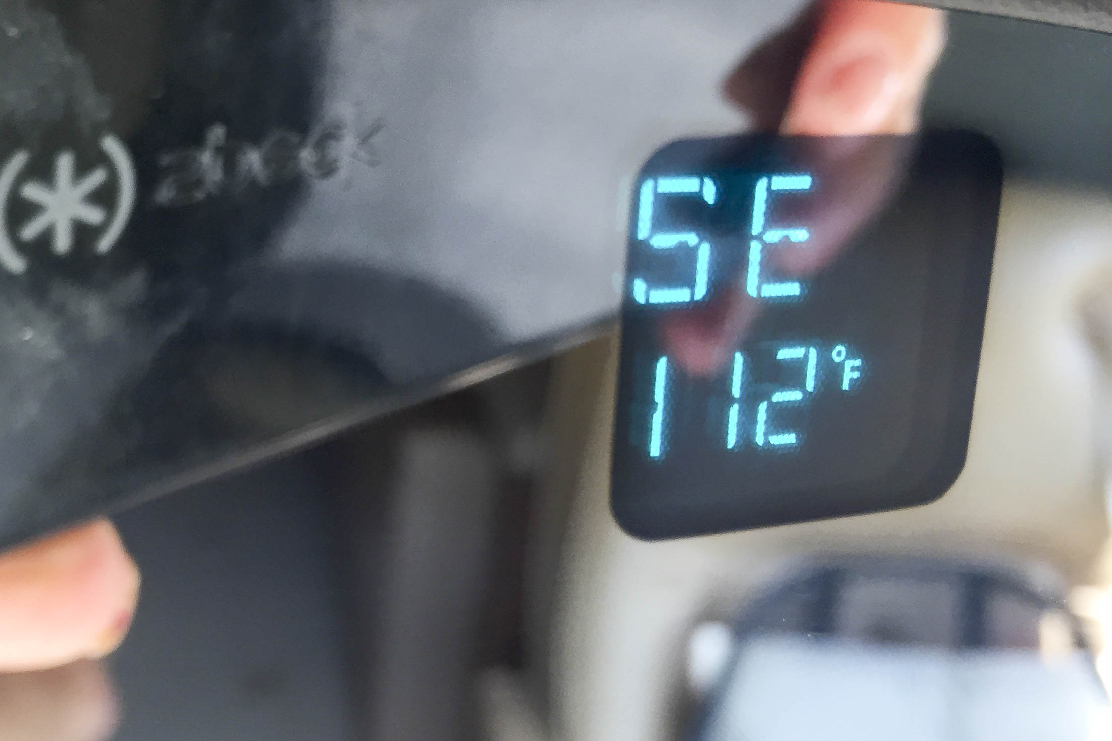
The leaves are turning and the temperature on the thermometer is falling —


148 2015 09 08 Brrr

34 degrees – YIKES!!


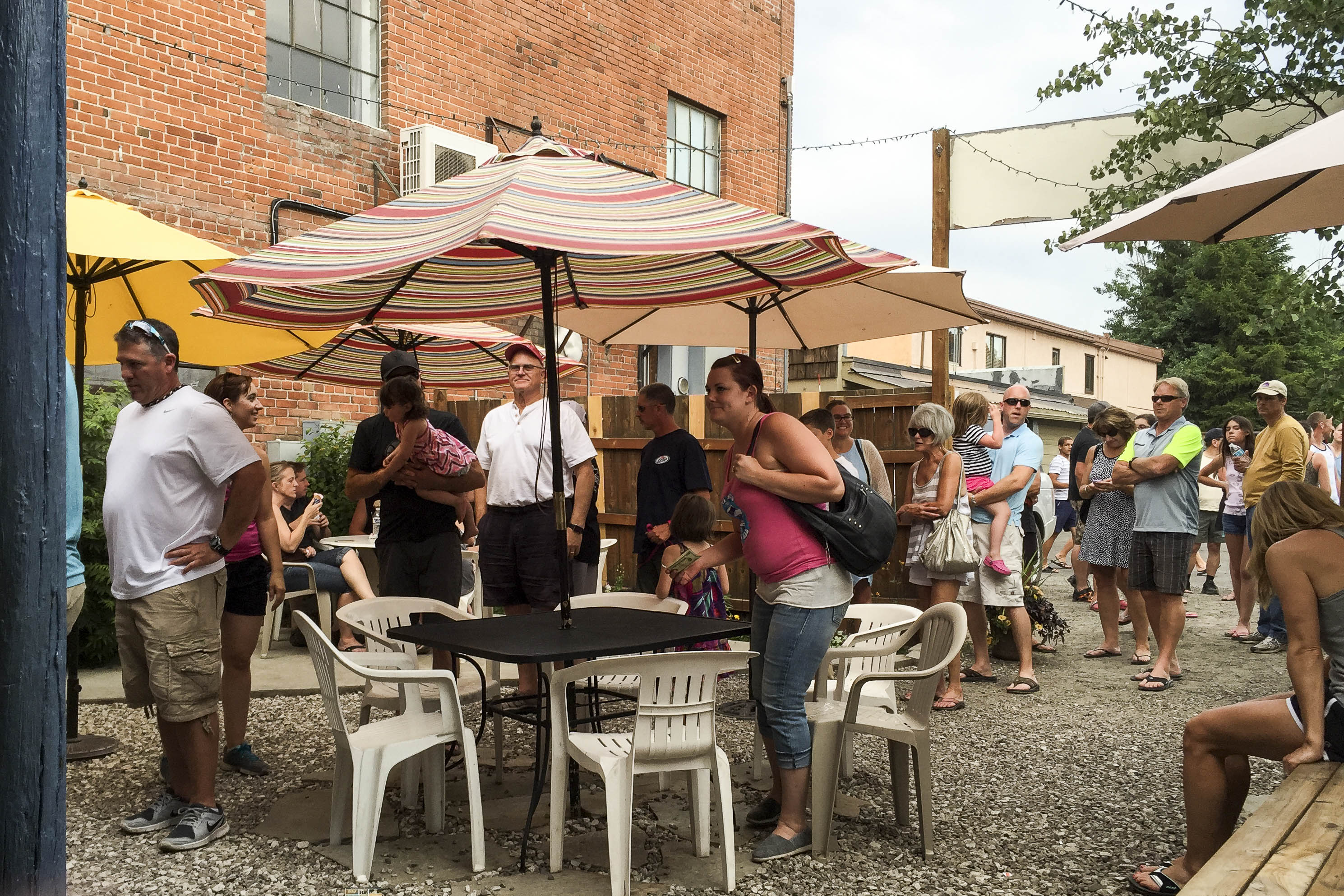
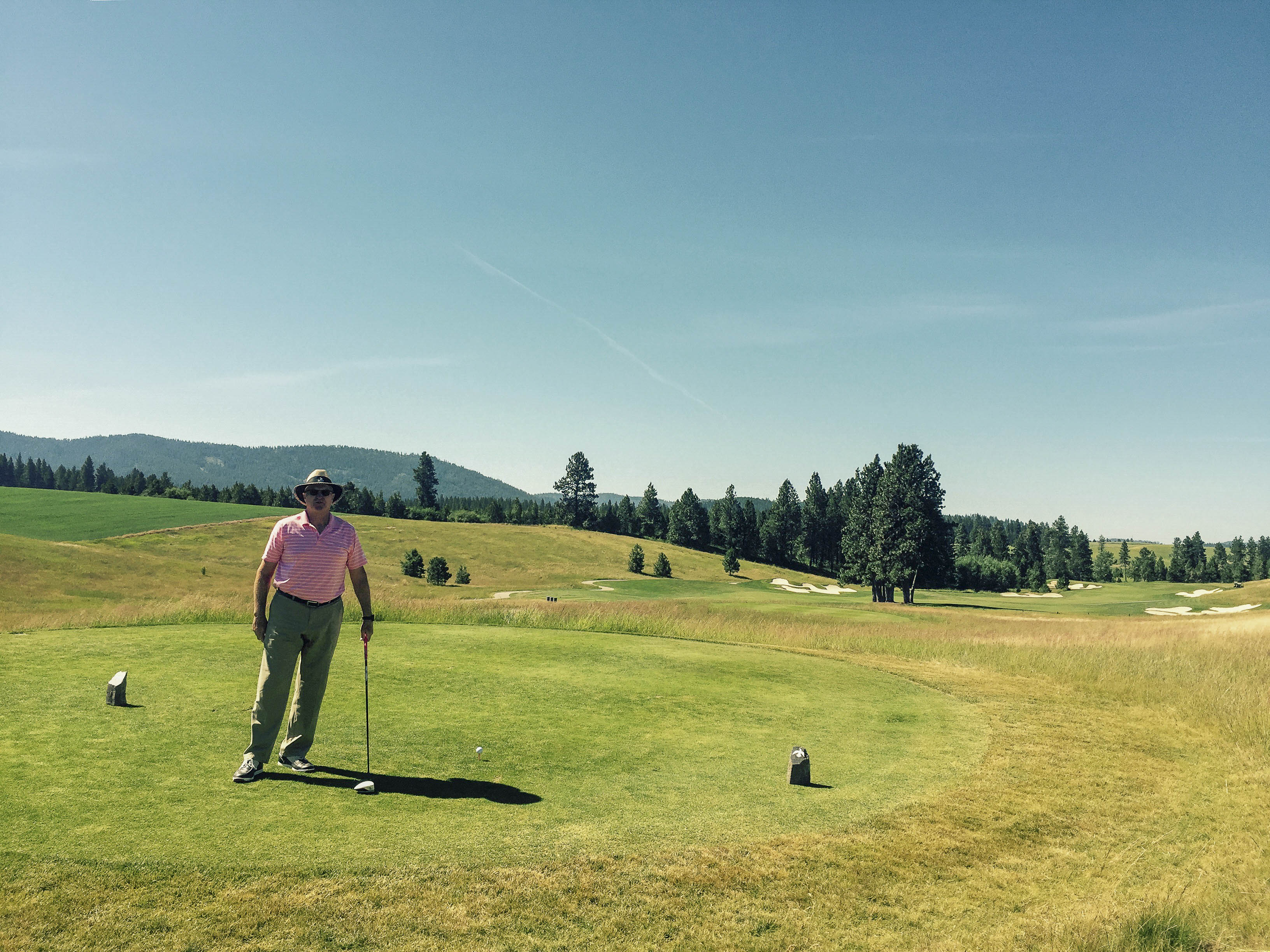
It must be time to pack up and head for warmer climates.  BUT – first there are several more Nine and Dines to be played with friends, several more dinners with friends at the Bus, more dinners out with friends followed by game night, a couple more Ladies Days, more golf to be played – –


149 2015 08 29 Golf Hike Elk001

A tall cool one after golf with Sally – Yes, even got Sally out on the course (blisters and all)!


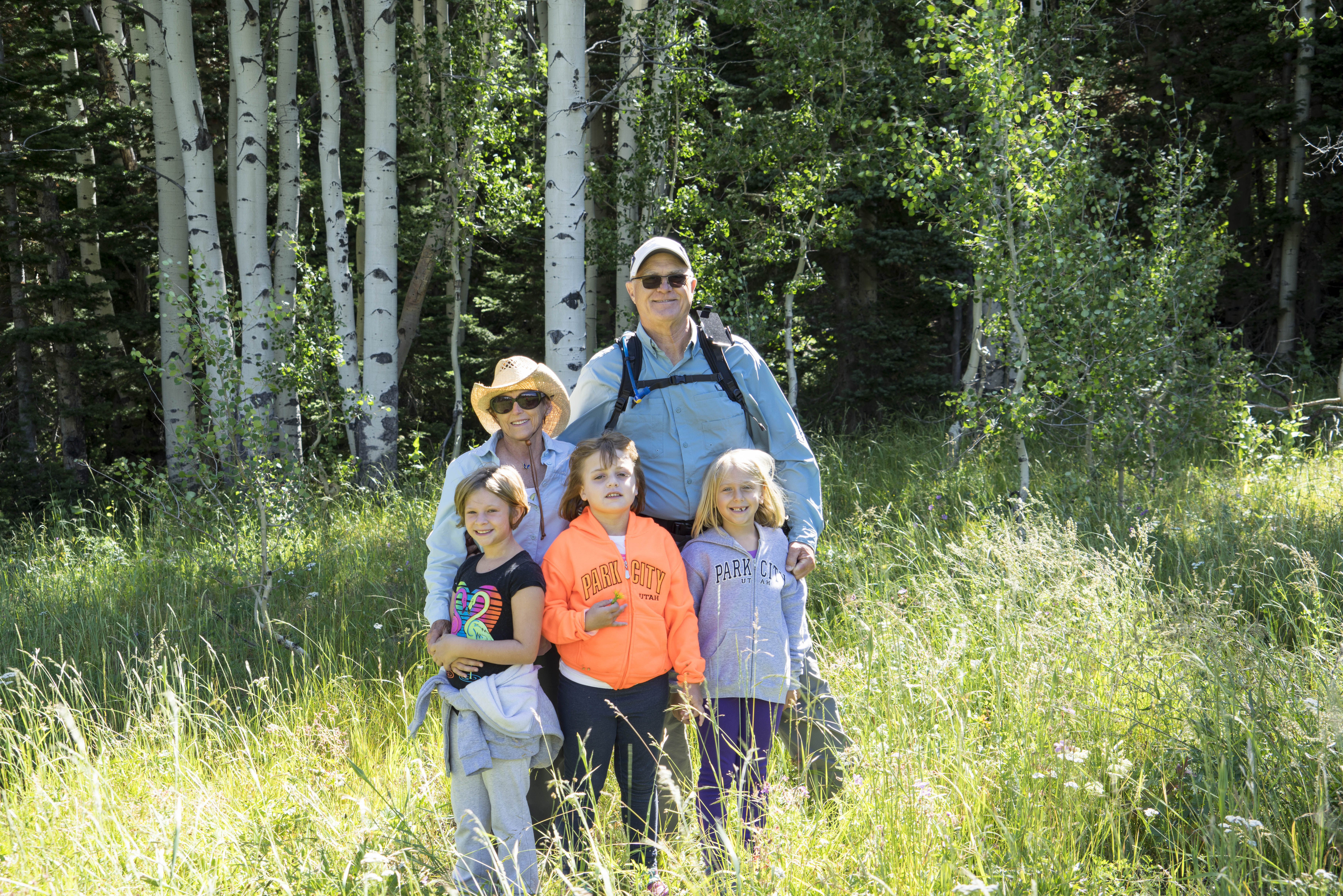
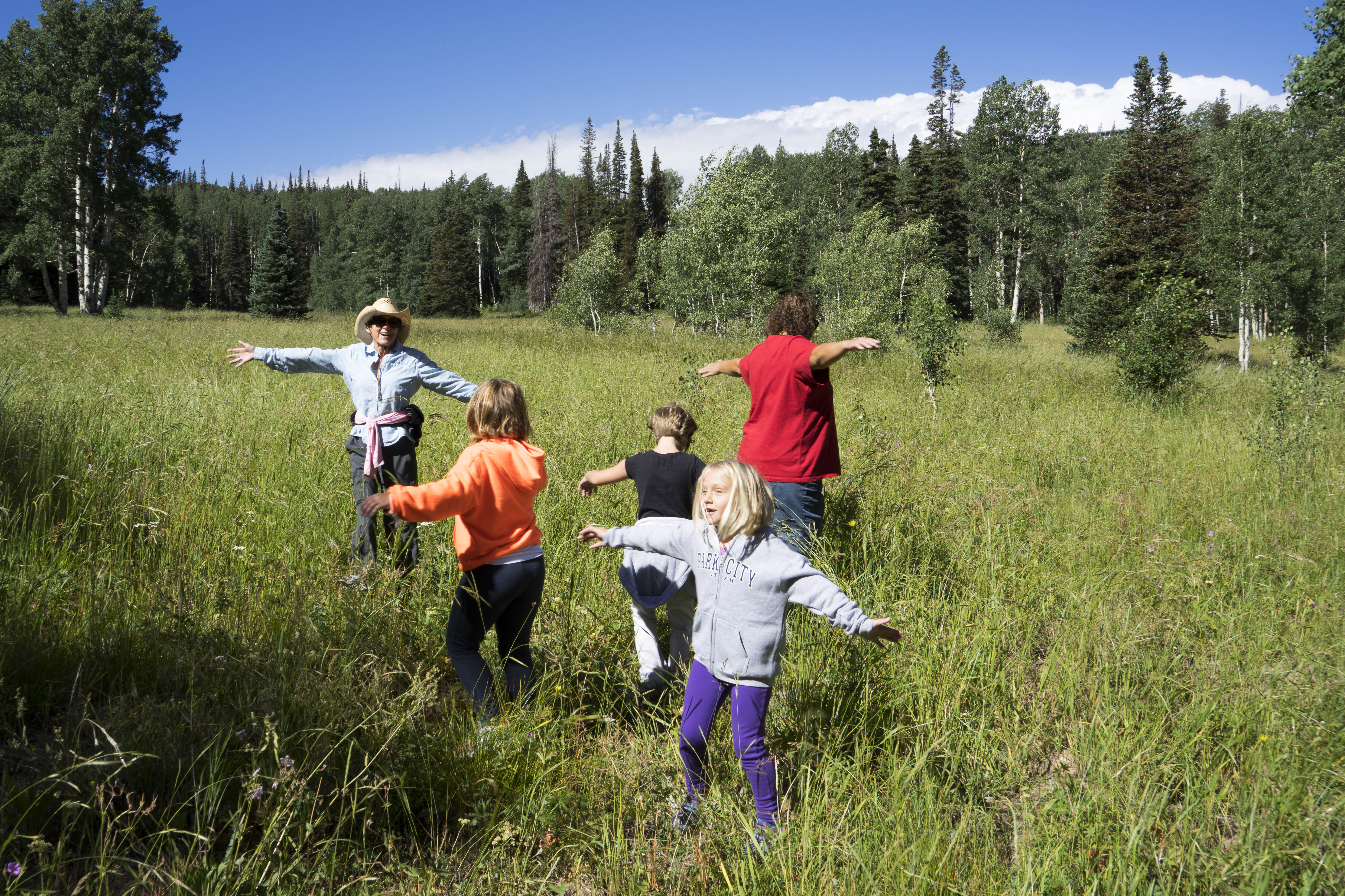
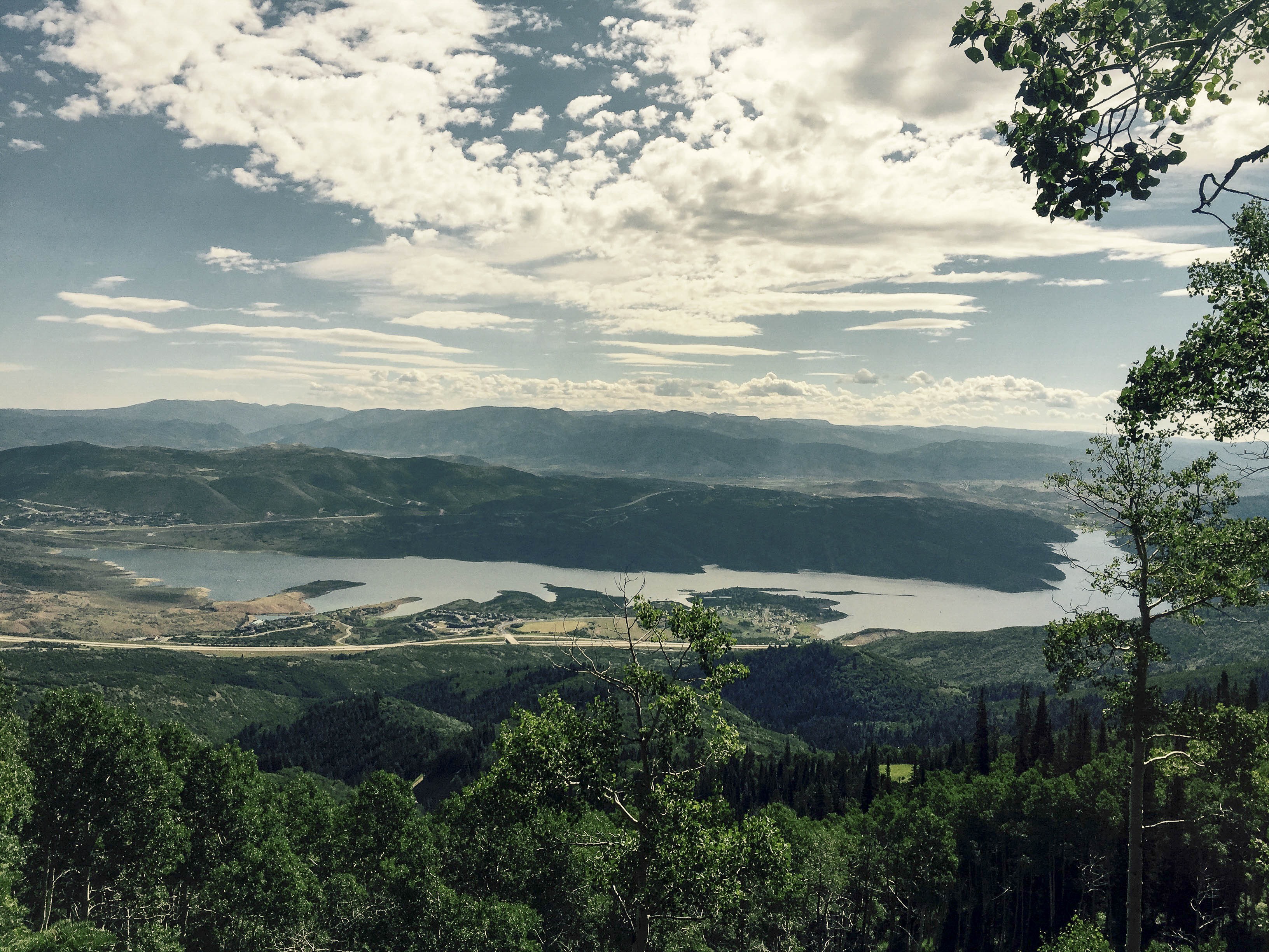
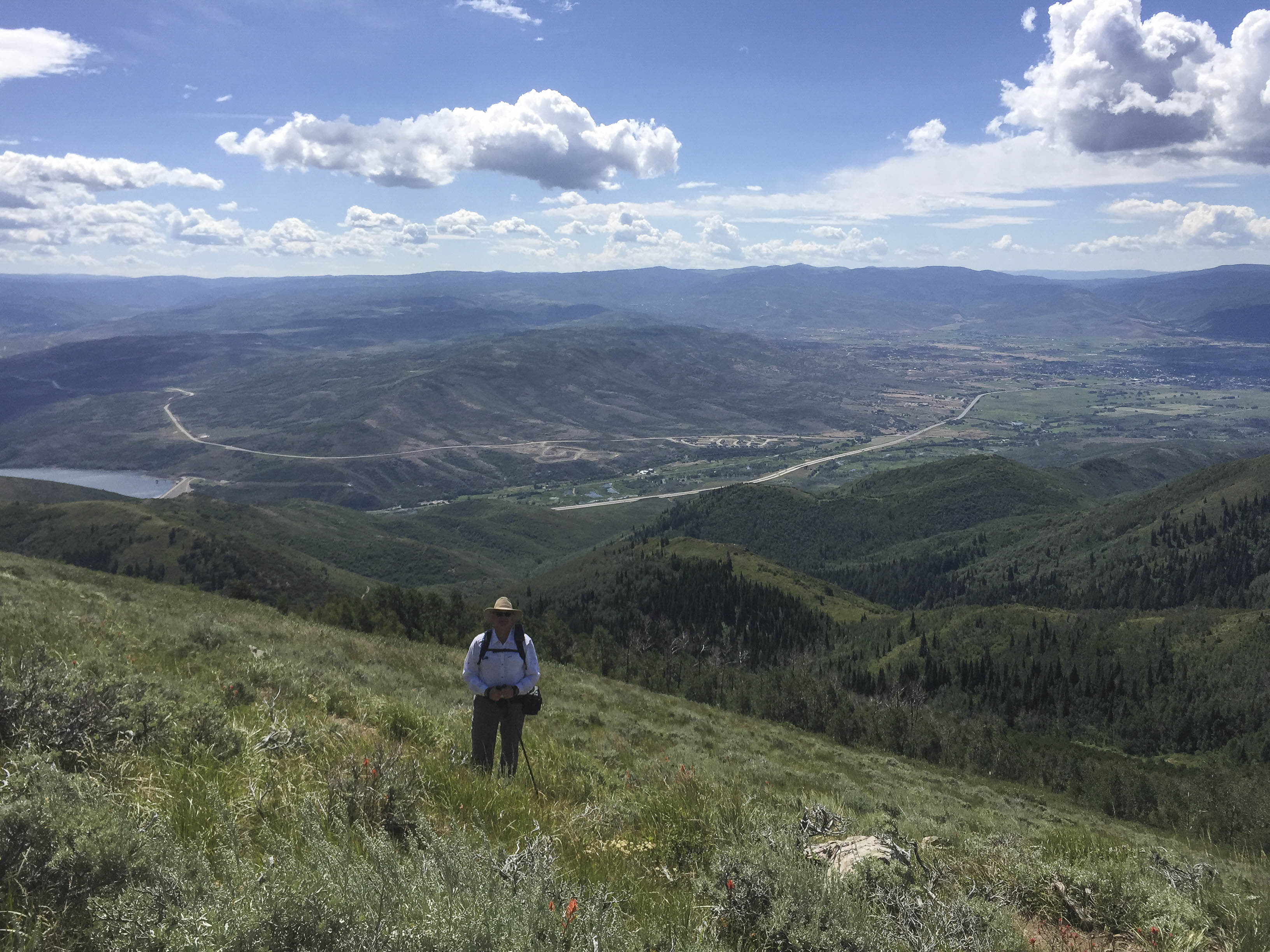
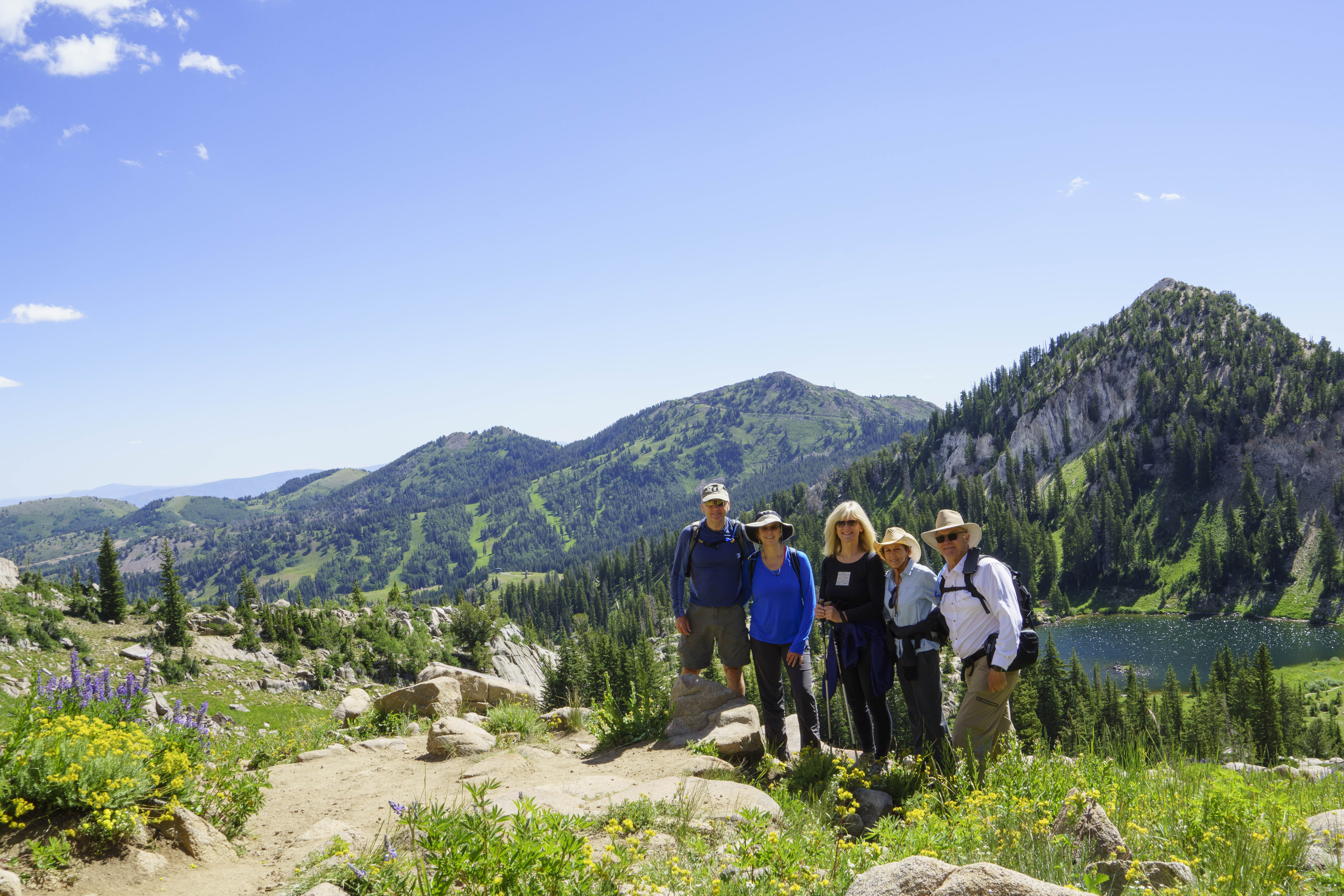
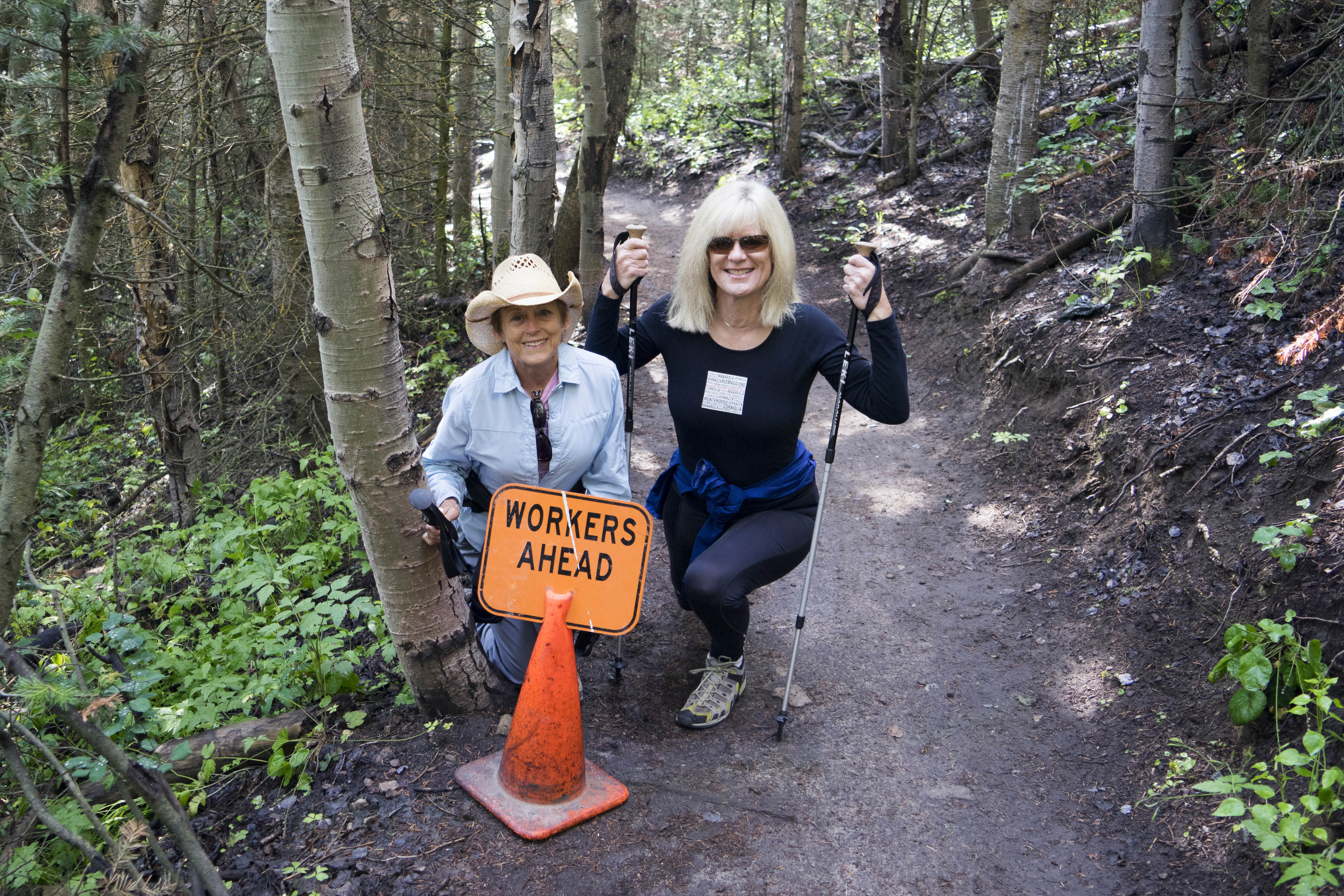
–and a couple more hikes!  Finally got to do the Mid-Mountain trail from Deer Valley Silver Lake to the top of Park City.  Unfortunately this is a favorite of the bikers and we did this on a Saturday.  Not a good choice of days;-(  But, even though there was a lot of bike traffic, the hike was great and the day was beautiful!!


150 2015 08 29 Golf Hike Elk002

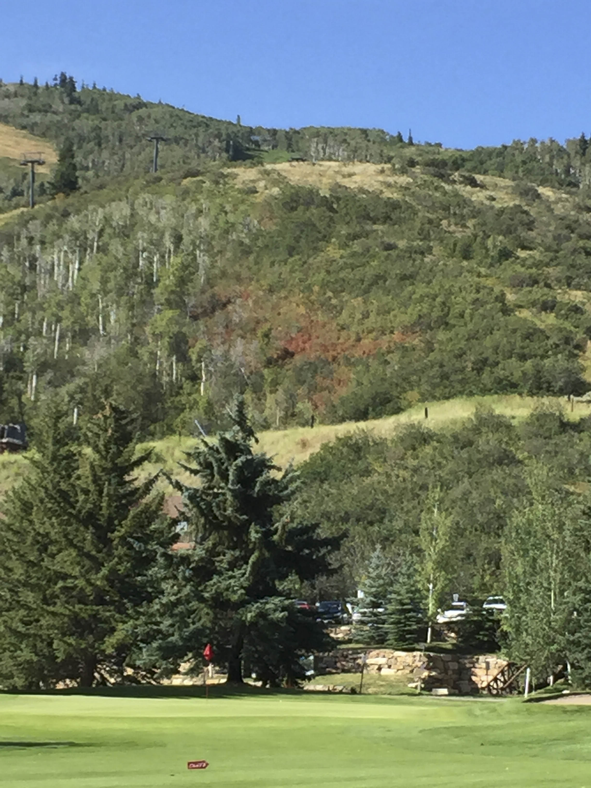
Even though Gary quit skiing – he can still ‘do’ his favorite run at Deer Valley;-)


151 2015 08 29 Golf Hike Elk003

And E can do the bumps in Lady Morgan Bowl – just a little light in the snow cover;-(


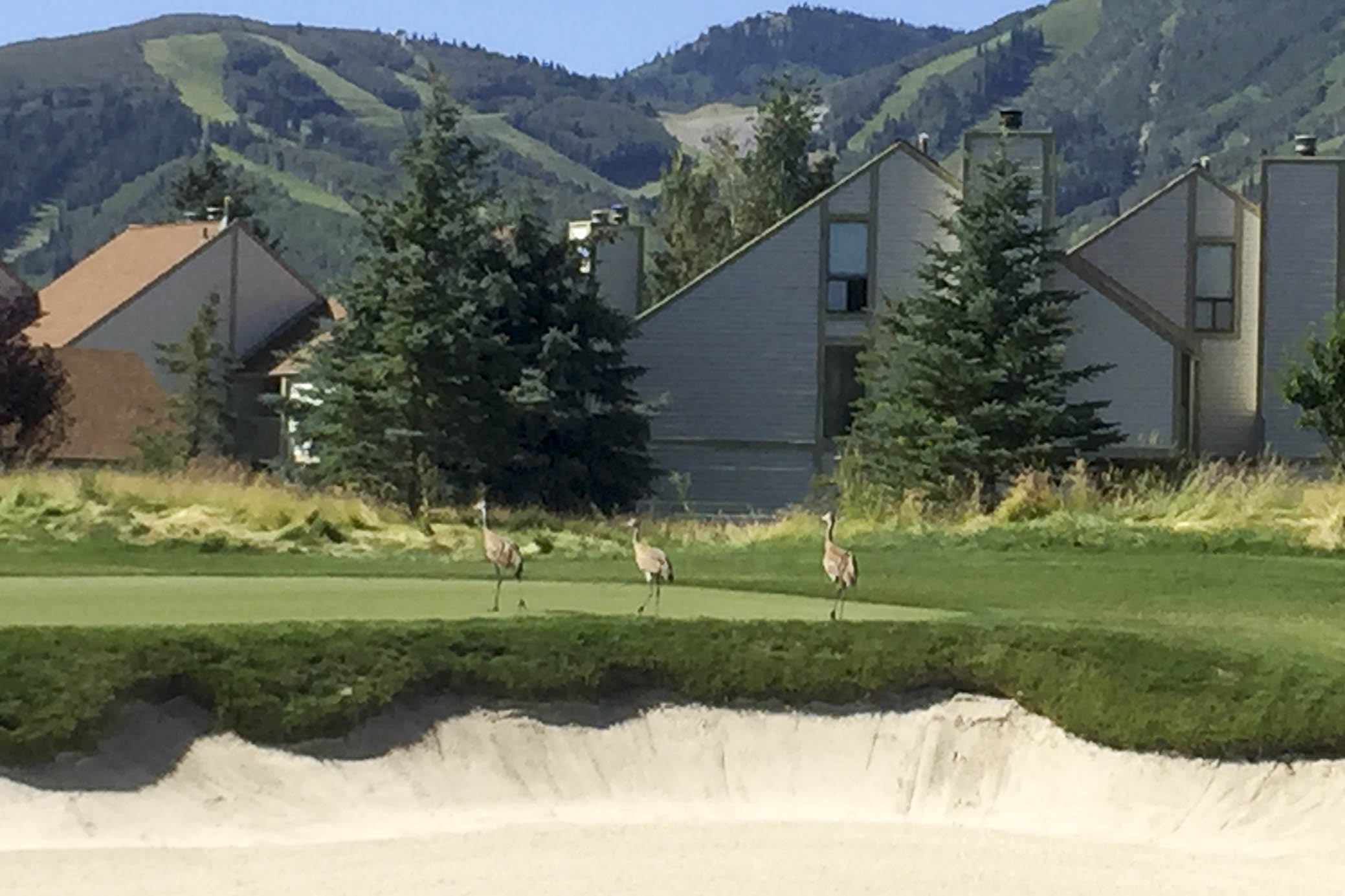
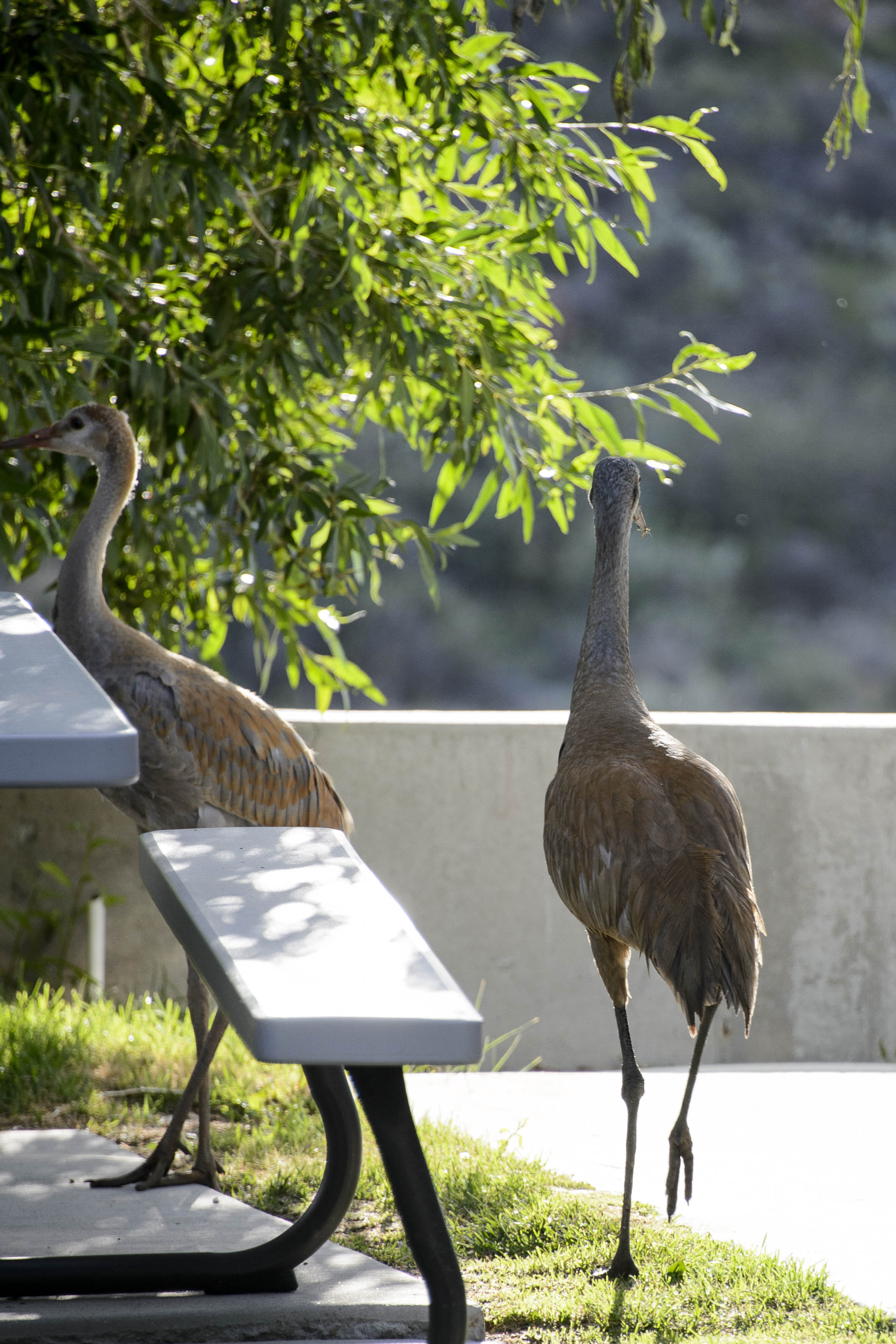
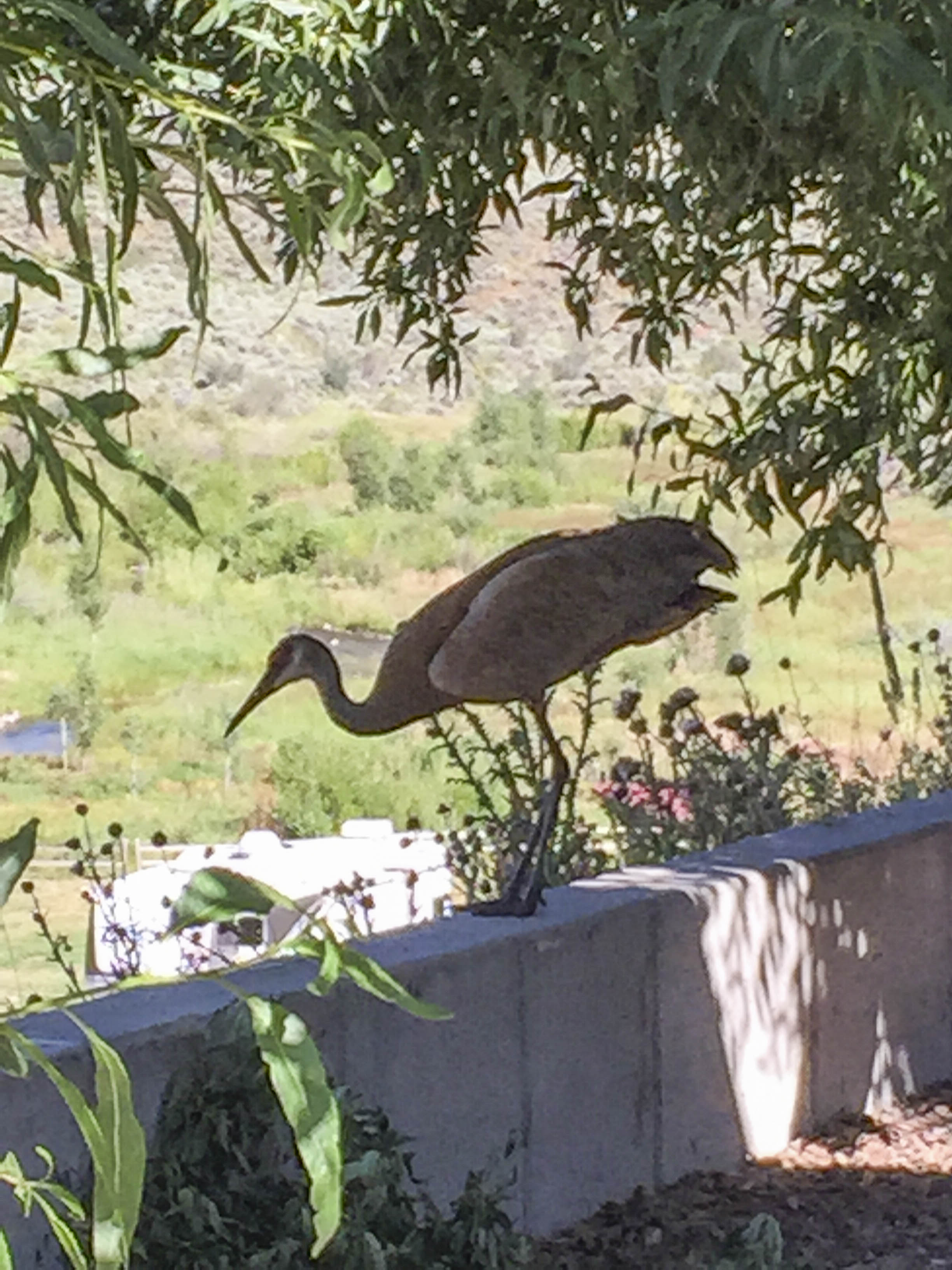
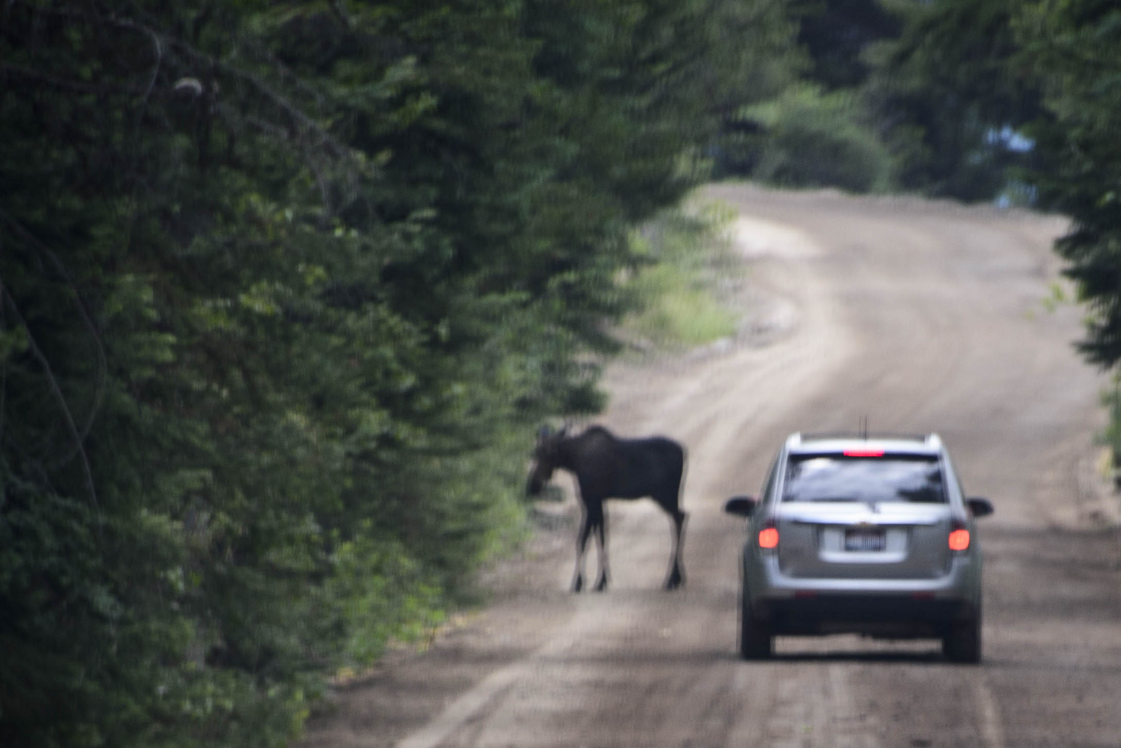
Also had one last animal sighting.  Lucy the Moose did not come back to say good-bye, but this BIG elk showed his agility crossing highways and jumping fences.


152 2015 08 29 Golf Hike Elk004

This guy had ONE BIG RACK;-)!


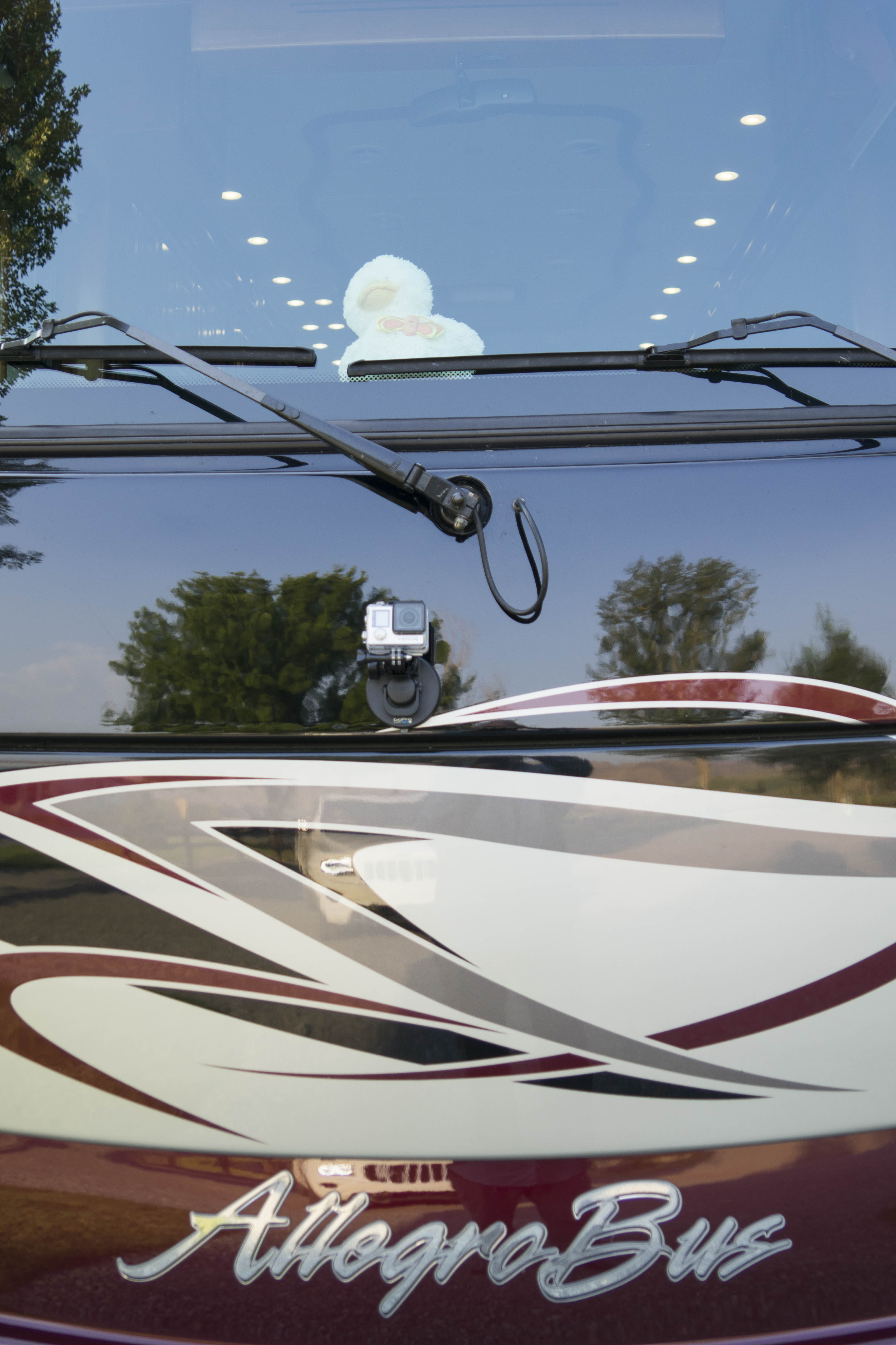
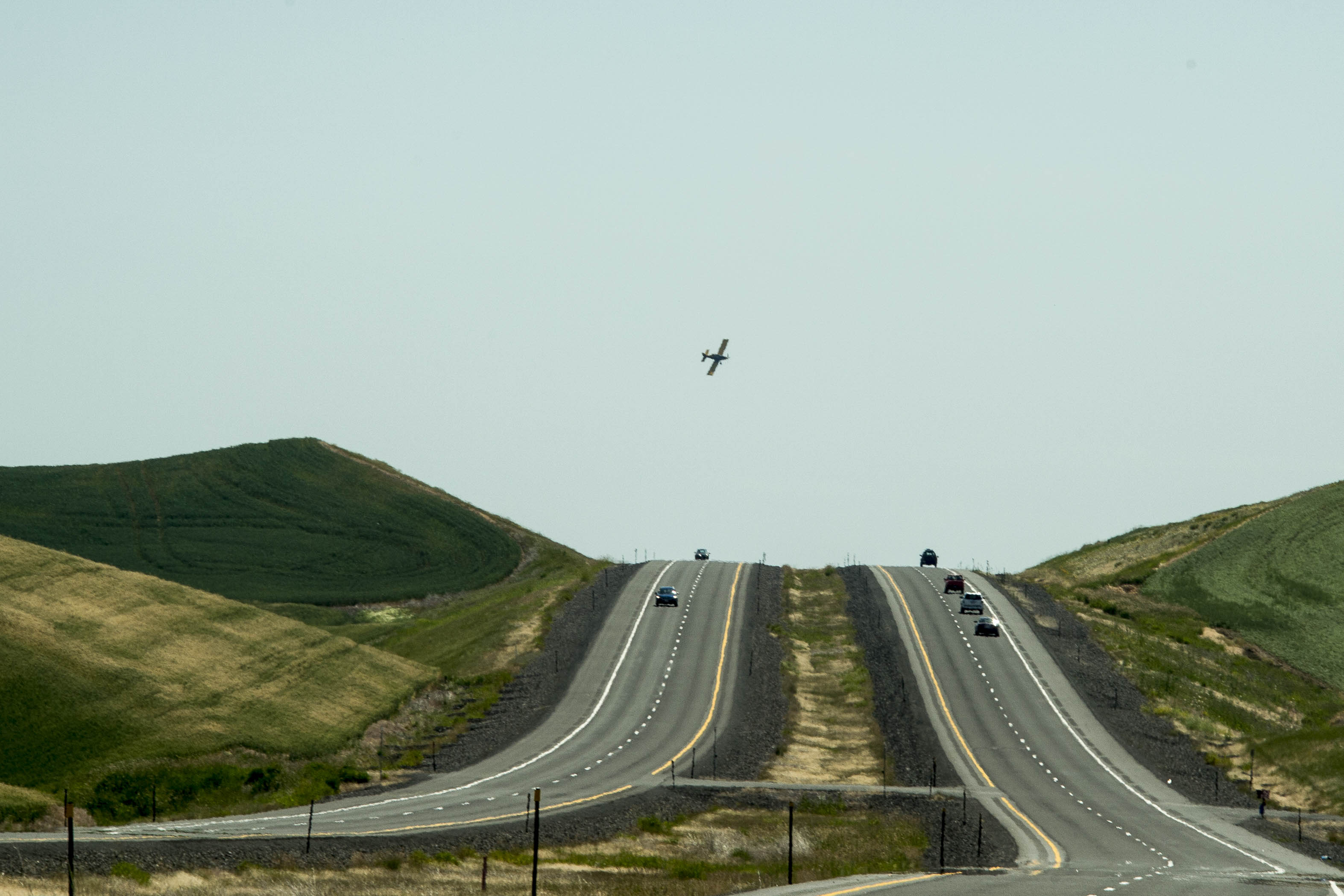
And so – our summer in Park City came to an end.  Magic was cleaned, our gear was stored and we were ready to roll.  Oh yes – gadget geek G has taken a few lessons from Ted the skier.  The latest is to have a GoPro attached to the front of the car AND TO MAGIC so no picture on the highway is missed.  (Don’t you just want to see the center line go by???)


153 2015 09 11 HellsCyn Loop 002

A new toy…the GoPro camera mounted on the Jeep – –


154 2015 09 12 Quacker Cam002

– – And on the Bus.  Perhaps we should call it the Quacker Cam.


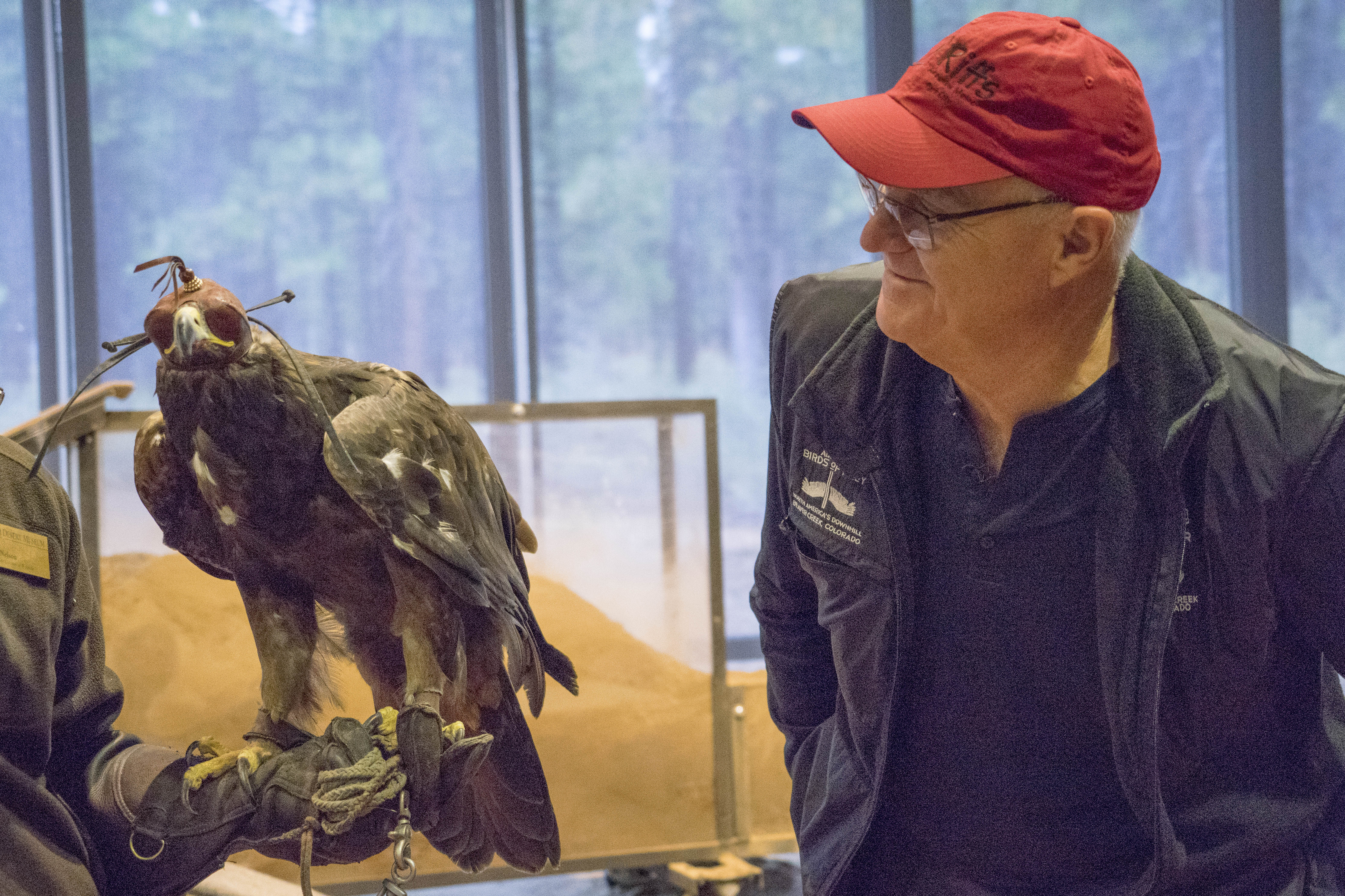
Our first destination on this portion of our trip would be Hells Canyon.  A little far for one day’s drive – so a stop just outside of Boise was in order.  This provided an opportunity to visit the World Center for Birds of Prey and to gather information on the Snake River Birds of Prey National Conservation Area.  The World Center for Birds of Prey is the headquarters for the Peregrine Fund, founded in 1970 to conserve endangered raptors around the world.  The Center overlooks Boise and the campus includes breeding facilities for endangered raptors and a large research library and the Archives of Falconry along with various offices.


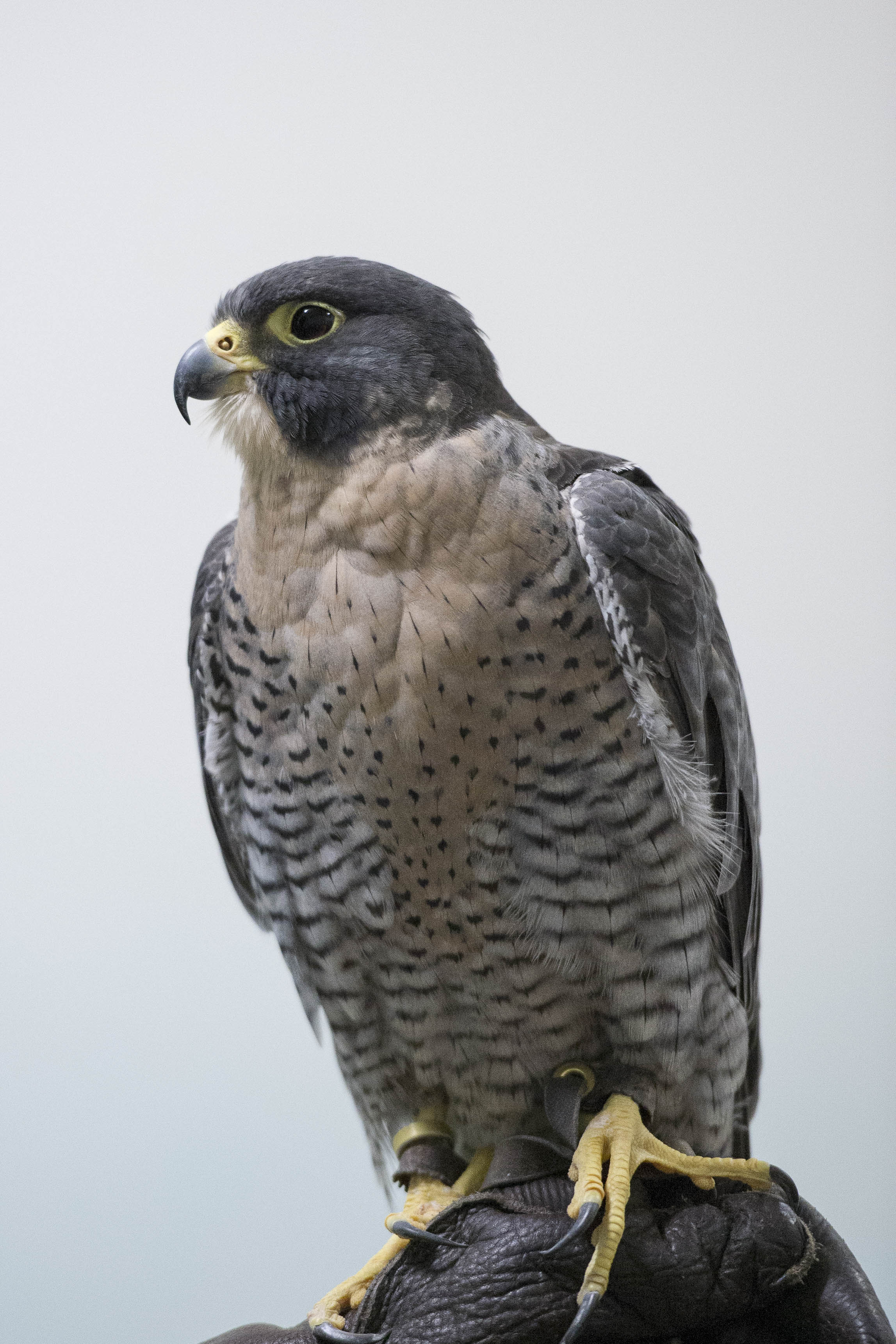
The propagation program of the Center played a critical role in the successful recovery of the peregrine falcon and the Center is currently breeding the endangered California condor and aplomado falcon.  Each year the Center releases the year old Condors from their breeding program into the wild at the Grand Canyon and in southern Utah.  We were particularly interested to find out where and when the Condors were released at the Grand Canyon so that we might include that in our travels in 2016 as well as checking out the mating/migration of the eagle, which is best observed at the Snake River Conservation Area near Boise in the spring.  Since our trip to Alaska, the Eagle has become a favorite of ours and learning more about birds of prey in general has become quite an interest.


155 2015 09 10 Raptors 018

A Peregrin falcon was THE topic of discussion at the Center’s presentation.


156 2015 09 10 Raptors 021

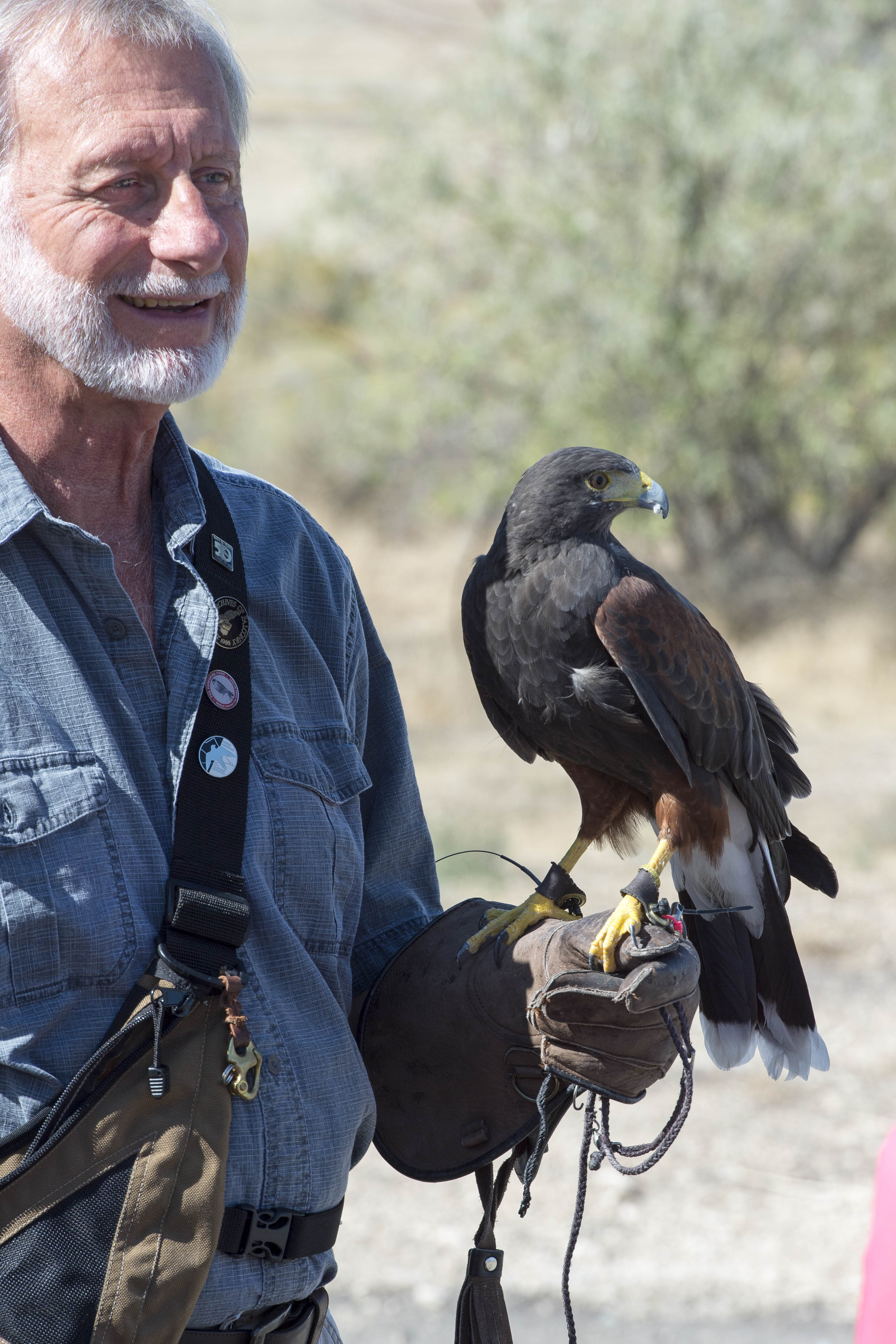
This Harris falcon was being trained for ‘flight shows’ that take place at the Center in October.


The morning at the Center was VERY interesting and has provided a beginning for our 2016 summer plans;-)


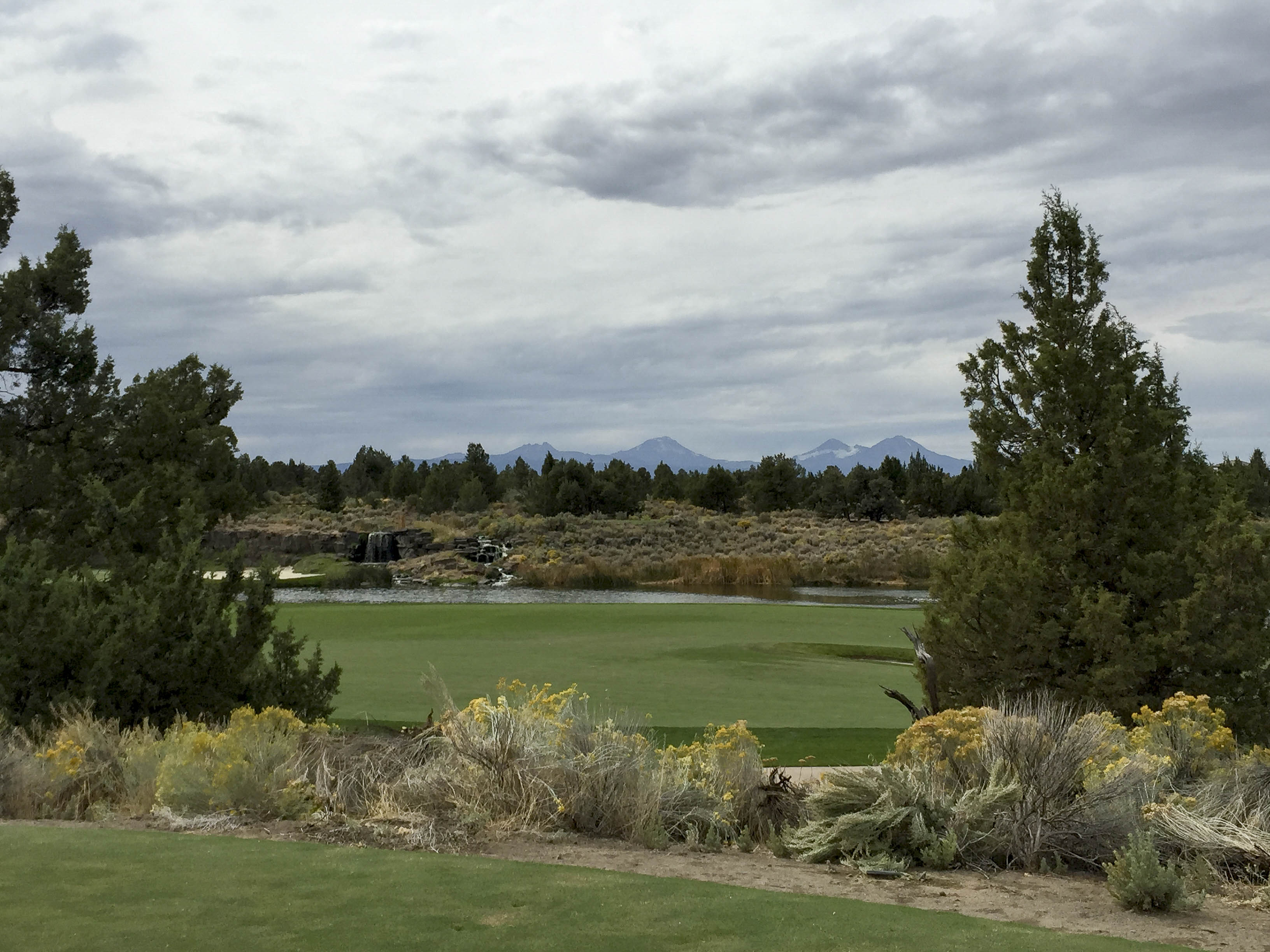
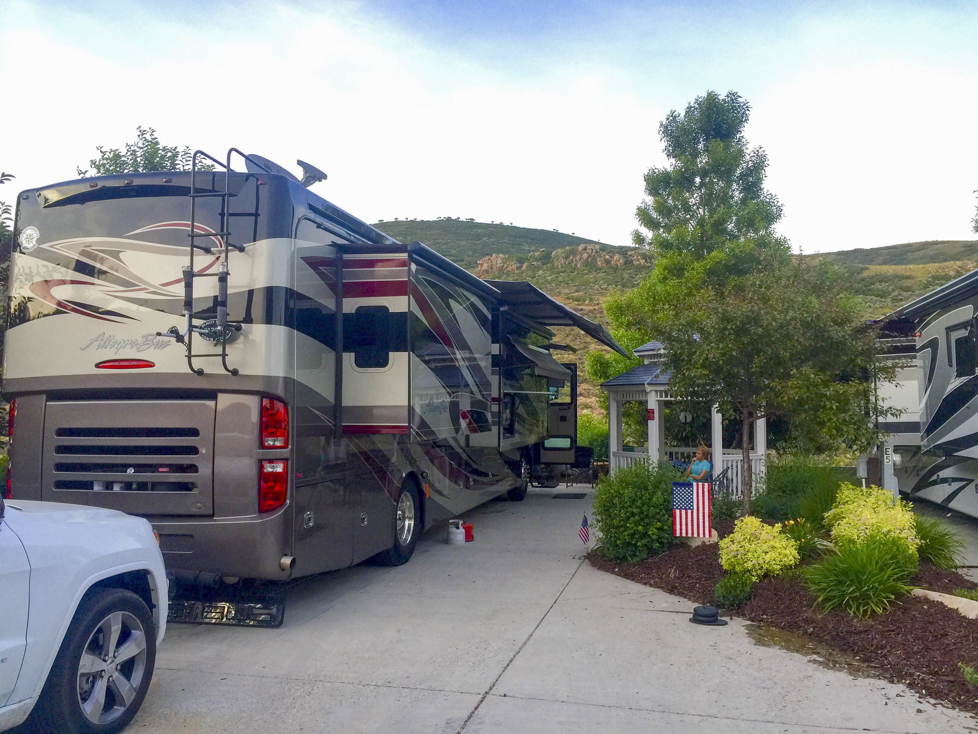
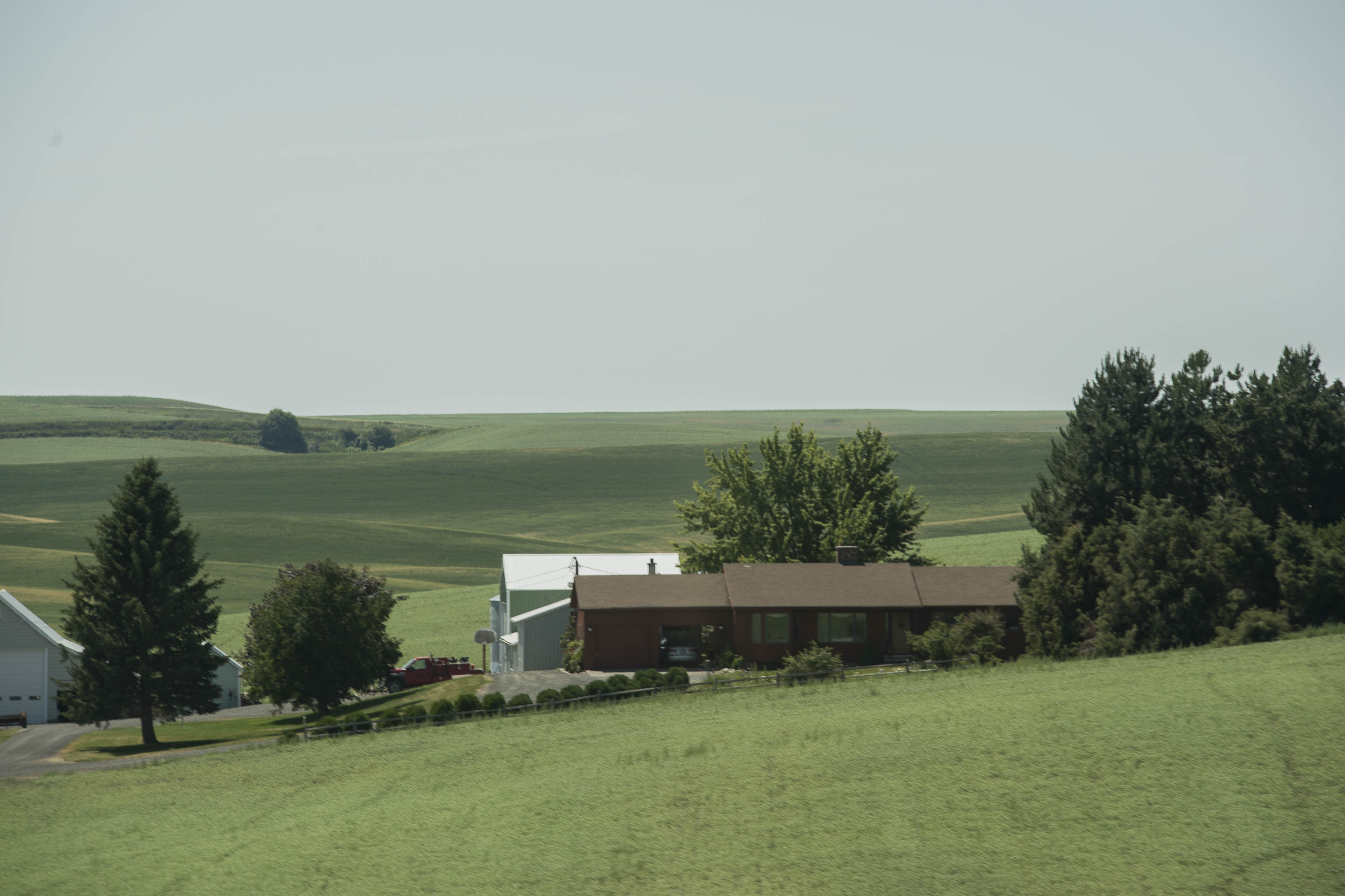
Hells Canyon was calling and it was time to head that way.  So – we were off to the northeast corner of Oregon by way of Baker City.  The small town of Richland would be Magic’s home for a few days, where our parking spot was in the middle of lush green fields with wonderful views of the Wallowa Mountains to the north —


157 2015 09 10 Richland 005

The view from Magic’s spot in Richland, OR is quite pastoral.


The next two days would be filled investigating the area in and around Hells Canyon National Recreation Area.  First would be the 208 mile driving loop that encircles the Wallowa Mountains, the Eagle Cap Wilderness, the Snake River and the deepest river gorge in America – Hells Canyon.


158 2015 09 11 HellsCyn Loop 006

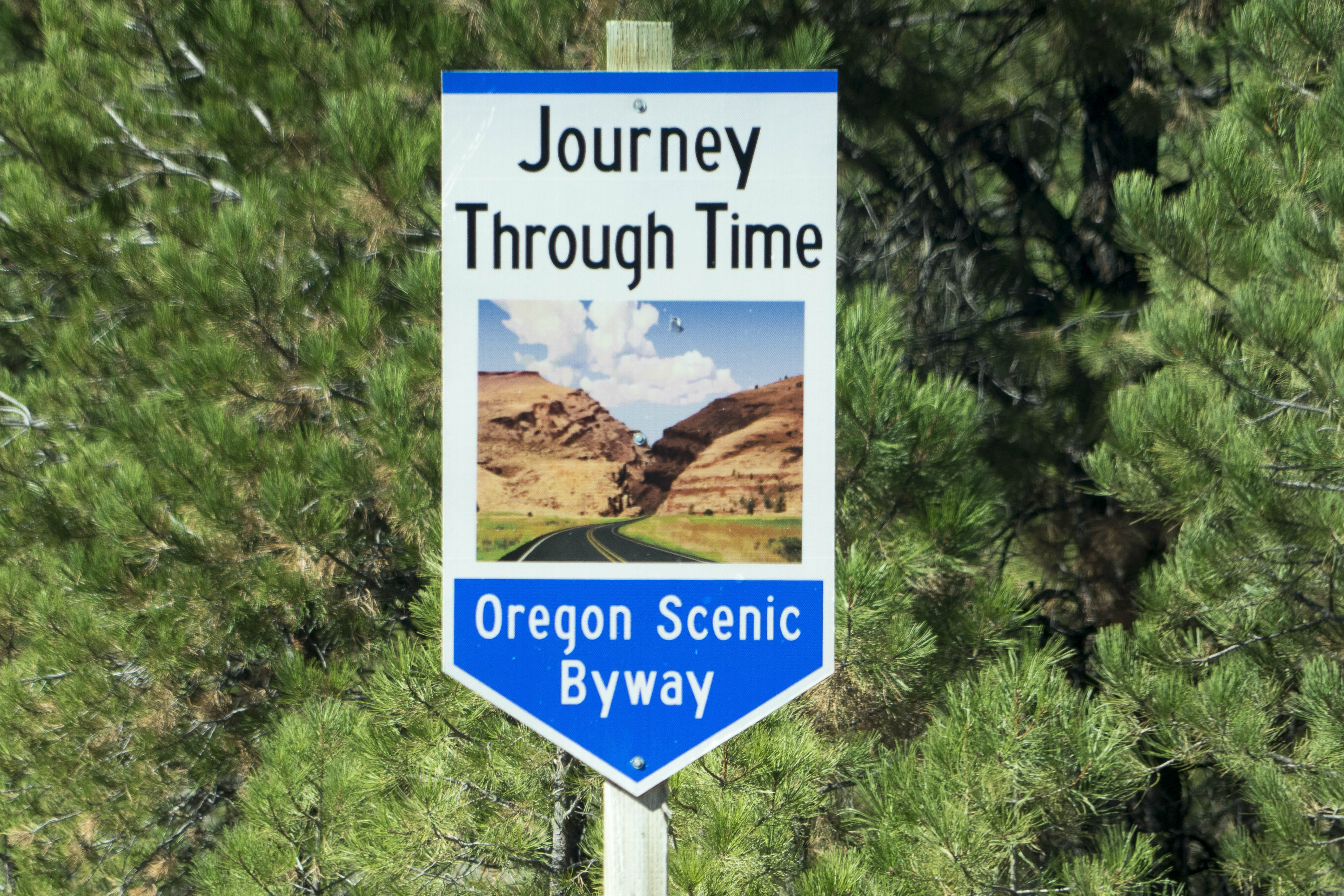
We are off to enjoy the Hells Canyon Scenic Byway.


Millions of years ago, the Wallowa Mountains sat at the bottom of the ocean.  It’s uplifted limestone layers evidence this fact with its fossilized shells.  Eons of volcanic action and faulting pushed the mass of rock upward and to the east while new land formed to the west.  Raging rivers and gigantic glaciers carved the peaks and canyons that are seen today along the Byway.


In more recent history, the Grande Ronde Valley (on the north side of the Wallowa Mountains) was used seasonally by Native Americans – the Nez Perce, Umatilla, Yakima, Shoshone, Cayuse and Bannock Nations.  This area was lush with grass and filled with game.  Explorers, trappers and gold miners found the area beginning in the early 1800’s (many via the Oregon Trail).  Today – farms and ranches retain the wide open spaces.


159 2015 09 11 HellsCyn Loop 022

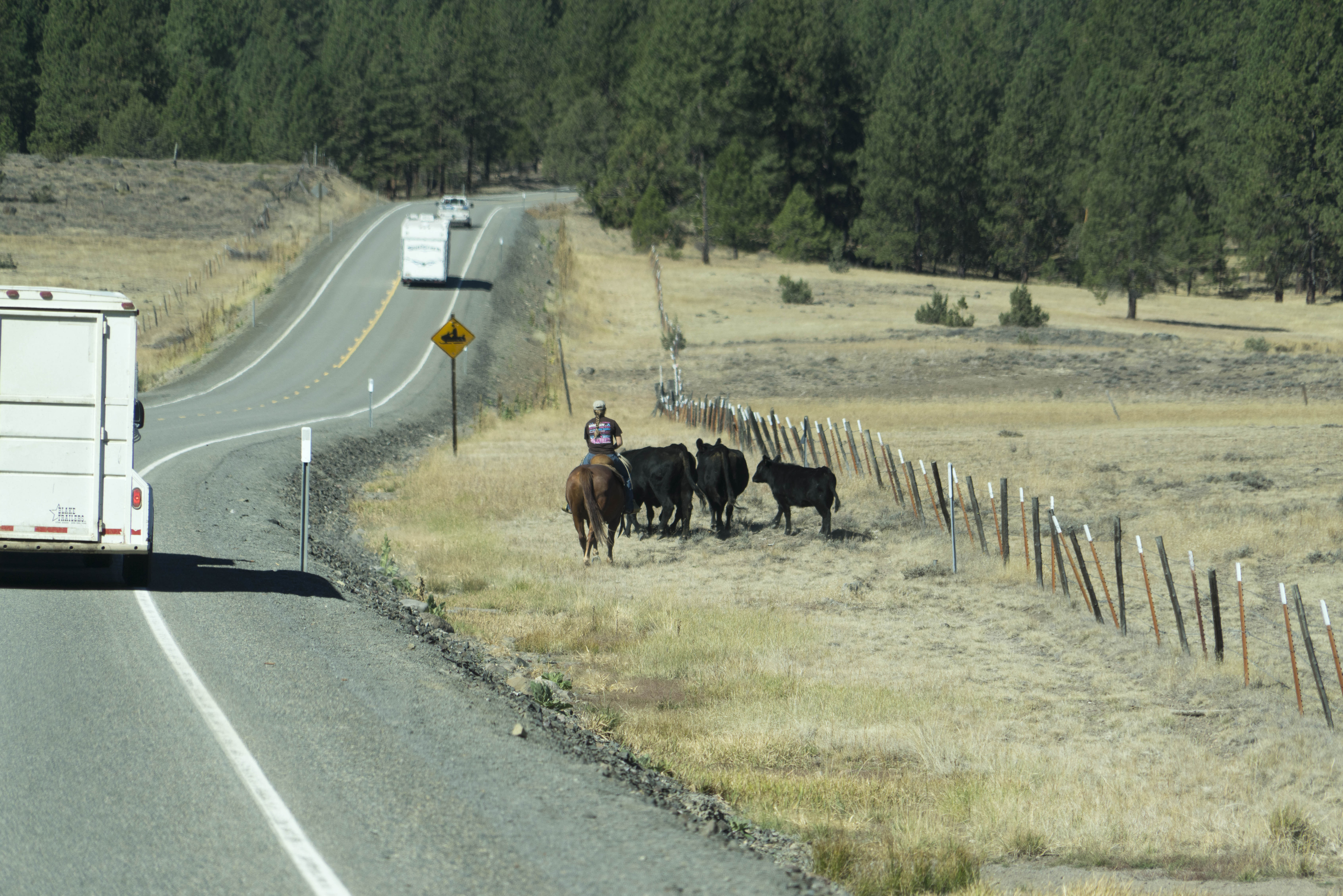
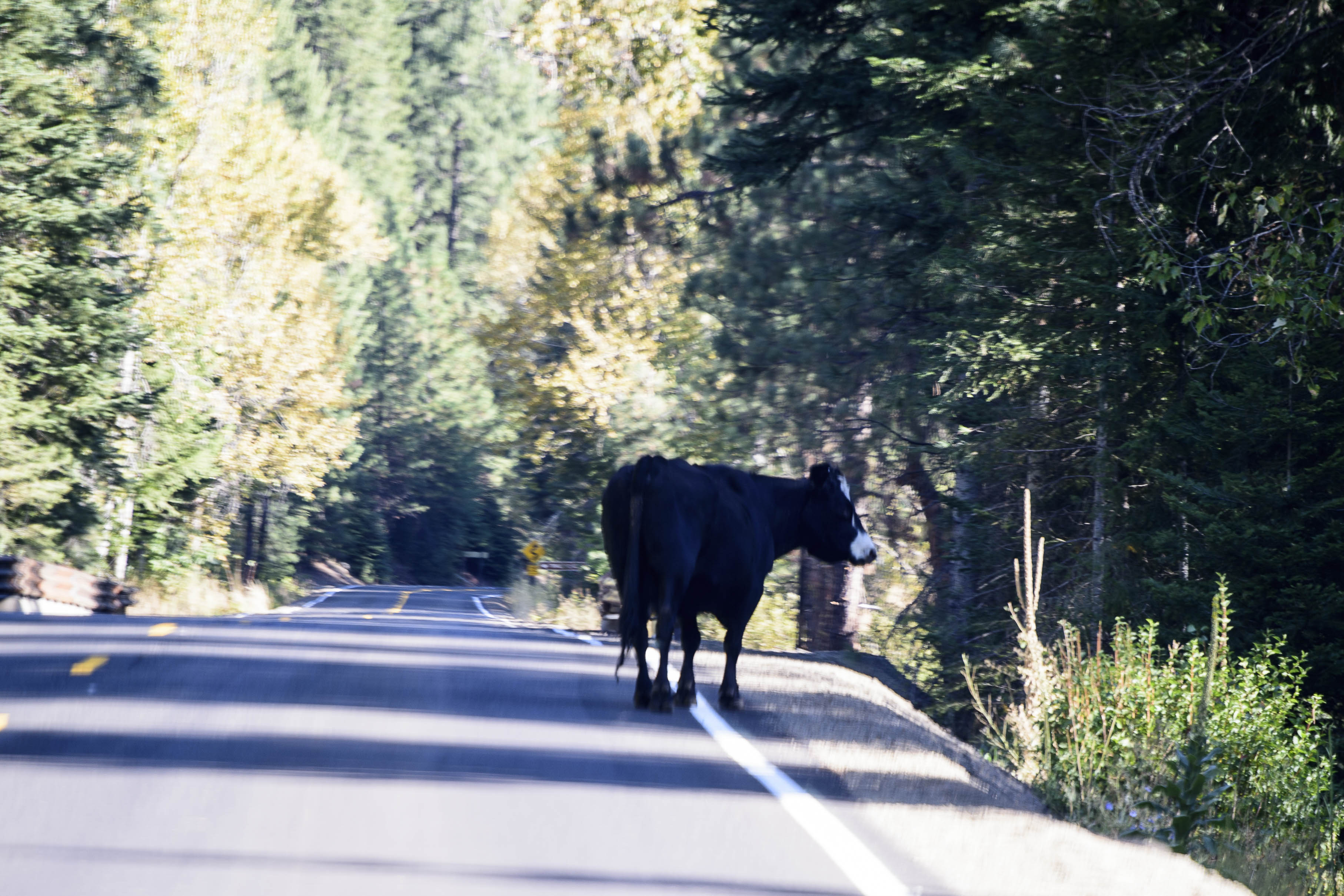
Open ranges prevail – and the cows own the road;-)


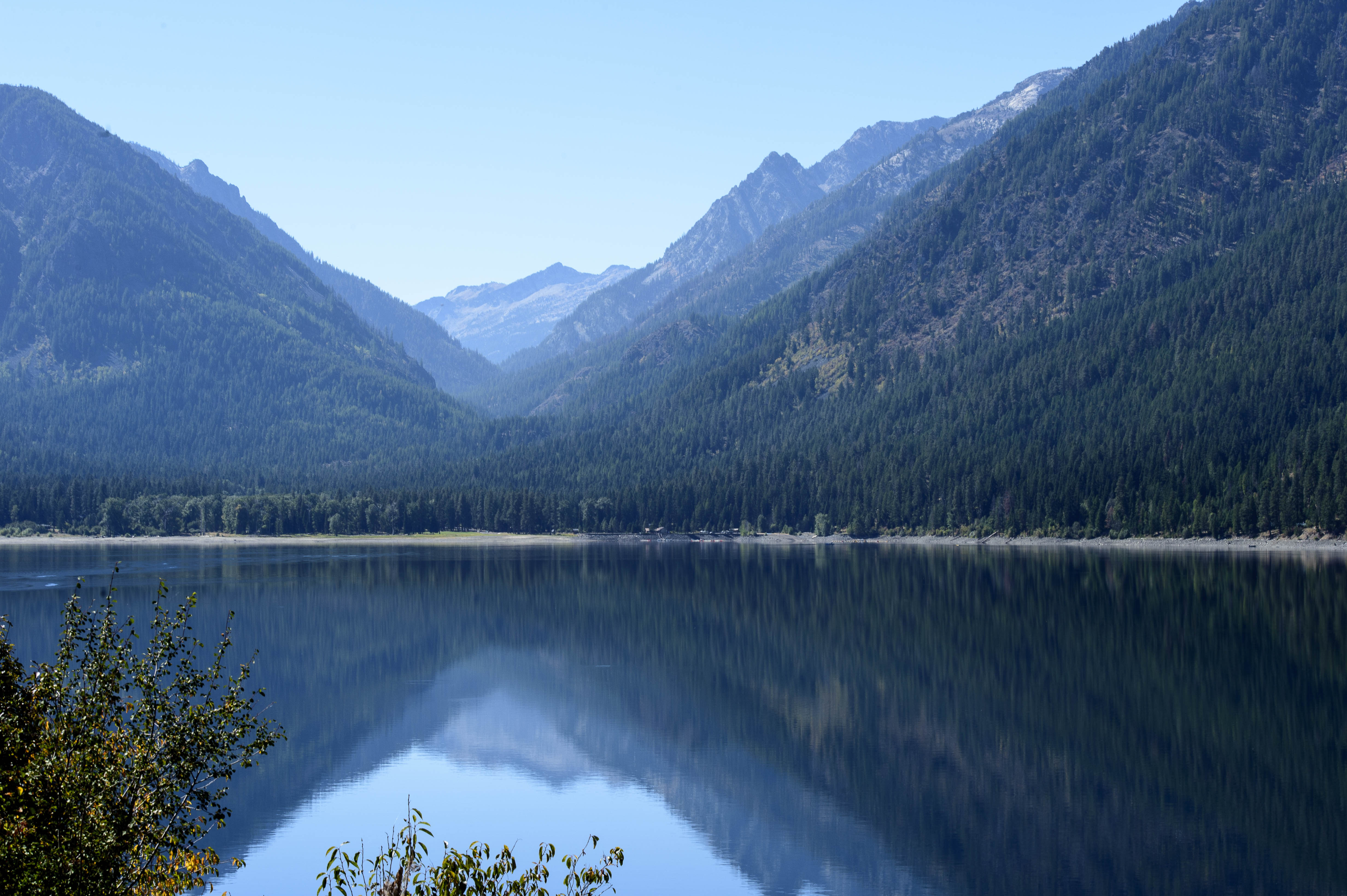
The Scenic Byway took us through the Wallowa Mountains (above) to the north side of the mountains and into the Grande Ronde Valley.  For us, the highlight of this north side was the town of Joseph and nearby Wallowa Lake.  The lake was shaped by glaciers which covered this region three to seven times.  The 2,000 foot thick Bennett Glacier scoured the land for almost 20 miles, creating the lake and leaving nearly perfect examples of lateral and terminal moraines around the lake.


160 2015 09 11 HellsCyn Loop 036

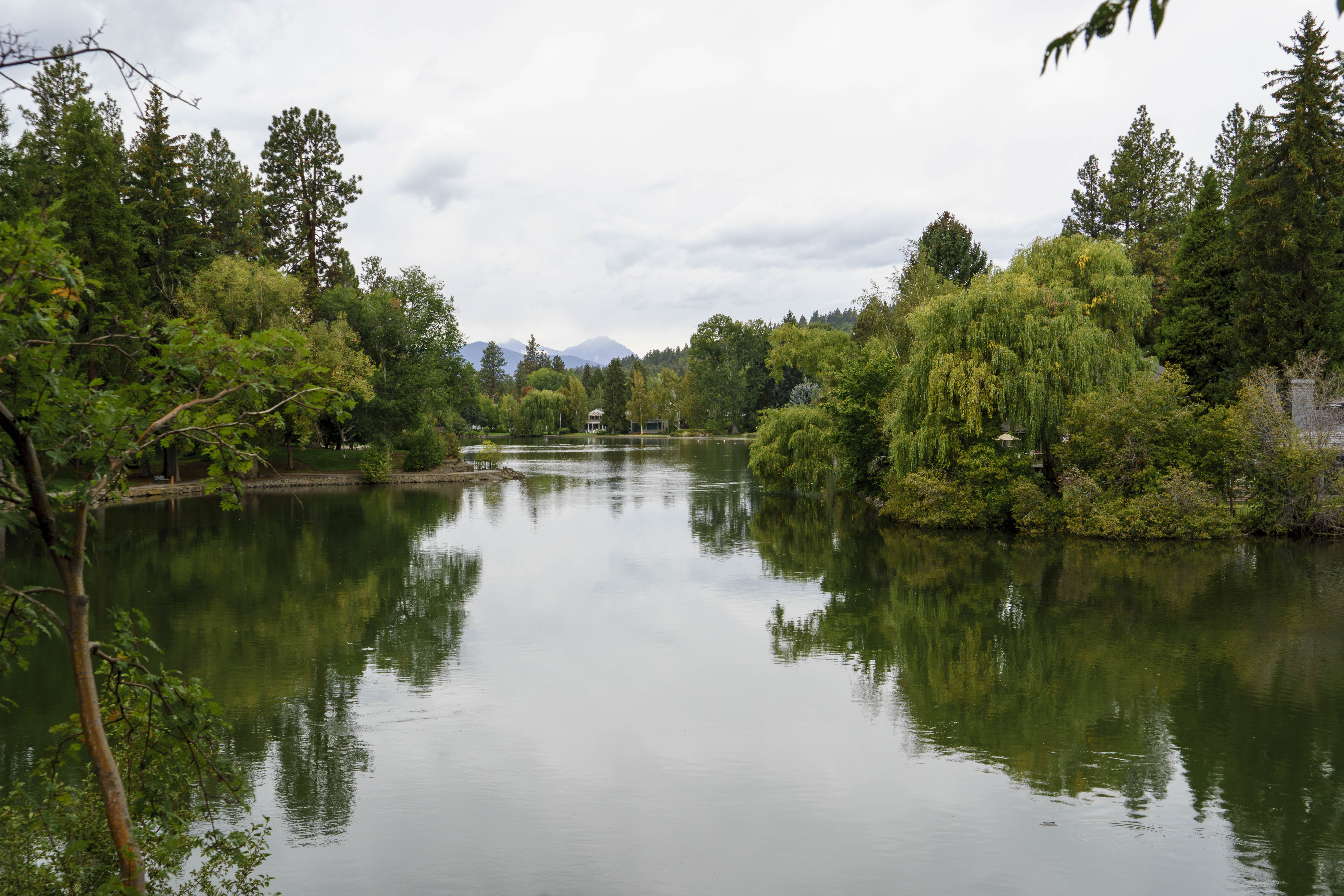
Wallowa Lake on a perfect day for ‘reflecting’ pictures.


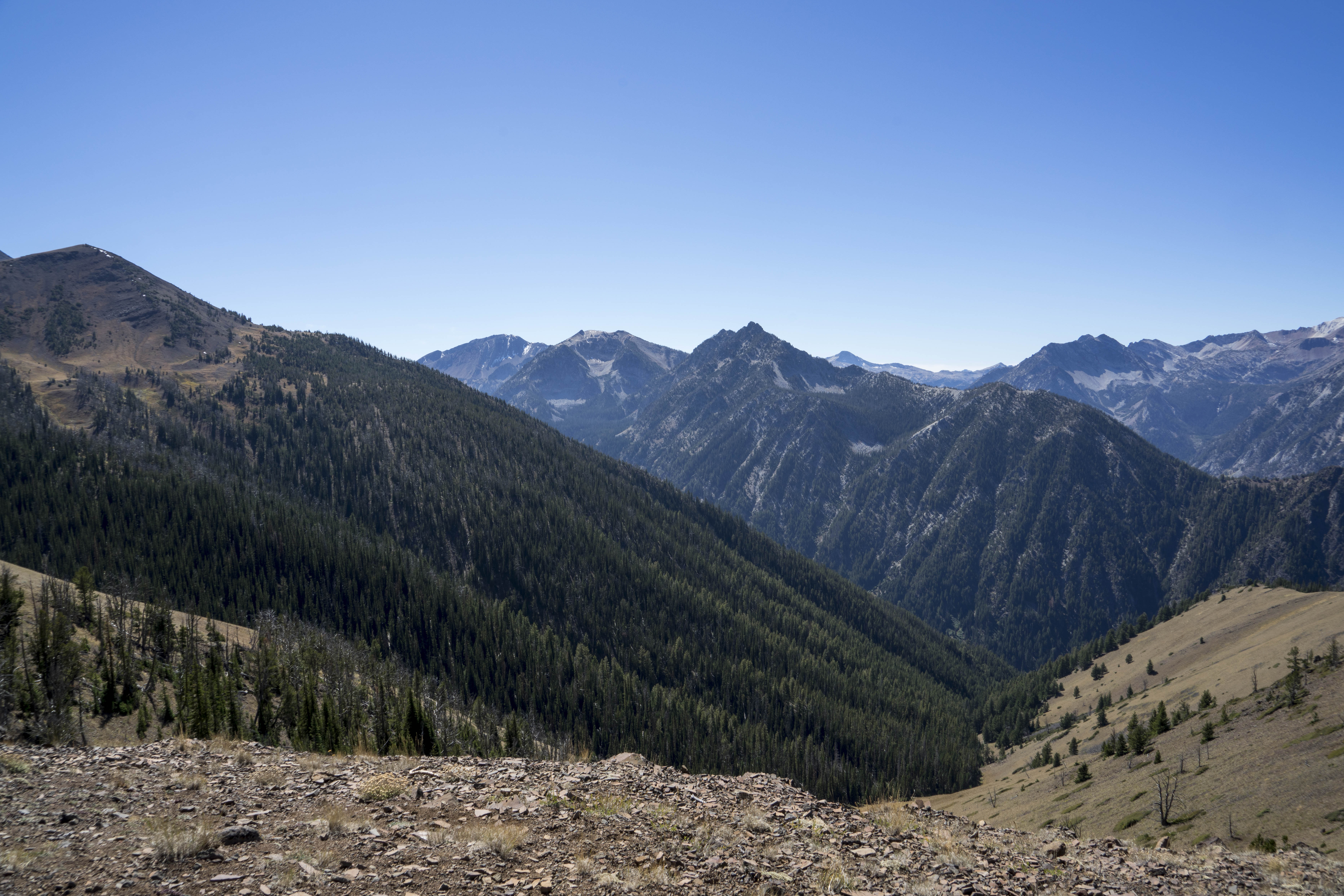
At the southern end of the lake is a wonderful little village (complete with campground) and a tramway to the 8,300 foot summit of Mt. Howard on the edge of the Eagle Cap Wilderness.  Two miles of hiking trails at the top of the tram provide incredible views into three states —


161 2015 09 11 HellsCyn Loop 047

Views from the top of the Wallowa Tram — Oregon and the Eagle Cap Wilderness.


162 2015 09 11 HellsCyn Loop 053

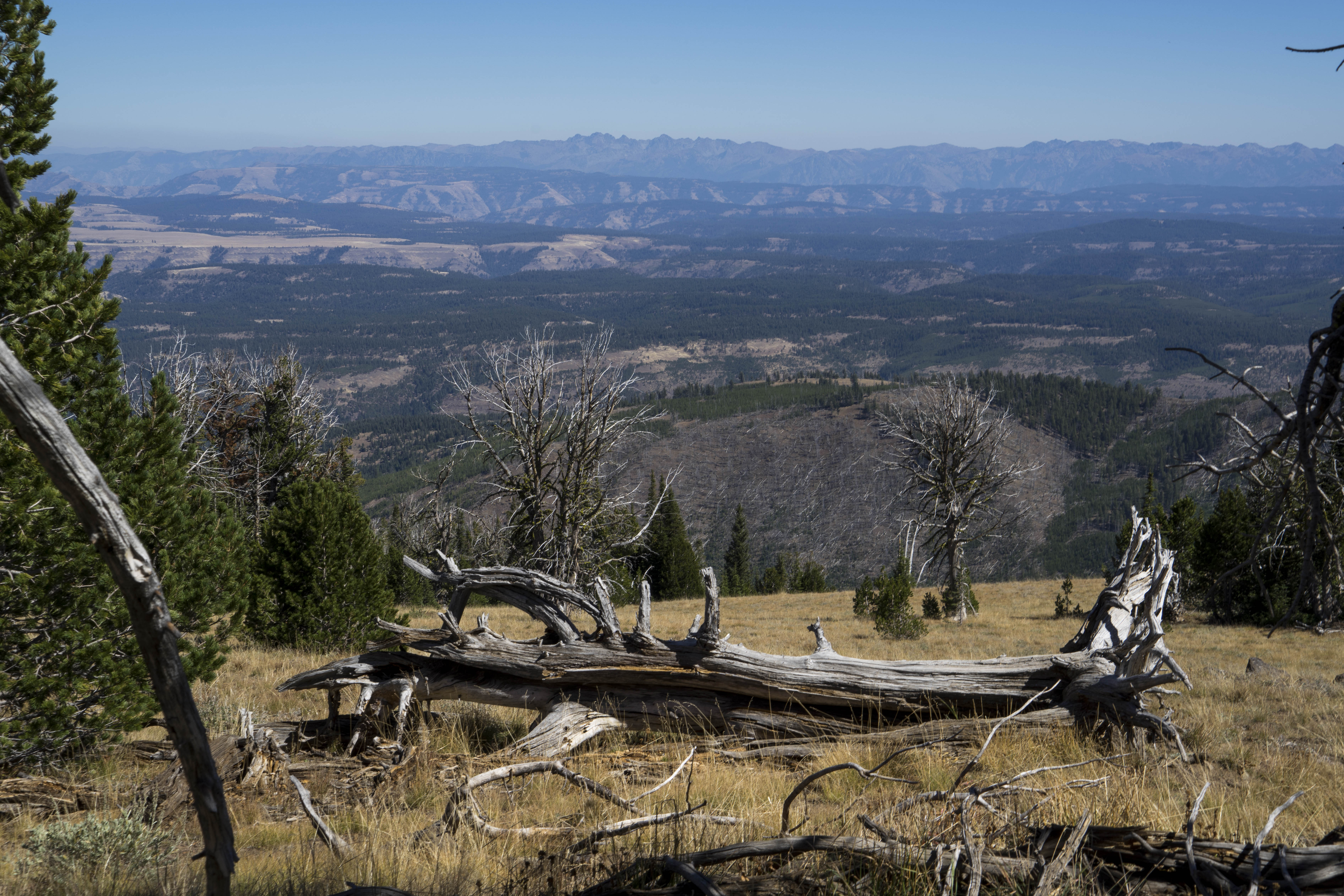
Looking East to the distant mountains is the Seven Devils on the Idaho side of the Snake River.


163 2015 09 11 HellsCyn Loop 054

Looking north to Washington – hang gliders launching themselves to the valley below.


164 2015 09 11 HellsCyn Loop 062

Soaring off into the Grande Ronde Valley.


The town of Joseph was the entry point to Wallowa Lake and was a charming little town.  Named for young Chief Joseph of the Nez Perce Tribe, it is now an art community with a national reputation for its top quality bronze foundries and galleries.  It also has a wonderful chocolate shop;-)!!


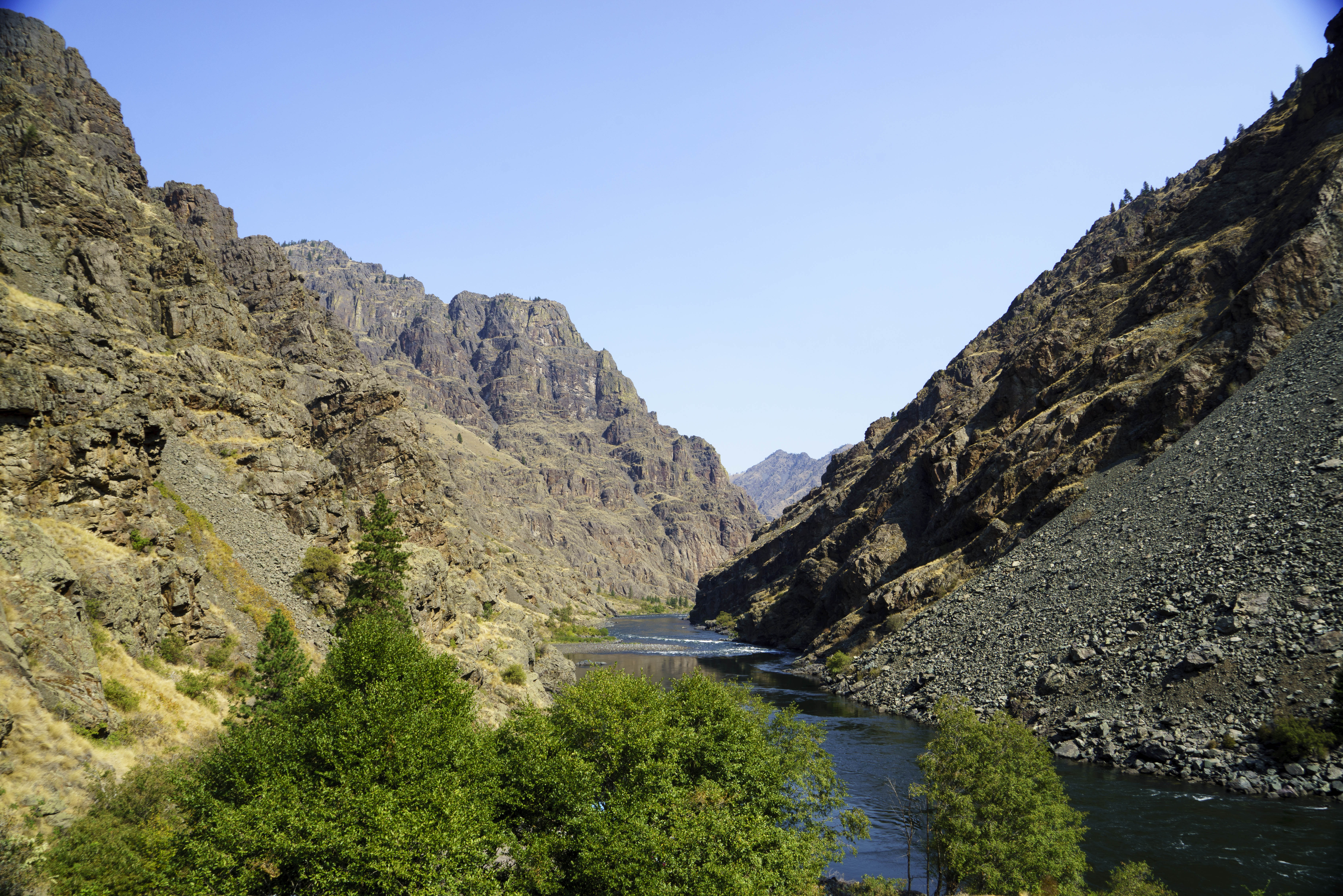
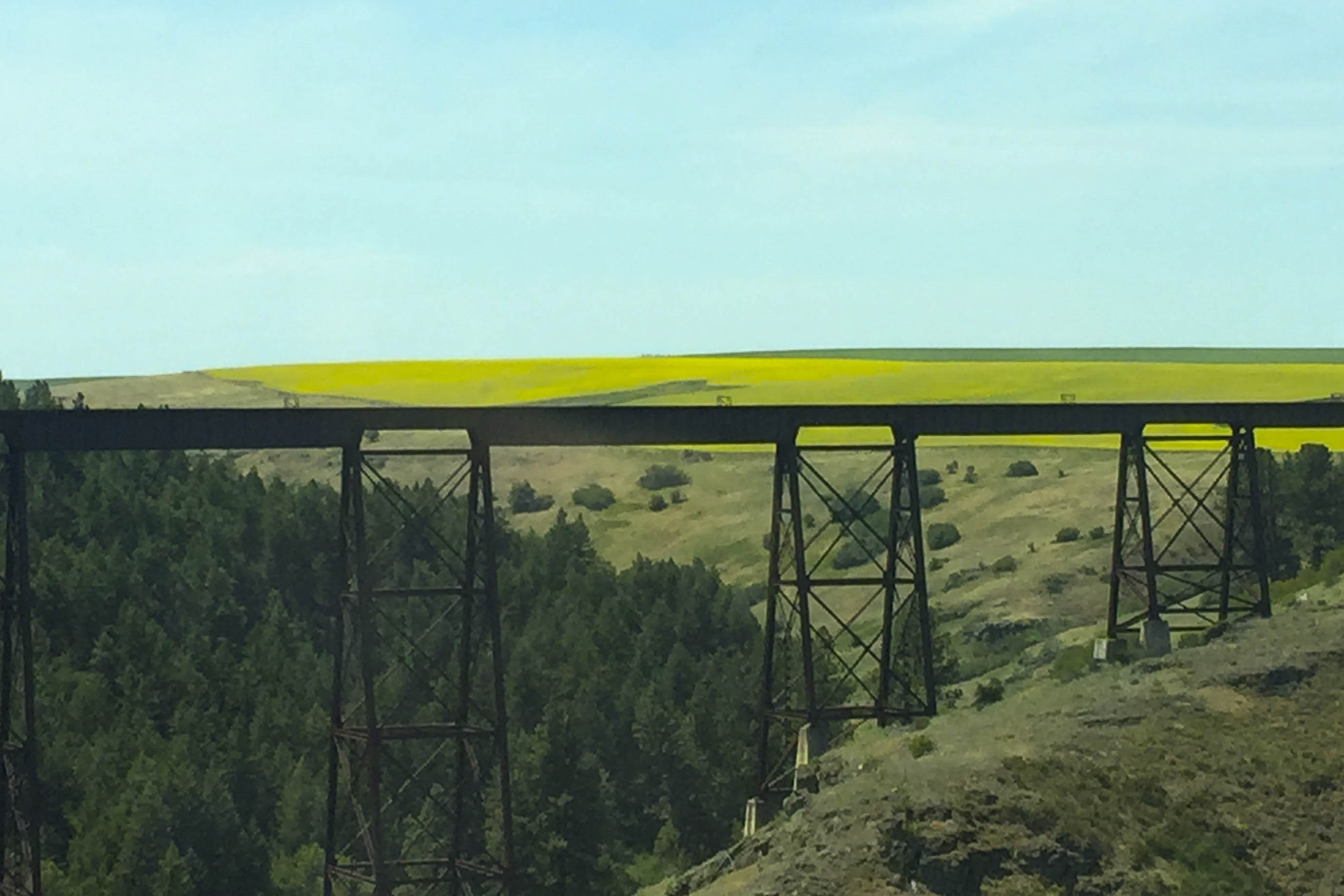
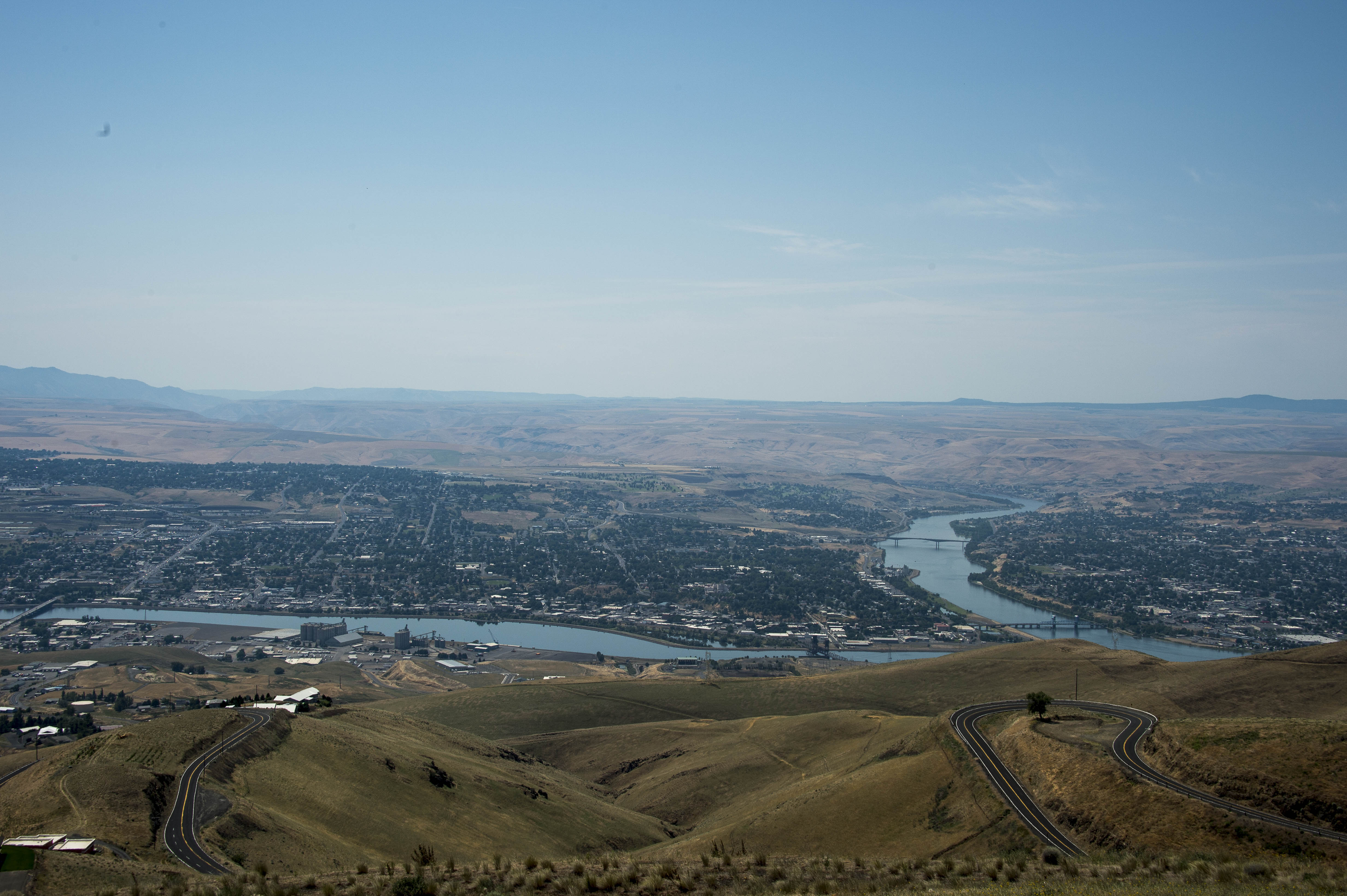
After the scenic loop byway, one must venture up Hells Canyon along the Snake river.  While the loop drive gives views from the top down, the drive along the Snake allows one to look up the sheer cliff walls that have been pushed up from the canyon that has been eroded.


165 2015 09 12 HellsCyn Dam 019

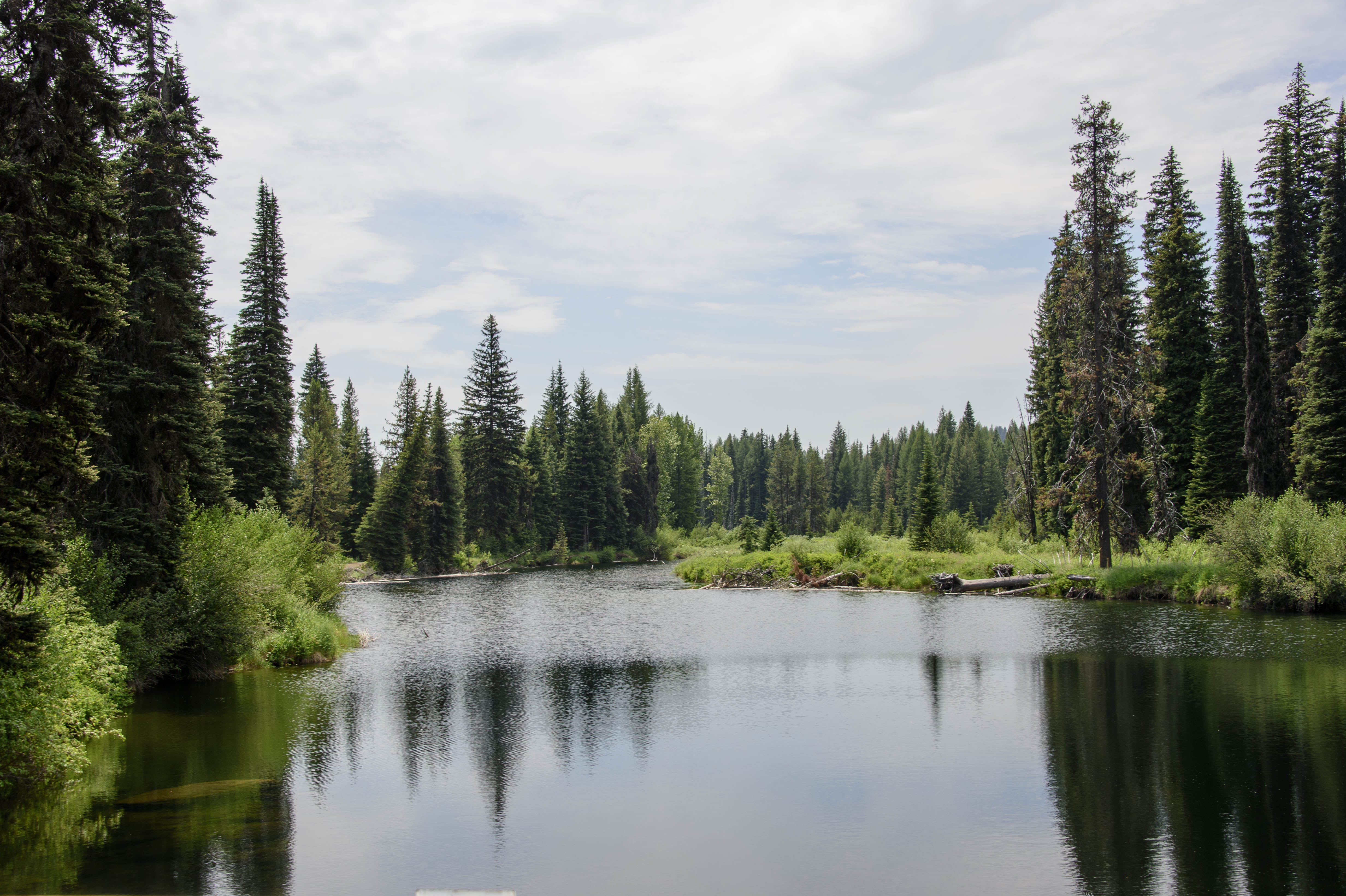
The Snake River heading into Hells Canyon.


Eagles were present to do their fishing along the portion of the Snake that was a little more peaceful between the two dams.  As said earlier – we have developed a real interest in these majestic birds.


167 2015 09 12 HellsCyn Eagle 021

We spotted this bald eagle along the Snake River.


168 2015 09 12 HellsCyn Eagle 007

Headed out looking for lunch.


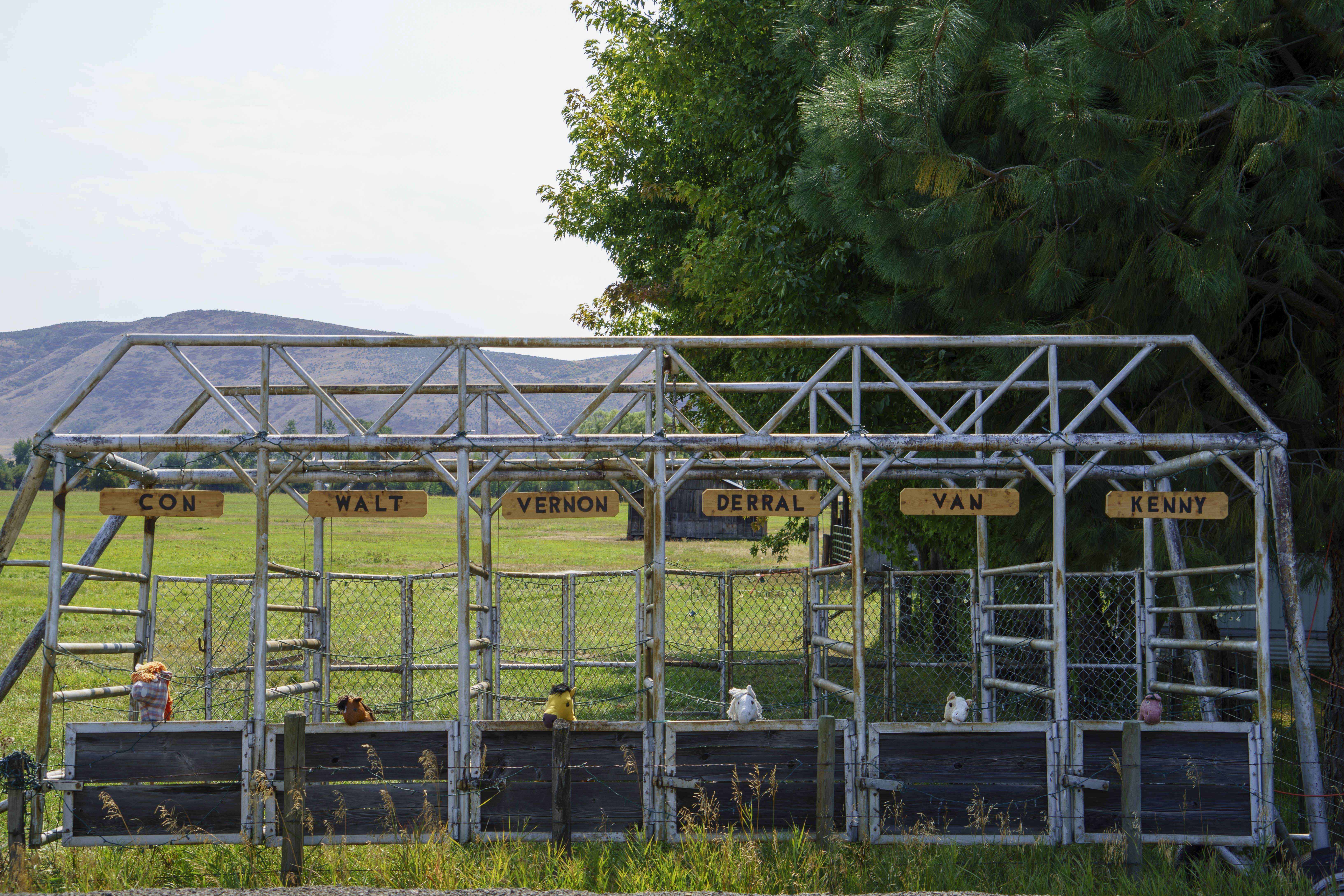
The trip home from the Canyon provided a look at a few more of the small towns along the way – and whimsical roadside humor – –


166 2015 09 12 HellsCyn Dam 031

The horses are in the starting gate.


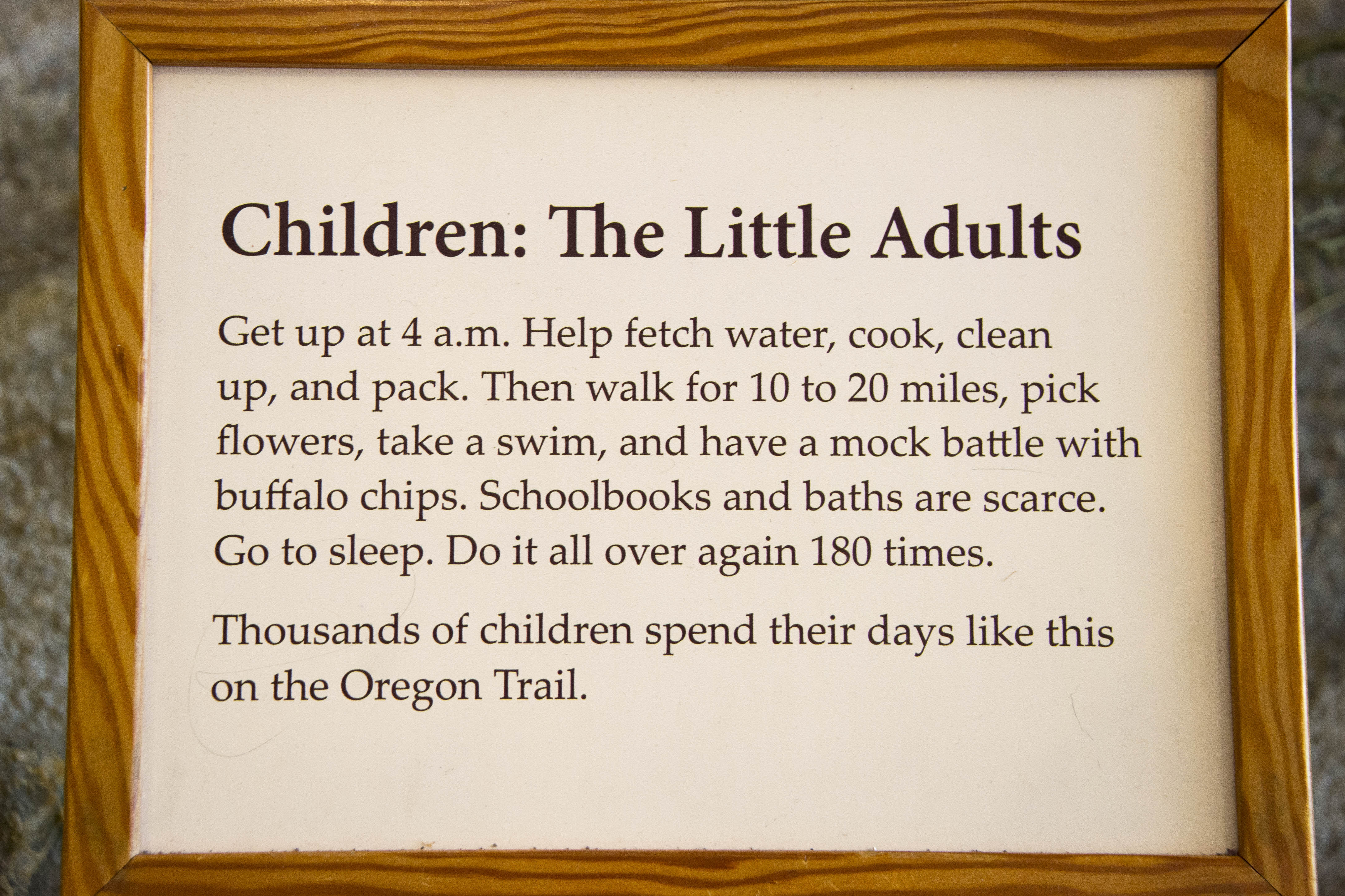
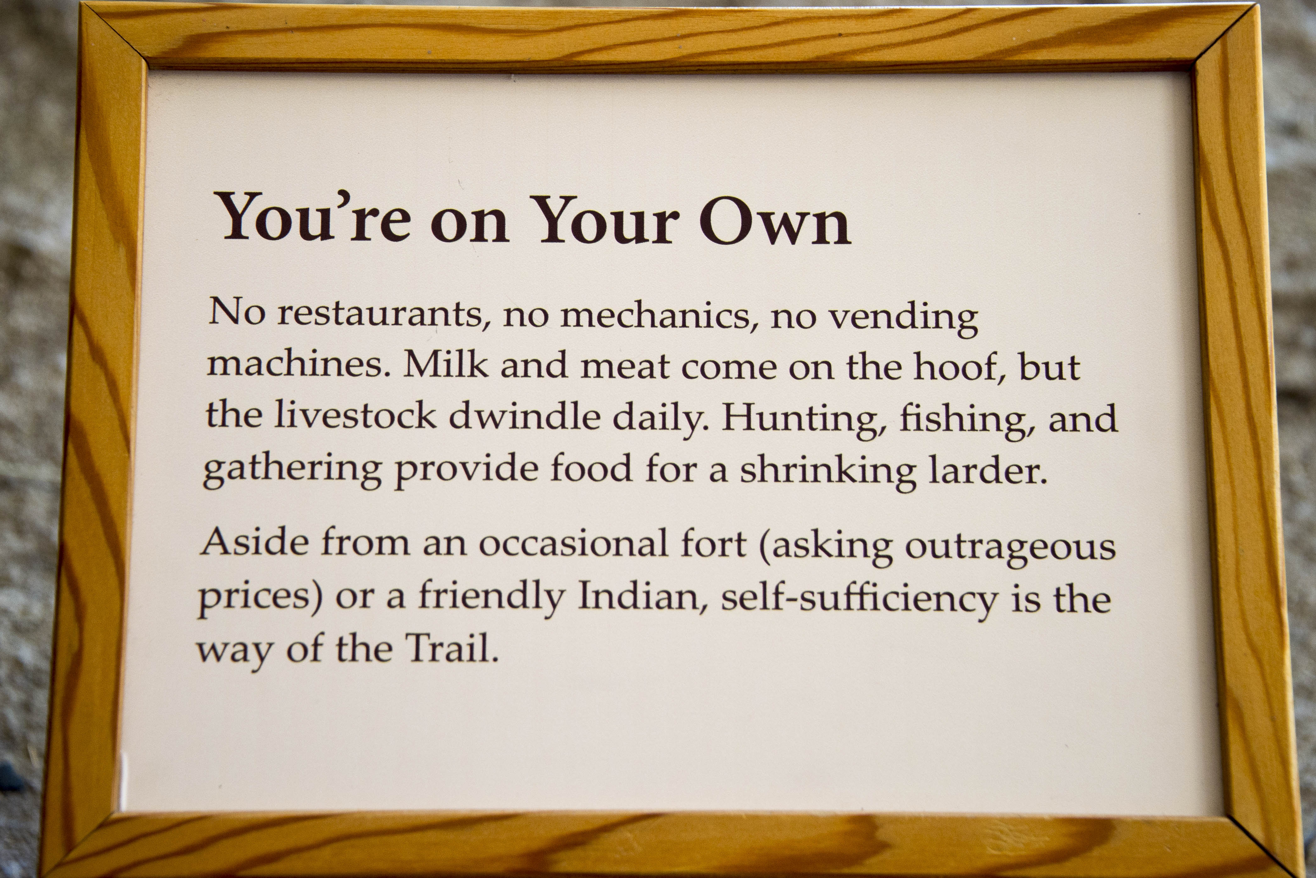
Not far from our campground is the National Historic Oregon Trail Interpretive Center.  The Oregon Trail – it began with a crude network of rutted traces (some of these rutted traces can be seen at the Center) across the land from the Missouri River to the Willamette River that was used by nearly 400,000 people.  It was created, though, from the West as trappers, maritime explorers and Europeans inhabited the west coast coming by boat around the tip of South America.  John Jacob Astor established Astoria at the mouth of the Columbia in 1812 and sent Robert Stuart overland to carry dispatches east.  Stuart found South Pass, only 7,000 feet above sea level with easy gradients, which became a determining factor for the Oregon Trail.  Economic depressions in 1837 and 1841, the collapse of the international fur trade and eastern churches seeing the American Indians as ready candidates for ideas of civilization contributed to groups with serious intent to emigrate to the west.  The trip from the Missouri River took approximately 6 months – if one actually made it.  The travel day was 8-10 hours covering 20-30 miles (on a good day) – mostly walking as the oxen had a large enough load in the wagon without the extra weight of people.  ALL supplies had to be carried so personal possessions were few.  Timing was very important, as the trek needed to be completed before the snow flew.  The trip was not for the faint of heart as the following plaques at the Interpretive Center indicate —


169 2015 09 10 Raptors 022

And Gary thought his paper route when he was a kid was work.


170 2015 09 10 Raptors 023

What no wagon drive through window?


The stay in this northeast corner of Oregon was brief but full of information, beautiful sights and lots of activity.


E & G – Off tomorrow in our cushy coach full of supplies traveling about 280 miles in 6 hours.


Tooooo Much To Do in Park City;-)!!

Park City is a mecca of activities – no matter the season.  Besides the ‘normal’ daily activities of hiking, biking, golfing, skiing, x-country skiing, snowshoeing, etc., etc., etc. – during the three summer months there are free concerts almost every night of the week at various venues around town, symphony and PC Institute concerts two – three nights a week, girls’ Triple Crown softball tournament, boys’ baseball tournament, soccer tournaments, the Annual Art Festival (E volunteered again this year) and the Tour d’Utah, with many of the Tour d’France participants!!


This last activity is perhaps the most fun we have had on Main Street since the Olympics in 2002;-)  Of course it was helpful that we were invited to the Ligety/Leader office balcony just above the start/finish line to watch the race and awards ceremony.


140 2015 08 09 Bike Race 017

Great vantage point at the start/finish line.


136 2015 08 09 Bike Race 010

They ran two laps through Old Town Park City before hitting the rest of the course.


137 2015 08 09 Bike Race 012

And they are off – How do they manage not to crash in such crowded conditions?


139 2015 08 09 Bike Race 016

There was time to wander the displays on Main Street while we waited for the riders to return to the finish.


141 2015 08 09 Bike Race 020

Here they come – The sprint across the finish line


144 2015 08 09 Bike Race 031

The champagne celebration just below us


Once all the excitement of the race died down, we were back to our normal routine of golf on Monday, Tuesday and Thursday – hiking on Wednesday and Friday – and TV golf on the week-end.  E did spend one week-end playing in the Tuhaye women’s golf tournament as the guest of Dyan —


147 2015 08 08 Tuhaye

A good time was had by all;;-)

We also played nine-and-dines with several friends, which gave us the opportunity to play late in the day when the wildlife might be out to ‘play’ – like this threesome of sandhill cranes–


145 2015 08 13 BruGolf 002

We decided to let the sand hill cranes play through.


AND – even though it is only mid-August, the hills are beginning to turn and remind us that summer in Park City does NOT last forever;-(


146 2015 08 06 Chgng colors


In just two short weeks it will be time for us to pack up Magic and head west again.  Oregon will be calling us and we are hoping (for lots of reasons) that all those awful fires in Idaho and Oregon will be OUT!


Can’t believe the summer is almost gone – E&G


7 Days in Park City with the Fab 5

E & G were off enjoying the awesome ‘Mia & Ted Wedding’ while daughter, Heather, and family (Haley, Christian, Olivia and Kira) were arriving at the PC RV Resort and setting up camp for a week.  Their pop-up trailer was a good kitchen and bedroom – and the tent made a perfect closet and dressing room;-)


114 2015 07 28 Moose hike 001

A perfect campsite on the creek!


It is quite different finding activities for 7 and 9 year olds and still imparting knowledge of what Park City is all about.  Needless to say – 9-mile death marches and several days of golf were out!  BUT – the PC Museum was a perfect place to begin.  With the help of a great Museum volunteer and a VERY fun scavenger hunt, the girls quickly learned about the mining history of Park City (discussed in a prior post) and saw how large and intricate the mines were from the two-story Mega Mine mill and aerial tramway.  They also ‘shopped’ in the neighborhood General Store from the early 1900’s, attempted to connect calls on the old switchboard and even took a turn in the old Park City Territorial Jail!!  (We did let them out.)  They also learned about skiing in Park City – from climbing aboard an original car from the world’s only “Skier Subway” that carried skiers through the mine shafts to the top of the mountain for skiing to the Olympics in 2002 .


This was a perfect transition to a visit to the Utah Sports Park (one of our favorite things to do with guests) to watch the week-end show of the aerialists practicing their jumps off the brand new jumps just installed into the swimming pool, the Olympic Museum and opportunities to ‘try out’ the luge and bobsled cars —


115 2015 07 26 Oly Prk 016

Athletes performing feats of wonder and amazement.

117 2015 07 26 Oly Prk 010

No fear acrobatics.


119 2015 07 26 Oly Prk 021

Christian, Heather, Haley, Olivia and Kira tried the bobsleigh on for size.


There were no death marches – but, we did wear everyone out on a couple of three mile hikes.  The first was to our favorite meadow up at the top of Deer Valley so they could see where we skied (back in the day) —


122 2015 07 27 Keith mdw 006

We hiked to the meadow where son Keith’s ashes had been spread.

120 2015 07 27 Keith mdw 002

And for his entertainment we tried our best imitation of a Sound of Music moment.

123 2015 07 27 Keith mdw 007

Then we tried  to recreate the “butt shot” that he had so meticulously orchestrated 20 years ago.


124 2015 07 27 Keith mdw 009

The wildflowers were fragrent.


Then we took the little trail by the creek at the back of the campground to the Junction – where the destination was our favorite Gelato place (it always helps to have a FUN FOOD destination – it keeps the kids moving!).  We even took the $1 million bridge to nowhere!!  AND – saw Lucy the Moose;-)!!


125 2015 07 28 Moose hike 004

Where is the Gelato??????

126 2015 07 28 Moose hike 003

Here it is!!  YUM!!


127 2015 07 28 Moose hike 011

Lucy – along our creek. Lots of oohs and aahs.


Oh yes – what would a summer in Park City be without a concert or two.  AND – the best kind.  Those FREE concerts provided by Mountain Town Stages.


128 2015 07 29 DV Conc 002

We went to Deer Valley to see the Motherload Canyon Band.


There was also a visit to that Famous historical spot – the Base of Park City Mountain (the new and improved name just revealed by Vail Assoc!) ski area and all the fun activities – – –


129 2015 07 29 PC Rides007

The Alpine Coaster..

130 2015 07 29 PC Rides020

Enjoyed the carousel..


132 2015 07 29 PC Rides026

rock climbed..


..and rode the zip lines.

..and rode the zip lines.


Are we done yet?!?!?!?  Because Gramma and Gramps are exhausted (and, by the way, so were ALL the kids!).  It was a terrific week and a good time had by all.


Resting – E & G

13 Days in Park City

No great history lessons in this posting.  Just a glimpse into 13 days worth of potential activities – and the associated scenery – in and around Park City.  How about 6 days of golf, 2 days of hiking, 3 days of a wedding and endless sights?!?!?!


101 2015 07 13 Canyons

E & Rheta on the newest PC golf course – Canyons Golf Course


102 2015 07 15 DV Hike 010

The Jordanelle Reservoir from the Silver Lake Trail in Deer Valley


103 2015 07 15 DV Hike 011

Heber Valley in the background.


104 2015 07 24 Albion 017

Enjoying the wildflowers and the view from the Lake Catherine Saddle in Albion Basin with Jack, Jane and Sally.


106 2015 07 15 Cranes 001

Another visit from the Sand Hill Crane family that wanders through the campground from time to time.


109 2015 07 24 Cranes 011

108 2015 07 24 Cranes 005

107 2015 07 20 Cranes 003


110 2015 07 25 MT Soccer 120

Ted and Mia organized a soccer competition the morning of their wedding.  It was quite competitive, but no members of the wedding party were injured.


111 2015 07 25 MT Soccer 144

A great way to start the day.


Can these possibly be the same people just 4 hours later?!?!?


113 2015 07 25 TedMia Wed 027

The ceremony was beautiful..congratulations to Mia and Ted.


What a fun way to end 13 days in Park City!!


Much love to all – E & G enjoying ALL the sights;-)

Park City – Who Are You?

It is so wonderful to be back in our old home town of Park City.  It has been two weeks since the last blog posting  – and you might wonder what in the heck has been going on for all that time.  Well – there have been 6 days of golf, 2 Fourth of July celebrations, A Full Moon concert and a DV concert with Big Bad VooDoo Daddy, dinner and women’s soccer finals with friends the Campbell’s, a book club meeting, 4 hikes and several dinners with friends, including new RV Park friends Julie and Allen – –


2015 07 08 Gitlin001

Early Dinner at the Riverhorse to take advantage of the 2-4-1


There are soooo many hiking trails in the Park City area, the two days a week allocated for hiking will not put a dent in them.  AND – the most interesting thing is that even on the hiking trails there is construction!!!


2015 07 08  Robs trl002

At least there was not a flag person required here.


This year our objective is to learn even more about this town that was our home for 18 years.  It seems everyone knows that Park City was a mining town – which is true.  Coming alive in the 1860’s when the government sent troops to comb the hills and see what they could find.  As they surveyed the area, they found signs of potential minerals and planted the US flag on a staff atop one of the mountain tops so they could find the spot on their return.  This mountain – Flagstaff, is now a part of the Deer Valley Ski Resort.  It was not long before the word spread and Park City became a mining boom town.  The first major producer was the Ontario mine – discovered by Herman Buden in 1872 and later purchased by George Hearst (this provided Hearst with his fortune!).   The mines kept Park City alive through the first and second world wars with the production of silver and iron.  By the 1950’s, however, when the price of silver finally dropped the city nearly became a ghost town.  Then in the early 1960’s, President Kennedy saw to the awarding of an economic development loan to the area to develop a ski area.  And as they say – “The Rest is History”.


Several of our hikes this year are to some of the mining remnants around Park City.  First stop is the old Armstrong cabin on the Armstrong trail at Park City Mountain Resort.


2015 07 11 Armstrong trl003

Gary and Sally in front of the Armstrong cabin – a real fixer upper.


Friend Sally is our hiking companion – always urging us on.  This past Sunday she managed to talk E into a NINE mile ‘death hike’ to the Western Monitor mine shaft with the PC Historical Museum.  The sites on the way were beautiful – when E could catch her breath and actually take in the views.  In the picture below in the open green area to the right lower portion of the picture you might see a small building.  This is an ore bin, which was used to store ore brought to the surface until some means of transportation could pick it up and get it to the train that came through PC.  Remember that these mines were at 7,000 to 8,000 feet in elevation and were mined throughout the year.  In the winter, getting the ore to the town was quite an effort for a team of horses and wagons.  So, the ore would be stored in the ore bins until it could be accessed and taken to town.


2015 07 12 Mine hike001

Hard to picture lots of mining activity when looking at this serene setting of Thanes Canyon.


Finally reaching the Western Monitor mine – this is what we saw —


2015 07 12 Mine hike003

Lax building codes?


As Sally said – “we hiked 9 miles to see this??”   The Western Monitor shaft dates to circa 1910 and, sadly, did not ever produce any ore.  The area also contained the remnants of a cistern and several buildings, including a bunk house complete with rusted bed frames.


All the ski areas in PC contain many similar mine shafts with collapsed caps, ore bins, miners shacks and other artifacts.  There are also a few shafts that can be found that have not been sealed.


2015 07 12 Mine hike004

Not for the claustrophobic!


2015 07 12 Mine hike005


It has been an active couple of weeks and don’t think it will slow down any time soon.


Having fun – learning and enjoying – E & G

‘HOME’ at Last

McCall, Idaho is a quaint little town of about 3,000.  It has that wonderful little Main Street right along Payette Lake (with that great ice cream place pictured in the prior post), a very nice muni golf course, a terrific state park and several great ‘parking spots’ for Magic;-)   What more could anyone ask for????  OH – maybe a little cooler weather.  Although the temps here did manage to stay in the 90’s instead of the 100’s.  As you might guess – all of the above are listed because we took full advantage of them all.


A drive into Ponderosa State Park took us to the Narrows and Osprey Cliff Overlooks for great views of the Narrows and Payette Lake – McCall is in that little cove to the far left of the picture.


2015 06 29 McCall 001

Payette Lake from Osprey Cliff Overlook


Then a drive all the way around the lake provided a lot more good sights – –


2015 06 29 McCall 002

We took a drive around the lake, crossed over this river and..


2015 06 29 McCall 003

…came across this moose. She disappeared quickly into the trees.


The few days in McCall ended all too soon.  But, we were quite anxious to get to Park City and be in place for the next couple of months.  So – off we went on a long (for us) 8-hour driving day.  There were a few distractions to keep us going – –


2015 06 30 to PC 006

The crop dusters were hard at work on the wheat fields along the route from McCall to Park City.


And then – we were ‘home’ again.  All settled in to ‘our’ spot at the Park City RV Resort and ready for what the months of July and August bring us.  The calendar is already pretty full of golf, dinners, the Egyptian Theater, weddings, more dinners, the Art Festival, DV concerts . . . . .


2015 06 30 to PC 009

Home sweet summer home.


Wishing you all a VERY HAPPY (and safe) 4th OF JULY;-)


Happy to be here in Park City – E & G


Are we in Kansas??

Very rarely does a ‘travel day’ get its own post – even though most provide new, interesting, beautiful – if not stunning – sights and sometimes unique experiences.   It is always a marvel to us when the landscape is just not what was expected.   And, often we don’t know what the expectation was – but, it wasn’t what was seen?!?!


Idaho – thinking Sun Valley ski area.  So mountains with pine trees – the Sawtooth Mountains – lots of green and cool maybe.  Driving down that panhandle on 95 we got – KANSAS!  Or maybe Oklahoma, Nebraska or Iowa.  But, not Idaho.  Miles and miles of crops – Soft White Winter Wheat, Spring Canola, Spring Green Beans, hay (baled and freshly cut unbaled) – and who knows what else in all those miles of crops.  (How in the world did we know all of these crops you ask?  One kind farmer ‘signed’ his fields!  We aren’t THAT good!)


81 2015 06 27 to McCall 008

Wheat fields as far as we could see.


And, just as we were getting used to planted fields instead of pines and mountains – there was a MOOSE munching his way through the wheat field;-)   But than the crop duster buzzed us just a we crested a hill.


82 2015 06 27 to McCall 007

Crop duster at work. Missed the better shot of the plane at eye level directly in front of us.


This was one difference from the mid-West – it was hilly.  Which required lots of neat old train trestles – –


2015 06 27 to McCall 003

Yellow flowered canola crop in the background bordered by Spring Wheat.


Then – BAM – there was the Lewiston Hill.  Thank goodness Magic did not have to take the original road built in 1917 with its steep grade.  But, we still had to get down the 2,000 feet with 20% grades into the Clearwater and Snake River Valley.  Another surprise!   In the valley below lay Lewiston – a steamboat landing and primary commercial center for Idaho miners during their hectic gold rush in the spring of 1861.  Steamboats continued to dock there until 1940 after Columbia (which the Snake flows into)  and Snake river channel improvements made navigation practical in 1914.  And finally a series of locks and dams made Lewiston a seaport, and large scale river shipping resumed in 1975.  YES – a seaport in the middle of Idaho!

84 2015 06 27 to McCall 012

Lewiston, ID and Clarkston, WA at the joining of the Snake and Clearwater Rivers.


Driving through the Snake River Valley had its beauty.  (E loves driving beside rivers and mountain streams.)  Our next overnight stop was to be Riggins – on the Salmon River and at the entrance to Hells Canyon, which would be explored EARLY the next morning before it got toooo hot.  HOWEVER – this is what was registered at Riggins – –


2015 06 27 to McCall 005

So that’s where the Hell’s Canyon area got its name.


What are we back in Phoenix???  I don’t think so.  Not stopping here – Hells Canyon will have to wait!!  Next on the map is McCall.  We know there IS a ski area there and several lakes (not to mention several nice golf courses) – so it must be cooler than this.  Let’s go.  So – McCall it is for a few nights, a round of golf, some down time AND – our reward – ice cream, which is not a unique idea in warm weather.


2015 06 27 to McCall 006

Long line at Ice Cream Alley.  YES – it was worth it;-)


So – travel days are not just 4 to 8 hours on the road.  They are experiences of new and sometimes unexpected sights that are talked about for years.  (The genesis of this posting is our very first trip in the ‘little’ Navion thru Alabama.  Don’t know what was expected – but it was definitely NOT what we saw.  We loved the tree lined highways – and since it was Spring the trees were all in bloom with beautiful pink, purple, orange and white flowers;-)  Simply beautiful.  Now when there is a travel day like experienced above – even years later our discussion is always – “Just like Alabama – NOT what we expected”.)


Elizabeth & Gary happily reporting from a little bit cooler McCall, ID


Floating??

Well – the eastern side of the Cascades is nothing like the western side in terms of temperatures!!  The beautiful 70 degree temps have been left behind and we are now enduring the 100’s – which we thought were left in AZ;-(


The next stop on the agenda – Coeur d’Alene and another ‘little’ bucket list item – playing The Coeur d’Alene Golf Course with the famous floating green.  As we travel from place to place and state to state, Gary has the neat little app for finding gas – Gas Buddy.  Especially if we are going to cross state lines, we check to see where gas is less expensive and gauge our fill up accordingly (you can imagine that at 75 gallons of diesel at a shot we are always looking to save a few cents per gallon!).  RARELY do we find a Costco with diesel – but we hit the jackpot here in Coeur d’Alene and just couldn’t resist this picture – –


70 2015 06 24 COR flt 001

First Costco we have found with diesel.


Coeur d’Alene is a cute little town (second largest metropolitan area in the state of Idaho and only about 30 miles from Spokane, WA) sitting on the north shore of Lake Coeur d’Alene.  Known for its resort and famous ‘floating green’ golf course it has grown recently due to tourism.


We were just here for the golf;-)  Since the course is ‘famous’ it can demand a hefty green fee!  They make it all better, though, by including FREE range balls, a FREE pre-round quick massage and a FREE fore-caddie.  So how can you NOT be happy?!?!


71 2015 06 24 COR flt 003

Our pre round chair massage was a nice way to get loosened up after hitting balls into the lake.


72 2015 06 24 COR flt 005

The views were stunning!


73 2015 06 24 COR flt 008

This floating green psyched us out – so our balls went swimming.


It is truly a floating green and the only way out to it is via Putter – –


74 2015 06 24 COR flt 011

This is the “golf cart” that took us to the green.


Well – after that, we needed a day off before tackling another course.  Since neither of us had ever been to Spokane AND it was only 30 minutes away AND it is home to Gonzaga University (a team we often cheer for in the March Madness tournament) – we thought it should be checked out.


A wonderful Riverside Park sets right in the middle of the downtown area ‘showcasing’ the Spokane River.  Between 20,000 and 13,000 years ago, massive floods from glacial Lake Missoula rushed through the Spokane Valley, carving waterfalls and islands from the hard basalt bedrock.  During ensuing millennia, Salish tribes gathered along these falls to fish, dance and compete in traditional games.  The Spokane people called this part of the river “fast water”.  During the 1870’s, white settlers moved in, attracted by both the beauty and the potential of the falls for power.  They built dams to harness this power, which is still a supply source today.  The falls, the river and the surrounding area provide quite a site in the middle of the downtown.


75 2015 06 25 Spokane 013

Spokane Falls still provides electricity for the area (Canada Island is in the middle).


76 2015 06 25 Spokane 009

The County offices are housed in this unique building.


77 2015 06 25 Spokane 001

This planter reminded us of the half pipes we helped move at Marta’s farm a few days ago!  They stole her idea;-)


78 2015 06 25 Spokane 012

Say it ain’t so…books being replaced by tattoos?


After wandering the downtown area and having lunch on the river, we headed over to Gonzaga to check it out.  Did you know that Bing Crosby graduated from here in 1924???  A very pretty little campus.


79 2015 06 25 Spokane 015

The original Gonzaga College building, erected in 1898 is still in use today.


Dessert at lunch was the most delicious strawberry shortcake, as the strawberries are in season here (as are cherries) and are soooooooo sweet.  So, after our visit to Gonzaga we were off to the countryside in search of fresh strawberries.  Would love to show you some BUT we ate them all;-)


Anyway, next thing you know it was another day and another golf course – Circling Raven.  This one was fun to play – but, quite interesting as it was in the middle of wheat fields with pine trees and marshes.  Don’t think we have ever seen such diverse landscape/topography in 18 holes.


80 2015 06 26 Raven 003

Sometimes it was hard to tell where the course ended and the wheat fields began.


It has been a very pleasant stay in Coeur d’Alene and its fun to say we have played the ‘floating green’.  But, it is time to find cooler weather so we are off early tomorrow.  Think it might be a few days to cooler temps, though, as Park City might be our only relief and it is a couple of days away;-(


Hurrying onward – E & G


‘2 Gems’ – or – ‘Whidbey to Winthrop’

Well – after that exciting adventure at the U.S. Open, there were 2 additional stops to the north before Magic headed toward Park City.  AND, both were American Gems – the first was cousin Marta’s Rainbow Chicken Ranch on Orcas Island and the second was the North Cascades NP;-)


So – off to Anacortes and a lovely spot at Pioneer Trails RV Park where we would park Magic while we took a day trip via ferry to Orcas Island.  But first, a quick excursion around the Anacortes area to check out Whidbey Island where a NAS resides. And, of course, you have to go across a bridge to get to an island – –


53 2015 06 20 Whid 010

Bridge connecting Fidalgo and Whidbey islands.


54 2015 06 20 Whid 001

Beautiful setting for a Naval Air Station.


Bright and early Father’s Day morning (7:30 AM), we boarded the ferry bound for Orcas Island.  Orcas is one of the islands in the San Juan Islands chain in the northwest corner of the contiguous US between the US mainland and Vancouver Island.   The islands have long recent histories going back to the 1700’s when the Spanish explored, charted and named the area.  But, the origination of the islands goes back millions of years when the surrounding glaciers carved the channels between the islands, the glaciers melted and the land shifted downward and the seas came into the carved valleys.


Anyway – by 8:30 we were approaching the quaint village of Orcas on Orcas Island and about to meet up with cousin Marta for the day.


55 2015 06 21 Orcas  005

The view from our ferry pulling into Orcas Island.


First stop – Marta’s Rainbow Chicken Ranch and a tour of her property with all the plans for the future – –


56 2015 06 21 Orcas  021

Logo for Marta’s Business.


57 2015 06 21 Orcas  011

Elizabeth and Marta touring the property.


58 2015 06 21 Orcas  035

A view of the house, some of the crop area, chicken coops and woods behind.


59 2015 06 21 Orcas  036

The future home of Marta’s farm store.


It wasn’t just sight seeing.  The first thing Marta did was put us to work!!  Heavy piping material needed to be lifted onto support structures.  This piping would be filled with dirt to become the strawberry beds;-)  Gary had one of his ‘ah-ha’ moments and came up with the method for transporting these awkward ‘pipes’ to their supports, which made the task quite easy!!


60 2015 06 21 Orcas  018

One – Two – Three – LIFT!


61 2015 06 21 Orcas  019

Tada!!


(If it looks like we were having a good time – we were.  BUT, we were also trying to get the pictures with the pre-set camera (sitting on the nearby pile of wood) going off.  It was “hurry, hurry, get in place, pick it up and get over in front of the camera before it quits clicking!”  (Think you had to be there.) )


And – that was not the end of my chores.  Next there was the collection of eggs – –


62 2015 06 21 Orcas  031

Hey Marta – wake up.  We have work to do!


Finally!  All the chores were done and Marta took us to the see the island sights.


Orcas Island is a beautiful, kidney shaped island with many lakes, harbors and mountains.  Mt. Constitution, the highest point on all the San Juan Islands, resides in the Moran State Park on Orcas Island.  This state park is a 5,252 acre camping park with five freshwater lakes and many miles of hiking trails.  On the mountain top, at 2,409 feet, there stands a stone observation tower built by the Civilian Conservation Corps in 1936.  From the top of the tower one can see Mount Baker, Mount Rainier (on a beautiful clear day like we had), the Cascade Mountains, the Olympic Mountains and a variety of Canadian and American cities.


63 2015 06 21 Orcas  024

View of Mt. Baker from the top of Mt. Constitution.


Although we had some delicious fresh scrambled eggs with mushrooms and cheese at Marta’s, after all the hard work and sightseeing we had done it was time for lunch.  Marta took us to another beautiful spot to relax and eat – Rosario Marina.


64 2015 06 21 Orcas  029


65 2015 06 21 Orcas  028

Enjoying the views and the company.


After a very full day of visiting, telling stories, eating, visiting, sightseeing, etc. etc., it was time to get the ferry back to Anacortes as tomorrow was another travel day.  We thank Marta for her hospitality and generosity in sharing her home and environs with us;-)


Another early day as we were off to the second ‘Gem’ to tell about in this posting – North Cascades NP (and my favorite NP sign!).


66 2015 06 22 Wash Pass 002


This NP includes the glacier-clad peaks of the North Cascades, which rise almost vertically from thickly forested valleys appearing almost like the Alps.  Thus often called the American Alps.  The Cascade Range is named for its innumerable waterfalls and extends from British Columbia to northern California.


This park preserves the wilderness and therefore much of it is inaccessible.  However, the North Cascades Highway traverses the middle of the park along the Skagit River in a beautiful valley with the mountains rising up on all sides.  At the visitor center there is an overlook where one can view Mount Terror, Mount Despair, Damnation Peak, Mount Fury and Mount Challenger!!  Do these names give you an idea of how treacherous these mountains are?!?!   When one comes out the east side of the park and climbs to Washington Pass at 5,500 feet, the views from this overlook are breathtaking.


67 2015 06 22 Wash Pass 013

A couple of views from the top of Washington Pass at the edge of the North Cascades National Park.

68 2015 06 22 Wash Pass 017


Our stop for the evening would be Winthrop.  New friends met at the Tiffin Rally, who live in the area, said this was a fun little western themed town.  Right they were.  It felt like we were on a movie set – but, it was a real town;-)  After checking out the town’s museum, a stroll down the Main Street boardwalk was in order followed by a wonderful, low key dinner.


2015 06 22 Wash Pass 021

Downtown Winthrop.


And now – E has run out of words so it must be about bed time.


It has been a very nice couple of days visiting and seeing new sights.  Tomorrow will bring more new sights and golf courses in Coeur d’Alene.


See you all there – E & G, off again