Here we go again

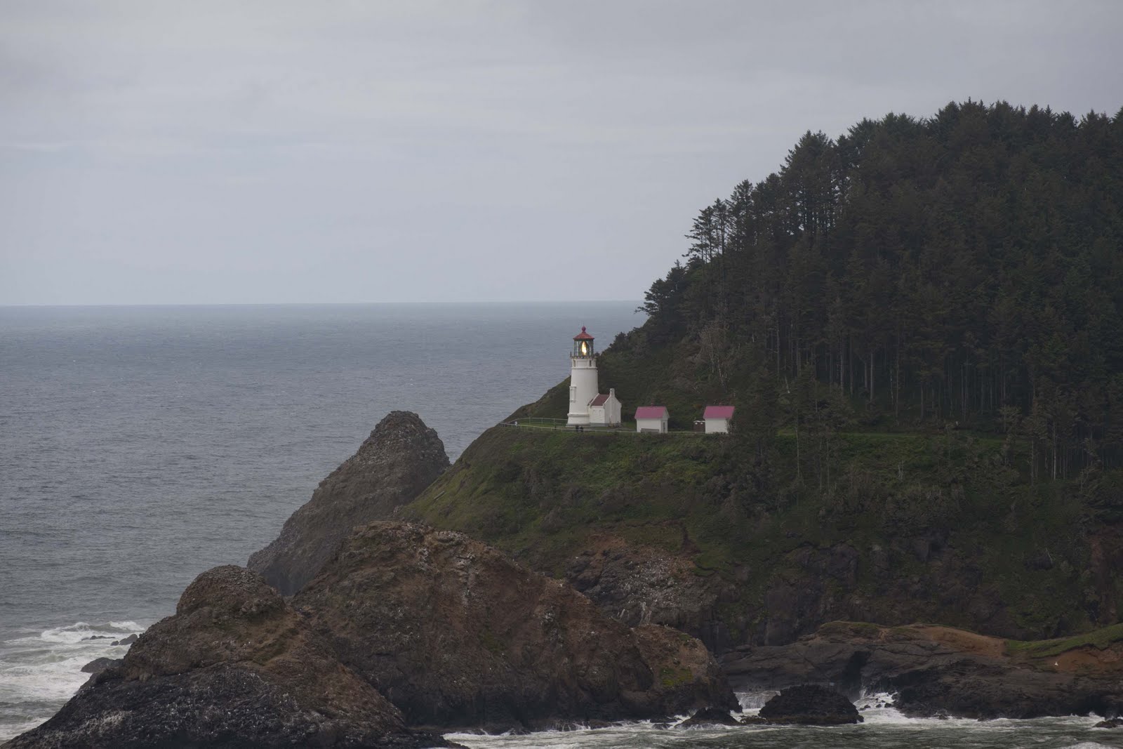
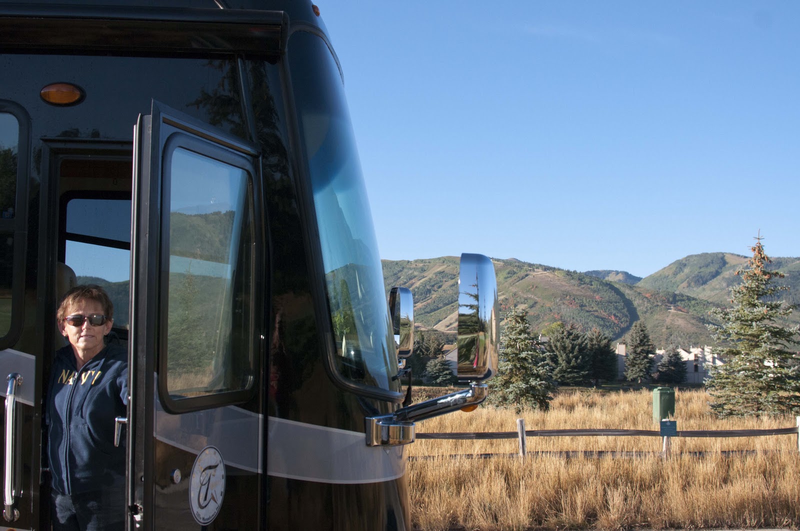
Autumn is upon Park City and the leaves are beginning to turn those wonderful, magical colors – therefore, it must be time for us to be on the road again.


Fall colors on the mountain – SO – C’mon..let’s hit the road!

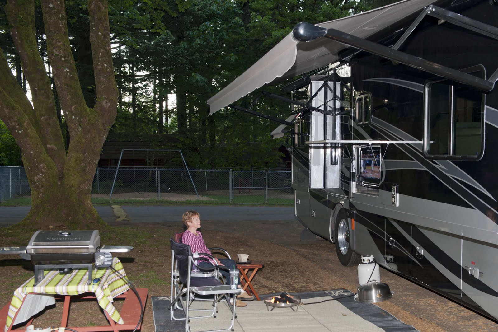
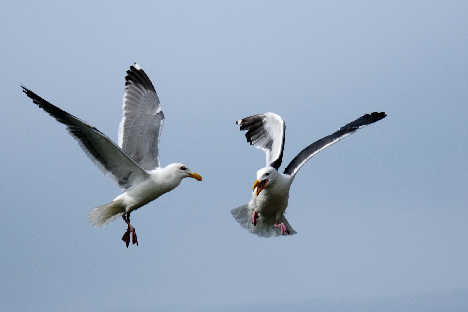
So – Magic is out of storage and we are on our way again. Our most immediate ‘activity destination’ is the Albuquerque Balloon Festival October 4th – but, we have a few miles to travel and activities to enjoy before we get there;-) It was appropriate, though, that the balloons in Park City were overhead as we pulled away from home Monday morning.

Must’ve known we were heading for the Albuquerque Balloon Fest.

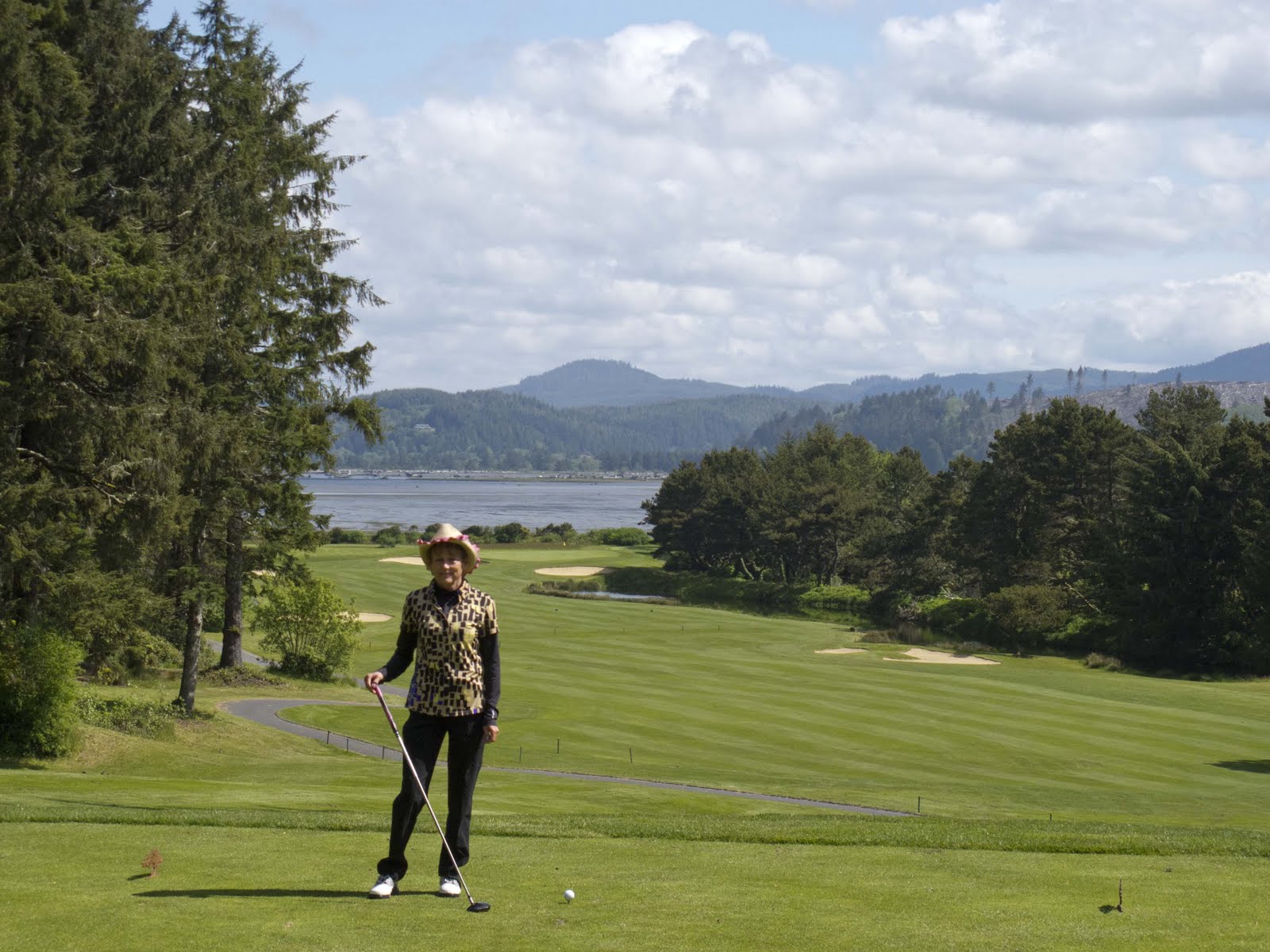
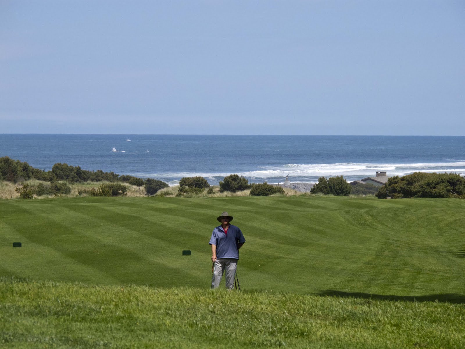
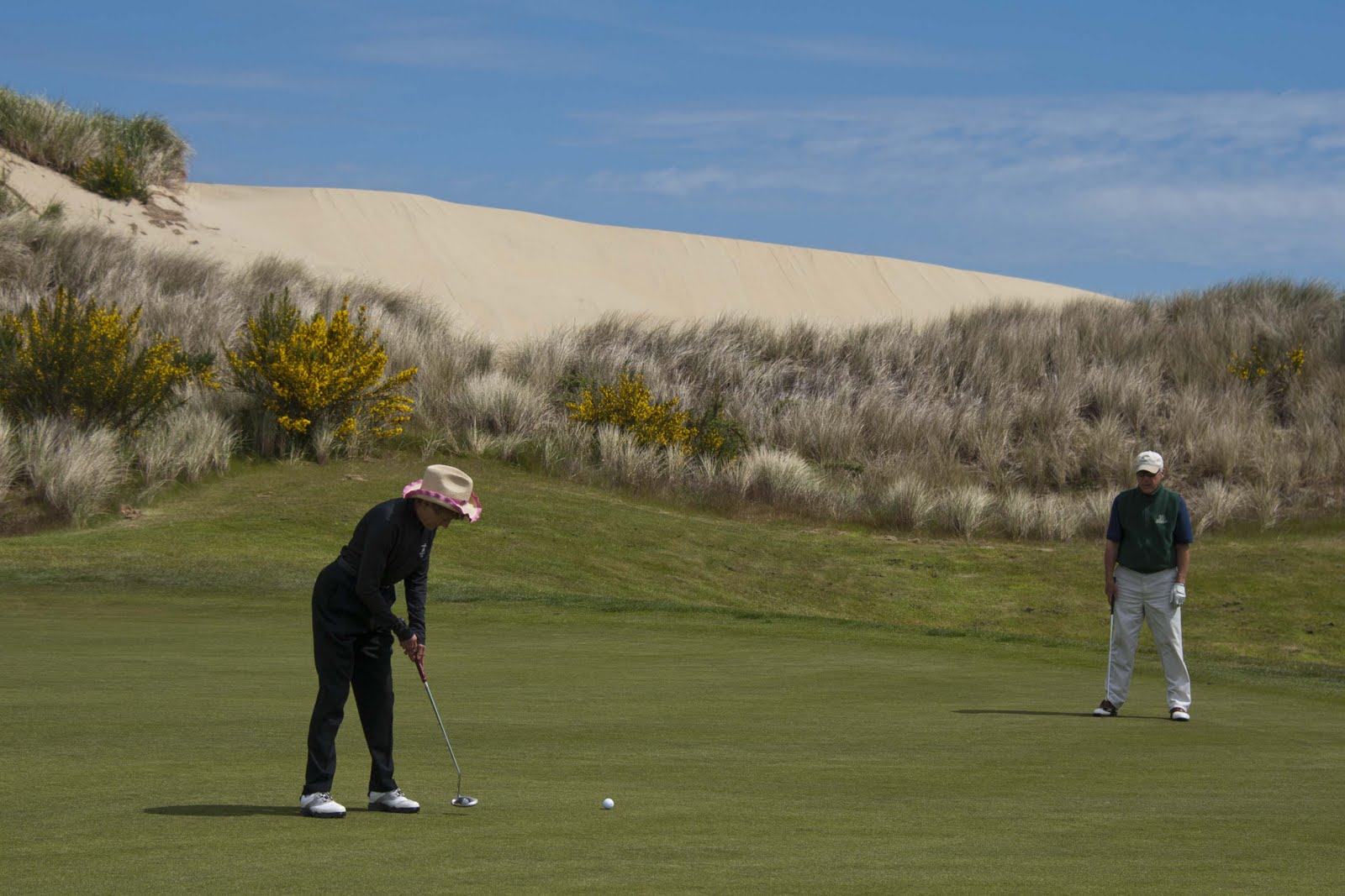
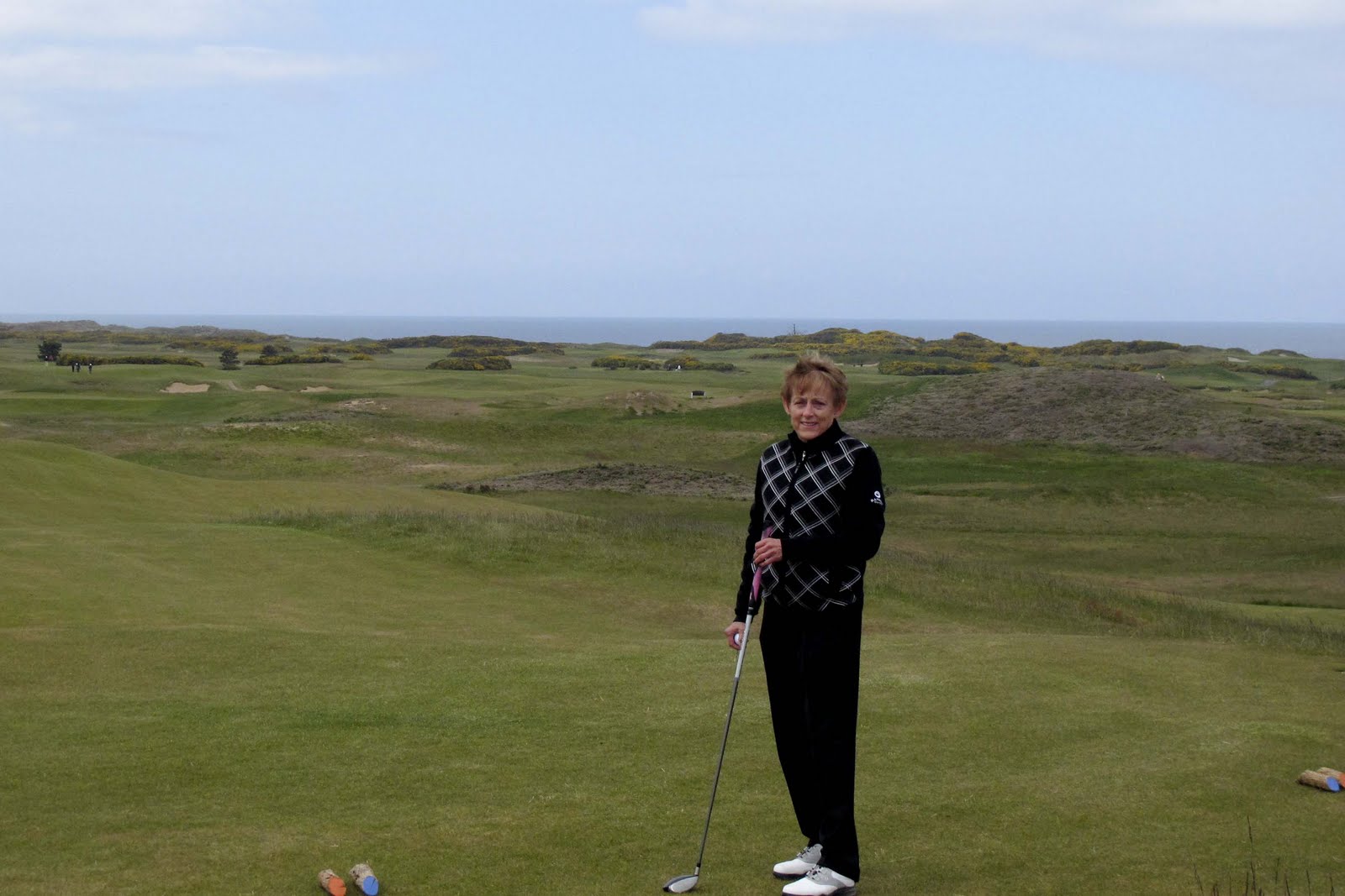
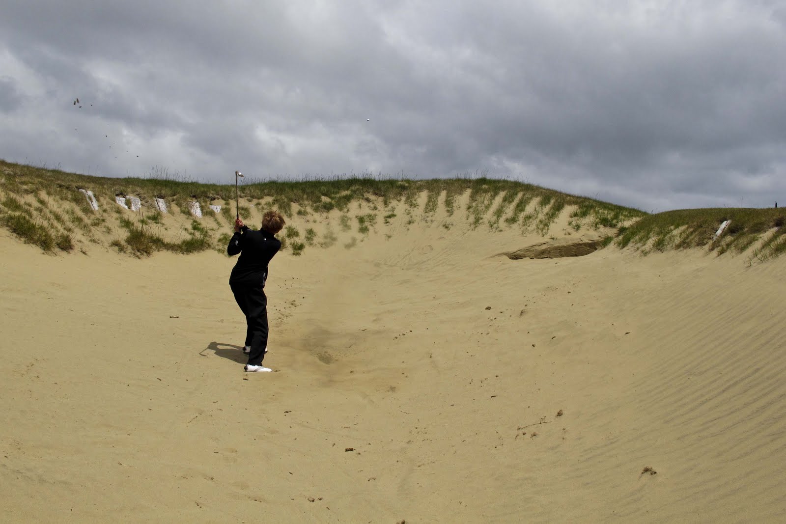
First stop – Moab and the beautiful red rock and many arches it has to offer. Also, that wonderful little muni course with the gorgeous views that we love. It warranted at least two days –

Golf in Moab is always a treat.

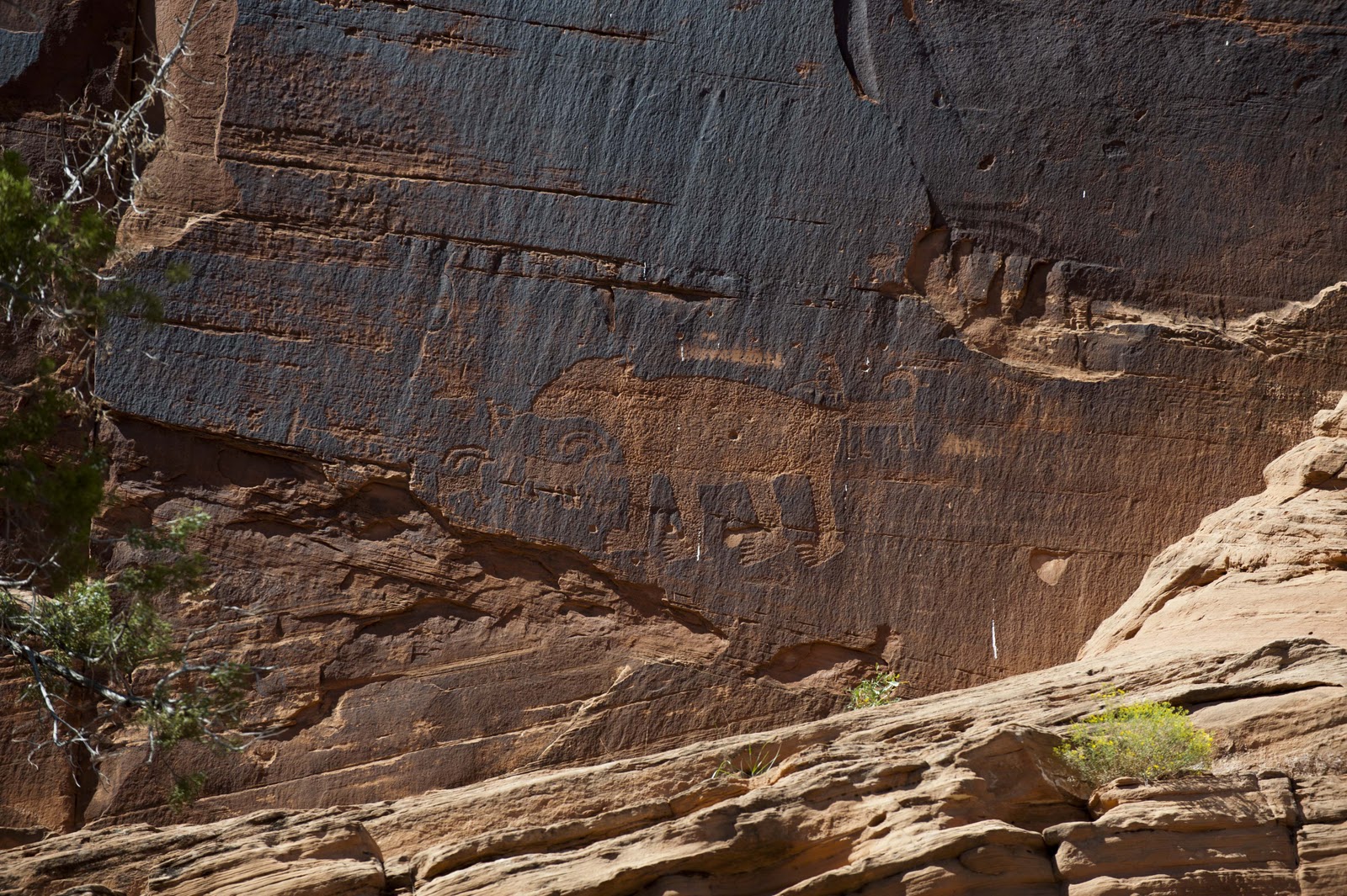
Then it was time to get serious about our National Parks (NP’s) and hiking and biking. We intend to visit many of the NP’s preserving the history of our Native peoples – learning about their history, homes and writings. This process was started with a drive down Utah Scenic Byway 279 where we were able to see petroglyphs from the Formative Period (1 – 1275 AD). There were “paper doll cutouts”, horned anthropomorphs holding shields, as well as a wide variety of other animal and abstract images. My favorite was the bear with the little man with a bow and arrow at his nose!


Petroglyphs galore. The Puebloans were very prolific.

Of course, we also found one of our usual dirt roads off the beaten path that took us up a beautiful canyon.

Oh, good. Another dirt road to explore!

This trip we even managed to find a Chuckwagon Dinner complete with Cowboy music to enjoy at the end of our day –

A chuckwagon dinner and a show. Most of the audience were French.

Tuesday – almost did ourselves in!! The day began with an 8 mile loop bike ride just to the west of the Arches NP. The ride was a lot of FUN (it did include a little bit of the slick rock!!) – and the views of the NP were wonderful –

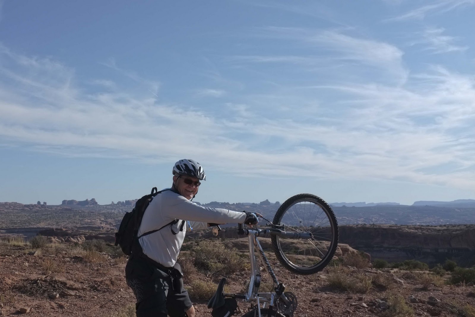
All right! Let’s ride. (See the Arch above his elbow!)
Arches Nat’l Park is in the background.


We got an early start, so the shadows were long.

After a quick ‘clean-up’ and lunch, Canyonlands Island in the Sky called.

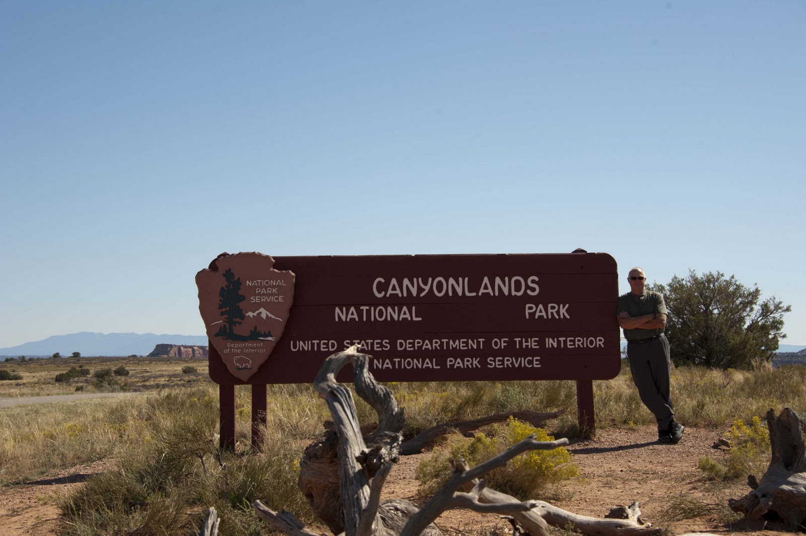
Off to explore Canyonlands.

There were many hikes to be had and we needed to get going. First up was the Rim Trail at the Grand View Point Overlook. Thousands of feet below was Monument Basin, Totem Pole and White Rim. It is hard to get a perspective from the pictures – but, we are 2,000 feet above the floor of the canyon and the monuments on the floor rise over 300 feet from the canyon floor!! It is sandstone layers of varying hardness that make up Canyonland’s visible rock. But the character of the land is largely shaped by underlying salt deposits, which, under tremendous pressure from the rock above, push upward, forming domes that fracture the surface creating these beautiful, interesting sites.
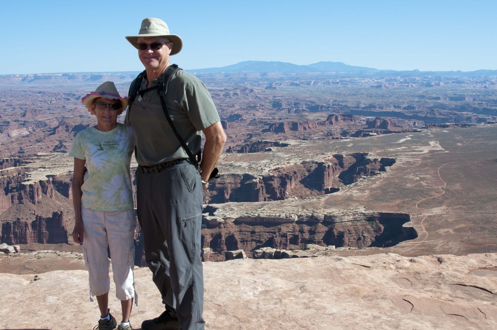

With deep gorges..
And gorgeous monuments!

There were short hikes to overlooks of the Colorado and Green Rivers, to Upheaval Dome (a mile-wide crater enclosed by rock strata upturned in concentric circles with a center rock spire – perhaps created by a meteorite) and Mesa Arch where we watched the sun cast long shadows as it set behind us.

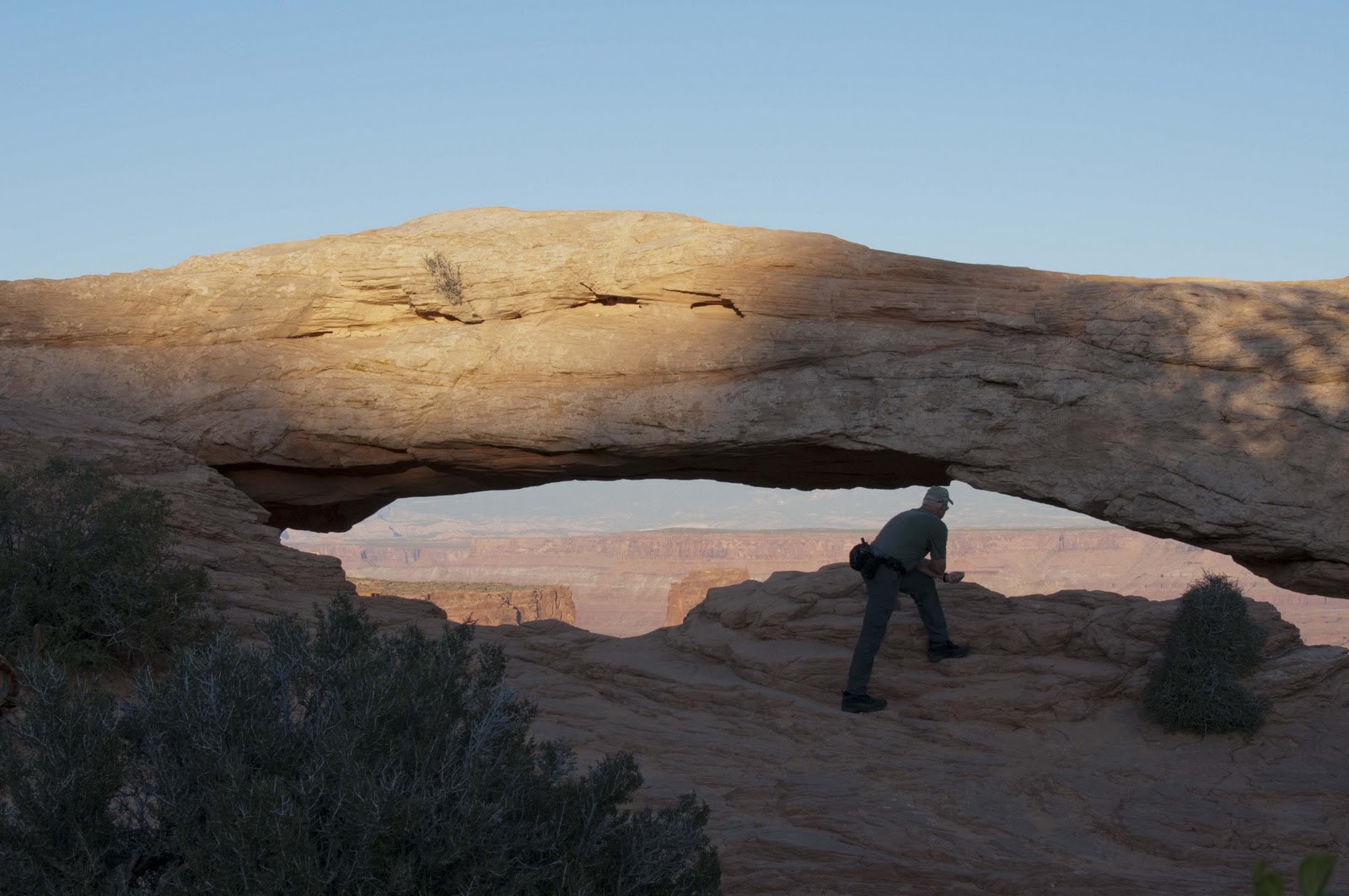
Mesa Arch as sunset nears.
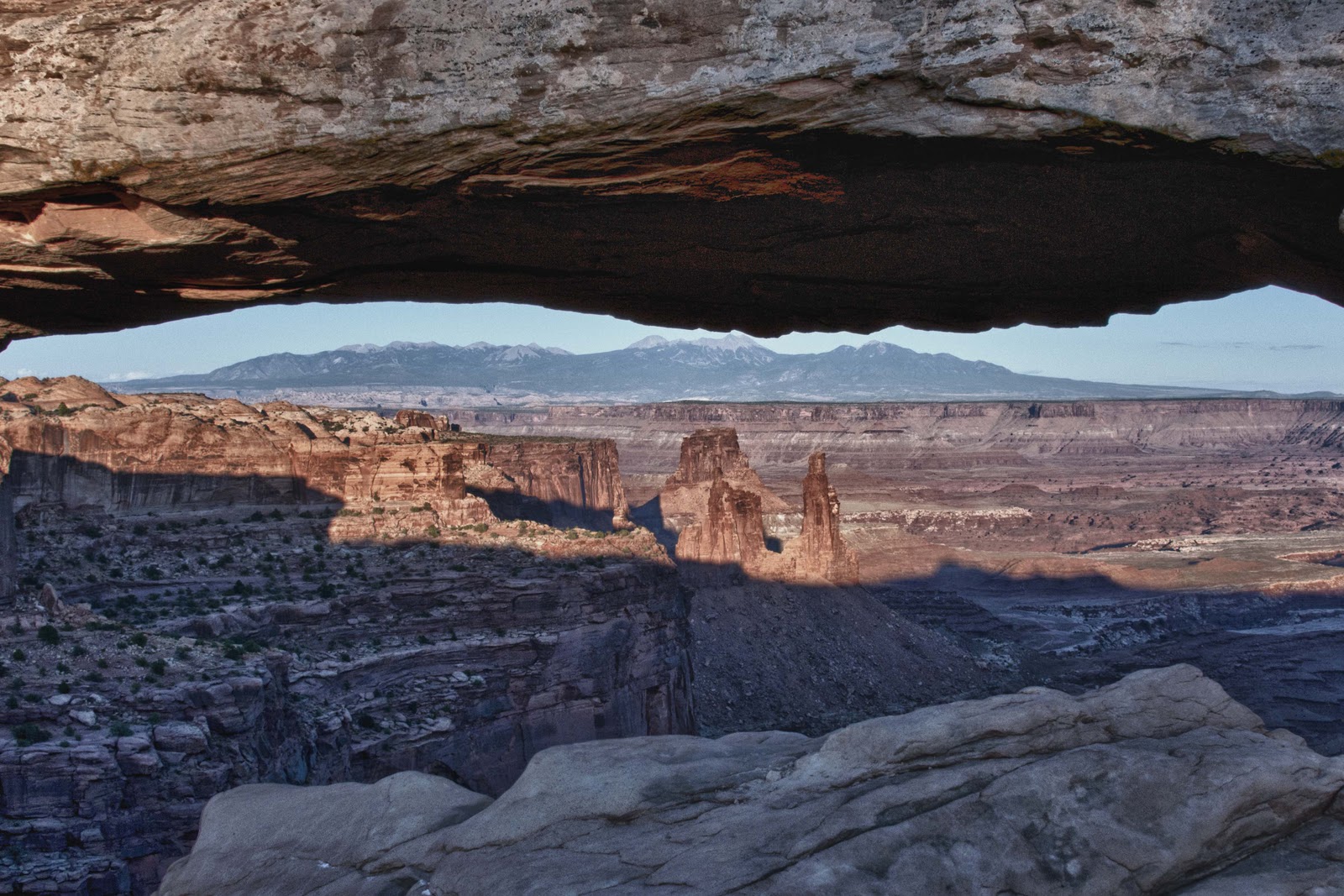
The LaSal Mountains are in the background (35 miles away!).


We had exhausted ourselves and headed back to Magic for a good night’s sleep;-)

It is great to be back on the road and enjoying all it has to offer. Hope you will stick with us and enjoy our travels –

Until next time – Elizabeth and Gary back in their Magic Bus


Pomp and Pageantry

While sitting at the Tiffin Rally, we discovered it was Fleet Week in Portland, with both US and Canadian Navy ships coming into port! So – we were off to spend the day in Portland and check it all out.

While wandering the streets of the downtown Portland area – which was quite charming-


Our World in Flowers! (Elizabeth is near the NW corner of Oregon.)
A beautiful old church – founded in 1851.
We needed one of these umbrellas on a regular basis the past two weeks.

waiting for the ships to come in, we came upon a Marine Combat Center Show Band doing RAP!!! Naturally we had to stop, listen and get pictures of this.


Huh… Marine RAP?
Semper fi, homies.

About 3PM, the bridges all started to go up – and there were the Navy ships in all their wonder along with the ‘fire boat brigade’! What a site to see and how much fun –


The Escort – Amazing!
The USS LAKE CHAMPLAIN getting ready to dock on the Willamette River.

After learning lots, a discussion with Bob Tiffin, enjoying the meals and entertainment – we said a fond farewell to our many new friends and headed back to Ashland for Brian Campbell’s graduation (our Godson). We were the beneficiaries of the Campbell family hospitality and a VERY HAPPY GRADUATION CEREMONY. Way to go Brian –

Pretend you can hear Pomp and Circumstance as it is being played by the SOU Orchestra.
Way to go Brian!

Visitin’ on the porch.

Now it is time to head Magic for home. So, we say a sad farewell to all of you for the time being. BUT – we will be back;-)

Much love to you all – and thanks for joining us in our adventures –

Elizabeth & Gary from our Magic Bus;-)

Bridges, Tunnels, Mountains and Rally…OH MY

There is a VERY long Indian legend about how the Indians prayed for a way to cross the mighty Columbia River and a landslide occurred creating a stone dam/bridge across the river. Today, there is just the Bridge of the Gods. Which we, of course, had to take –

Bridge of the Gods

on our way to another GREEN Dot road – with lots of tunnels right along the Columbia River –

More than 40 trains a day pass through this tunnel.

The destination was Indian Creek Golf Course, which is framed by snowcapped mountains – north is Mt. St. Helens and south is Mt. Hood. Beautiful –


Mount Hood from the Indian Creek Golf Course.

Our next move was a whopping 80 miles to the base of Mt. Hood and the Tiffin Rally. Tiffin is Magic’s creator – and the Rally includes 150 brothers and sisters of Magic!! A VERY weird feeling to walk down the road and see multiple Magic’s.


Haven’t seen this many Tiffin coaches in one place since we were at the factory
in Red Bay, Alabama last year at this time.

We are learning a lot – and getting a lot of FREE work done on Magic!! A great perk. The conversations with other Tiffin owners are also quite informative and enlightening – as there is always someone else with your same problems. Tonight is a dinner with the California Cowboys entertaining – so we have our dancing shoes on.

One shout out for the Ladies of Arizona State University and their Softball Championship – WAY TO GO LADIES!!!!

Next report will be from Ashland – E & G from the Rally;-)

Forts and Green Dot Roads;-)

Only one day left on the Oregon Coast – in Fort Stevens State Park. Figured it was time to find out what this Fort was all about – along with all the ‘fuss’ about Lewis & Clark and Fort Clatsop. Here comes another history lesson – so, if you just want the travelogue you might want to skip the first half of this posting;-(
Magic had now been parked in the campground portion of Fort Stevens for a couple of nights, and it was time to find out where the ‘Fort’ was and what it had to say for itself. LOTS!!
Here comes the “Did you know?”:
Fort Stevens was constructed during the Civil War and remained active until shortly after World War II! “Why in the world was a Fort necessary at the mouth of the Columbia in this far-away territory during the Civil War?” – you might ask. The British and pirates were ‘hanging around’ the area, and Lincoln was afraid that the British – who were siding with the South – would invade from here – and confiscate this territory. Although, if the South had won the Civil War – there was no need for the British to confiscate as this territory had been promised to them by the South for their assistance. The British were NOT really fond of “The Union” and were very willing to assist the South. And so, Fort Stevens was constructed and manned in 1864 – The only fort of its type on the west coast.
Try to imagine the moat and drawbridge that protected this original entrance to Fort Stevens.

The Fort was not really utilized during the first World War. In fact, four of the primary guns were removed and shipped to France to bolster the allied defenses. However, during World War II, a group of batteries was constructed along the west coast to supplement the harbor defenses. Fort Stevens is the only continental US fortification bombed during WWII (in fact since the War of 1812!) – struck by shells from a Japanese submarine off the coast on June 21, 1942!! During WWII barracks were constructed to house 2,500 soldiers. Today – there are only remnants of the installation to view.

Riding in this deuce and a half brought back a few Air Force memories for G.
E just thought she was in the Mash 4077!!
The bunkers remain but most of the large guns and mortar launchers are gone.

After our Jeep Tour of Fort Stevens, we were off to Lewis and Clark’s (The Corps of Discovery) Fort Clatsop. Not sure what was expected after viewing the intricate Fort Stevens – but, what we saw was not it. We were underwhelmed at the same time we were terribly impressed?!?! Fort Clatsop (the Clatsop Indians were one of the tribes that helped ensure the survival of the Corps) was the winter encampment for the Corps of Discovery from December 1805 to March 1806 while they prepared food and supplies for their return trip across the territory they had traversed and mapped. We were underwhelmed as the Fort was barely larger than Magic – but, we were terribly impressed that the entire Corps of more than 20 could live here for months along with stockpiles of supplies!!


Ft. Clatsop was very small. Very tight quarters for Lewis & Clark and the Corp.

After this day of history lessons, we needed something mindless(??) like a round of golf. Seems like the oldest (there is that -est again!) golf course in Oregon might fit the bill. Figured we might stand half a chance on this one – fooled us. One of the worst rounds of golf for both of us so far this spring;-( The upside is we played with friends – Jo & Greg – we have met along the way.

Fun course. The rain cooperated for the most part.

Since food is never far from our thoughts, we headed to the cute little village of Gearhart (home of chef and cookbook author James Beard) to drown our golf woes – and had a ‘snack’ at Beard’s Pacific Way Bakery and Cafe.

Friday was another moving day. And, this one was a long one – 177 miles!! This was REALLY difficult to cope with when for the last 6 weeks we had been doing anywhere from 20 – 60 miles at a stretch on moving day. Perhaps another GREEN Dot road would make the drive a little more tolerable. So – a GREEN Dot road it was! Sometime mid-morning Gary pulled over on a wide spot along the Columbia River to let the ‘caravan ‘ behind us pass. As long as we were stopped – a snack and a cup of tea were perhaps in order. So – we climbed out of Magic to watch the river flow by while we drank and next thing we knew this cargo ship was coming at us. (Hard to think of Portland as a ‘port’!) Boy was this thing BIG – and did it leave a wake!


The Columbia River is a major shipping route.

Our new camp is awesome!! The best thing about it is – it is about 80 degrees during the day and maybe 60 at night. We can actually sit out, watch the College Women’s World Series of Softball, make s’mores and enjoy the evenings WITHOUT three layers of clothes and almost no bugs. E is in HEAVEN!!!!

Enjoying the warmer weather we found at our new location and watching ASU in the college softball world series.

To celebrate the good weather, we wandered down Historic Columbia Gorge Scenic Highway – Historic US 30 – the oldest GREEN Dot road (scenic route) in the country. The KING of GREEN Dots!! It was built beginning in 1913, and still retains its old road character and charm –

Nice drive with great scenery.
Wonderful Old Bridges.
The original white guard rails were replaced in the mid 80’s.

One of the highlights of this historic highway is the aptly named Vista House. Built in 1917 to mark the completion of the road, this was to be – and is – a place for the tourist to stop, rest and take in the view from over 700 feet above the Columbia River.

This unusual looking building didn’t seem very utilitarian as a traveler’s waypoint-BUT –
The view was fantastic!!

The magnificent highlight is the series of waterfalls along this wonderfully charming old road. The biggest and best is Multnomah Falls, which drops 620 feet into a densely forested canyon, bridged by a delicate concrete arch. Can you find Gary??

Multnomah Falls.
Hello down there
Latourell Falls.

We capped off our day in the car with the sun roof open and the wind blowing through our hair with a dinner cruise down the mighty Columbia River on the Sternwheeler Columbia Gorge.

Ready for our evening dinner cruise.

What a beautiful evening that made E feel like “The Queen of the World”!!!


I’m Queen of the world!

Ahhhhhh!!!!! What a little really good weather does for the attitude;-)


The little village we are staying in – Cascade Locks – is quite cute with the little Main Street (Post Office and Ice Cream stand!) – AND a municipal airport!!

The Cascade Locks municipal airport.

E & G – Sailing off into the sunset on the Columbia River –

Say goodnight.

Memorial Day Weekend – Days to Remember

What better way to kick off the Memorial Day week-end than to visit the US Naval Air Station in Tillamook?!?! (Another Naval Air Station in the middle of cow pastures, just like Lemoore. But, at least this one is close to the water!)

Another Naval Air Station in the middle of dairy farms.

Did you know?? In 1942, the US Navy began construction of 17 wooden hangars around the US coastlines resulting in a huge semi-circle around the US. These hangars housed the K-class blimps used for anti-submarine coast patrol and convoy escorts. Two of these hangars were built at Naval Air Station Tillamook. They were commissioned in December 1942 and served the Oregon-Washington coastal area. Hangar “B” was the first one built and was completed in August of 1943. (Hangar “A” was completed in only 27 days – but, unfortunately, was destroyed by fire in 1992.)

The fact that these hangars were built so quickly was a major feat that – perhaps – can only be understood when one knows that each of these structures houses SEVEN ACRES under one roof. That is enough space to play six football games!! BIG!

The signs to locate the museum were hard to spot. Almost missed it.
One of the world’s largest clear span wooden structures. 192 ft. high x 300 ft. wide x 1,072 ft. long. Dwarfs this cargo carrier – the Mini Guppy.

If you are a fan of vintage airplanes, don’t miss this adventure. The hangar now houses a collection of more than 30 World War II combat aircraft, including a P-38 Lightning, F4U-Corsair, P51-Mustang, PBY Catalina and SBD Dauntless dive bomber – AND, a Ki-43 Hayabusa (also known as Oscar) – the most important fighter of the Japanese Army Air Force. Many of these planes are still in flyable condition!!


Republic Aviation’s P47 Thunderbolt. One of many aircraft on display.

As we bid Tillamook farewell, we crossed one more McCullough-designed bridge – built in 1931 in a bowstring arch design.

Another McCullough Bridge. This guy must have been quite the salesman.

Next stop – Astoria, Oregon.

Our touring began at the Flavel House Museum. Captain George Flavel (1823-1893) found his way to Astoria in the mid-1800’s, became a noted bar pilot on the Columbia River – which, coupled with his being an astute businessman, led to him owning a good portion of Astoria by the late 1800’s (as best we could tell)! He built his dream/retirement home in the Queen Anne architectural style on a hill overlooking the Columbia River for $36,000 in 1886. It included ALL the modern conveniences – gas lighting, a central heating system, even indoor plumbing, which meant ‘real’ bathtubs and toilets!


Built for $36,000.

It sits on park-like grounds covering an entire city block. The flowering Rhododendron (remember our Rhody Day Celebration in Florence??) are just beautiful up here! And, they are everywhere in the wonderful shades of pink and lavender. Couldn’t resist this picture of Gary’s handsome face enhanced by all these Rhodies!!

More Rhodies.

Heading up Coxcomb Hill, one finds the 125-foot Astoria Column sitting atop the Hill. The Column was built in 1925 to commemorate the westward sweep of discovery and migration. This unique structure has 14 murals made in Italian sgraffito technique (etched concrete). You can see these murals in this fantastic photo taken by my personal photographer traveling with me –

Astoria Tower.
We were glad the tour bus didn’t beat us to the stairs.

Of course, Elizabeth ‘demanded’ that we climb the 164 steps of the spiral staircase to get the breathtaking views from the top of the column! From here you can see the bridge crossing the Columbia River, connecting Oregon to Washington, and the Columbia River flowing into the Pacific Ocean.

Great views from atop the tower.

We did run across this one building in the middle of Astoria, which really intrigued us – the Film Museum/County Jail. Not sure if this one building is still used for both purposes – if it implies that one equals the other – or it used to be one and is now the other?!?!

Is this a statement on the film industry’s net profit sharing arrangements.

Tuesday was another rainy day – so, back in the car to investigate the coast. Of course, this whole area celebrates components of the Lewis and Clark Expedition – the end of their trail, their camp before returning, etc. Seaside, Oregon’s oldest seafront resort, has a statue in “The Turnaround” of Lewis and Clark marking the end of their trail.


The end of the trail for Lewis & Clark.

Seaside is a real trip – built as a destination for Portlanders to ride the railroad to the beach (that railroad thing again!). It is a step back in time to the old Boardwalks on the beach! Here every other store is a candy store – mixed in with the tee shirt shops. And, how long has it been since you saw a building housing bumper cars and a Tilt-a-Whirl?? You gotta see it once – but, once is more than enough!

Ecola State Park and Cannon Beach, on the other hand, are delights! We braved the mist and rain to walk to the viewpoints in Ecola State Park to get what we could in the way of pictures of Cannon Beach, Haystack Rock and the Tillamook Rock Lighthouse. (Ecola is the Chinook Indian word for whale and was affixed to this region by the Lewis and Clark expedition, as they found a whale washed up on a beach here.)


Wet morning. You can almost see the lighthouse.
Haystack Rock in the distant mist. Cannon Beach is hidden in the mist!

The rain got the better of us this time – so we ventured on to Cannon Beach to wander the galleries and shops. This little community is an artist’s colony – so the galleries have wonderful pieces with a great variety to please all eyes. Don’t miss wandering here if you are in the area.

As the day wore on – the clouds began to part. So, we headed back to Ecola State Park to see what kind of shots there were to be ‘had’ with a little sun. The waiting was well worth it – don’t you think??

I can see clearly now..
This lighthouse is no longer used, except as a repository for cremated ashes
.

Haystack Rock is now visible with Cannon Beach in the background.
Ya’ got to be kidding me…right!
Indian Rock

The bird atop this rock seemed to enjoy the spray….. for over a half hour.
Elizabeth shot these trees because they reminded her of me…
I hope she meant this one.. tall and statuesque.
and not this one… old, gnarly and decrepit.

So – these were our Memorial Day travels. During the days we also watched coverage of events across the country and in Washington DC honoring those who have and are serving this country. We talked a lot about our family members who had served for us in the past and our son-in-law and cousin who are serving for us now. We also celebrated Keith’s 36th birthday – hard to believe he would have been that old. We just enjoyed the remembrances.


Main Street, USA, decked out for Memorial Day.

All the houses too.

Hope you all had a memorable Memorial Day – E & G

Wait ‘Till the Sun Shines (Charley)

So – the rain finally caught up with us. Really can’t complain, though, two or three days out of about 80 isn’t bad. And, all it did was make us change our thinking for a few days – we went inside. Gary opted for a massage and Elizabeth went for that mani/pedi she has missed for 11 weeks! We also did a quick ‘car tour’ of the areas in Newport we had not yet gotten to – including the Yaquina Bay lighthouse (this made the third of the nine Oregon lighthouses for us) and yet another of the McCullough bridges (this is claimed to be the most photographed of his bridges). The Yaquina Bay lighthouse is the only wooden lighthouse on the Oregon coast, the only one with living quarters attached and the oldest of the Oregon lighthouses.

Yaquina Bay Lighthouse – the oldest.
Yaquina Bay Bridge.

A nice Chinese dinner with a couple we met at the recent coach park was also in order. (We hope to meet up with them again in Astoria and then at the Tiffin rally in Welches.)

Then it was time for a moving day. So, other than the fact that Gary had to drive in the rain, the weather was not a factor. We moved another HARD 70 miles up the Oregon coast – from Newport to Tillamook. Sound familiar?? Yes – it is the cheese place. So we drove through a lot of cow pastures on the way. After finding a place to park and setting up, we were off to the Tillamook cheese factory. VERY INTERESTING!!

The Tillamook cheese factory is a century old dairy cooperative producing 58 million pounds of cheese each year. A visitor to the factory has the opportunity to see milk come in the front door and go out the back door as packaged blocks of cheese. And then, of course, you have the opportunity to taste – and then buy;-)


This joint was really cheesy.

BUT, you will probably never guess the best part of the cheese factory?!?!?! It is the ice cream!! Yes – ice cream. Being a dairy cooperative they don’t JUST make cheese. AND, their ice cream is delicious. Especially the chocolate peanut butter ice cream with hot peanut butter topping;-)!!!! What more could one ask for to make them happy on a rainy afternoon?!?!

Saturday we awoke to sunny skies again, which led to a road trip to the beach on the Three Capes Scenic Loop. First stop was Cape Meares to see – what else – the Cape Meares Lighthouse. This is the shortest of all the Oregon lighthouses (as you must have noticed by now all lighthouses, bridges, trees, etc. have to be the ‘-est’ of something – oldest, shortest, tallest, etc.).

Cape Meares Lighthouse-the shortest.

As is typical of the spots where a lighthouse is placed – the views are magnificent! Especially the view of the Three Arch Rocks.

3 Arch Rocks seen from the Cape Meares Lighthouse.

The candelabra-shaped Octopus Tree also lives nearby. This is a large Sitka spruce that is thought to have been ‘shaped‘ by the Killamook Indians.

This tree really spruced things up.

The rocks and trees are homes to many forms of bird life and the park includes many interpretive viewing areas. Today the bald eagle was the rare sighting. Unfortunately, we were about 30 seconds too late to ‘capture’ both the parent and youth – but, Gary did a good job of getting the youth as he was catching the upward thermals and going heaven bound!

Gorgeous young eagle..too far away for a really clear shot.

By the time we reached Netarts Bay, we had worked up an appetite. The patio at The Schooner Restaurant was a perfect place to enjoy the ocean, Cape Lookout view, sun and good food. Almost couldn’t pry us away. But, we had more territory to cover – so, on to the third Cape – Cape Kiwanda. What a kick this was – cars right on the beach and sand surfing!

Parking on the beach was the norm in this little village.

Might have some sand in your knickers after slip-sliding down this hill.

Tillamook is not just farmland – it adjoins gorgeous woodlands. Unfortunately, in 1933 catastrophic fires blackened some 550 square miles of northwestern Oregon’s old-growth Douglas fir. A favorite hike in the area is a quarter-mile walk to Munson Creek Falls, which winds through stands of gargantuan Sitka spruce and red cedar trees that managed to escape the burn. At the end of the walk is the highest (there is that ‘-est’ again) waterfall in Oregon’s Coast Range – a clear stream that plunges 319 feet over basalt cliffs. Truly a beautiful spot –

A very potholed road led to this charming waterfall .

Perhaps you can tell that the rain did not slow us down much. We just moved inside until the blue skies returned.

One other ‘sunny’ thing happened on Friday – Gary’s Mother’s house closed;-) This is a great relief for Gary and his brother – so, we celebrated BIG!!


Still more to experience here in Tillamook – will let you know about that next time.

Happy the sun is back – Elizabeth & Gary


Just Thoughts and Observations

It was a rainy day to start, so we decided that a car trip was the order of the day. Corvallis was our target – we could investigate the Oregon State campus and whatever else came our way.

What a delightful afternoon. The little shopping area (we assumed it to be the old downtown area) adjacent to the campus was a wonderful little walking area with our kind of shops – sports, camera, men’s and kitchen shops. Oh yes – and the proverbial Starbucks! Couldn’t ask for anymore than all of that.

The Oregon State campus was beautiful and charming. There was a baseball game about to start (perhaps you would remember that the underdog Oregon State won the College World Series in 2006!?!?) – and, had it not been for the rain and cold, we surely would have clambered into the stadium to take in the game.

The thought struck us on the drive back to Magic – we had just driven 50+ miles (one way) for an afternoon’s activity. This was twice the distance we had moved Magic some of our days wandering up the coast of California and Oregon!!!! But, the drive was beautiful and the activity was FUN!! So – who cares???

No pictures on this outing – just thoughts and observations.

More later – Wandering Souls (E & G) from rainy Oregon

Good Food, Good Views, Good Weather, Good Golf

Believe it or not – today marks ELEVEN (11) weeks on the road!! When we left Park City on March 8th, it seemed like we had soooo much time to travel ahead of us and that thinking has remained with us. Until today – and the realization that there is a little less than three weeks left in this adventure;-(

Monday (May 23), we said a fond farewell to Florence with the promise to return. Another tough travel day was on the agenda – about 65 more miles up the coast to a State Park just south of Lincoln City. The Seal Rock Bakery & Espresso Drive-thru presented itself early in the drive and we couldn’t resist! Neither should you if you are ever in the area. They have the BEST home-baked breakfast goodies;-) (We did the walk-up ‘thing’ in order to save them the drive-thru with Magic).


Man, did they have good pastry!


We never made it to Lincoln City!! Found a great place (Pacific Shores Motorcoach Resort, a sister resort to where we stay in Las Vegas) just north of Newport, OR – and couldn’t resist the views.

Hmmm, so what do you think of our view?
Pretty good?
Damn good!!


Perhaps one of the most notable ‘must dos’ in Newport is the Oregon Coast Aquarium, which is ranked in the top ten in the nation. I am just NOT an ocean/sea person – much prefer bears. It was interesting, however, to walk through the “Passages of the Deep” exhibit where one walks through a suspended underwater acrylic tunnel to see sharks, bat rays, and other deep-sea fish swimming. All this visit did was confirm why I don’t eat anything that comes from the ocean!!


The Newport Aquarium was nicely done.

A visit to the historic Nye Beach district seemed as though we were in Manhattan Beach , CA – with far fewer people. In the 1890’s the “summer people” began coming to Nye Beach by train (here is the railroad in development again!). Today, Nye Beach attracts tourists to shops, restaurants, lodging, and – in our case – also in search of the dry cleaner!


Nye Beach.

Tuesday was yet another day with absolutely beautiful weather!! So – we were off to the golf course. Played a beautiful course at the Salishan Lodge just south of Lincoln City – front 9 inland and the back 9 on the water. Again, we had the course all to ourselves. Couldn’t have asked for a nicer round of golf!


Wish my golf game was a pretty as the flowers.
Salishan Golf Course was nicely laid out with some good views along the way.

Heading ‘home’ back down the coast several stops were in order. Just south of Depoe Bay we jumped onto the ‘old road’ – the Otter Crest Loop – which hugs the beaches and sandstone bluffs. It does ascend to the 453-foot headland of Cape Foulweather – named by Capt. James Cook, the English explorer, who discovered the Cape in 1778. The weather was particularly stormy on the day of his discovery – thus the name. If he had been there on a day like our visit the name would have been “Cape Clear as a Bell”;-) (Gary’s contribution to the blog write-up!)

We had great weather at Cape Foulweather.
The view from Cape Foulweather. See the Lighthouse in the distance?
Ahoy, Matey!

Our next two stops could be spotted from the lookout at Cape Foulweather – Devil’s Punchbowl and the Yaquina Head Lighthouse.

The Devil’s Punchbowl – which looks like a punchbowl carved out of the lava rock – gives a ringside seat to a frothy confrontation between rock and tide –

The Devil’s Punchbowl.

The Yaquina Head Lighthouse sits atop (and at the tip of) a narrow, coastal headland that extends one mile into the Pacific Ocean. For 4,000 years, Yaquina Head has provided coastal inhabitants with a pathway into the open sea. Native Americans used this pathway as a place to hunt marine mammals. Explorers, marine traders, and pirates used the headland as a navigational marker for more than 300 years before the U.S. Lighthouse Service built the Yaquina Head Lighthouse in 1873. At 93 feet tall, this is Oregon’s tallest lighthouse and continues to cast its light with the original lens in place!!


Yaquina Head Lighthouse in Newport, OR.


These gulls seemed to be having a little airborne spat.

Well, it had to happen. After such a spectacular day yesterday the rain finally moved in and it is pouring! It is a good thing we have days like this every now and again or this blog would never get any postings.

Maybe now that this is done, we will take a little car trip over to Corvallis to check out the University and get our afternoon snack;-)

Sun’s out – gotta go – E & G

Florence – Ti Amo!!!!

Leaving Bandon, we wandered a whole 70 miles up the coast through “Dune Country” – Oregon’s Sahara – traveling the entire 40 mile expanse of the Oregon Dunes National Recreation Area, which is part of the Siuslaw National Forest. This was really something to see – and experience! In order to find out all about it (including hikes, campgrounds, good places to eat up the coast, etc.) be sure to stop at the USFS Oregon Dunes Visitor Center in Reedsport.

These dunes have been formed by the natural forces of wind, water, glaciers and time and are like no others in the world. They are the largest expanse of coastal sand dunes in North America, some towering to 500 feet above sea level. The desert-like landscape blends with lakes, rivers, ocean and forest creating a diverse ecosystem filled with plants and animals that changes daily. These blending ‘systems’ also create confusing pictures for the mind’s eye as you travel from desert dunes immediately into forests then back to the tumultuous ocean against the lava formed rocks. (You will see this in the pictures below – all taken in a 20 mile stretch!)

But – back to the dunes and their history lesson. It has taken about 55 million years for these Oregon Dunes to develop, starting with the building of the Coast and Cascade Mountain Ranges (via lava from the earth’s core). Then glaciers, wind and rainfall began to grind these peaks down to tiny grains of rock and carry them to the ocean. There currents push the sands back onshore, where winds sculpt them into dunes.

There are foredunes – low hills parallel to the ocean, which exist because European beach grass slows the wind causing the sand to drop out and pileup. (The European beach grass was originally planted in the early 1900’s to stabilize sandy coastlines and protect roads, railroads, water supplies, etc. But, now the grass has taken over and become a real problem changing the scape and the ecosystems.)

Followed (moving inland) by deflation plains – areas scoured out by the wind all the way down to the water table. These appear as small lakes.

Then there are transverse dunes – with wave patterns; oblique dunes – the largest and most spectacular dunes growing as tall a 180 feet; and parabola dunes – tangling with the forest to see who wins out!

These dunes provide miles and miles of opportunities for recreation including off-road vehicle use, hiking, photography and camping – to name only a few. We felt it necessary to take full advantage while in the area. First a hike to ‘get our feet wet’. So – a walk out the small path to the rear of our RV park, which had “dune access”. Silly me – I thought up and over the (approximate) 100 foot dune and we would be at the ocean!*#$ When we hit the top of the dune the expanse of sand before me took my breath away!! REALLY. And, as we walked a short distance and looked from whence we came – one had NO idea which direction might be the way home?!?!? So – lots of footprints – like dropping breadcrumbs. Maybe a sand angel or two. And the beginning of a sunset. AND, by the way, the ocean was no where in sight. Turns out, it is about a mile and a half away.


I hope the wind doesn’t blow before we get back.
Sand Angel

Shady characters!

Well, after this little adventure, I just had to do the dune buggy thing. Sand Dune Frontiers provided the ‘buggy’ and a knowledgable driver that gave us a good turn on the rippled dunes – out to the ocean – AND safely found his way home!! What a BLAST!!


And awaaaaaay we go! (Aliens????)

Beach cruisin.
These dunes stretch 50 miles along the Oregon coast.

Our home away from home for the last four days has been just that. Florence – Oregon, that is – not Italy. And, we have fallen in love. This little town on the Oregon coast reminds us sooooo much of Park City. Especially since we just happened to be here for “Rhody Days”!! Perhaps not what you might be thinking – this is the celebration of the Rhododendron, which is in full bloom decorating the roadways, town, lawns, etc.


Namesake of the Rhody festival.

This is the Florence equivalent of Park City’s 4th of July. Everyone from all the surrounding area is in town for all the festivities, which include breakfast, BBQ’s and pie sales by the Elks, a vintage car cruise on Saturday night (I truly felt like I was in a scene from American Graffiti!!), a flower parade Sunday morning, a carnival at the foot of Main Street and the line up of Harley’s on Main Street through it all –


Bikes and bikers galore.
Carnival atmosphere.
Lots and lots of neat old cars.

Our “Road Trip USA” book says this about Florence:

“If first and last impressions are enduring, Florence is truly blessed. Entering the city from the south, travelers are greeted by the graceful Siuslaw River Bridge, perhaps the most impressive of a half-dozen WPA-built spans designed by Conde McCullough and decorated with his trademark Egyptian obelisks and art deco stylings.”


Siuslaw River Bridge in Florence, Or.

As “Road Trip” continues, the best part of Florence is Old Town, along the north bank of the river. Just like Main Street Park City, Main Street Florence is filled with cute little shops, galleries and lots of restaurants. We sampled it all!!

Downtown Florence.

The activity and scenery do NOT end at Florence. Hopping in the car, we headed 10 miles up the coast to discover the Sea Lion Cave, America’s largest sea cave and the only mainland rookery for the Steller sea lion. The formation of these caves began over 25 million years ago. They are the height of a 12-story building and the length of a football field. The Steller sea lion makes its home in these caves in the winter and moves to the rock ledge just outside the cave in the spring and summer. These dudes are BIG! The bulls weigh up to a ton when full grown (and are VERY territorial) – the cows are about half as big. We saw them outside the cave sunning themselves on the rocks (unfortunately, wrong time of year for them to be in the cave) –

At the Sea Lion Caves.

While touring the cave, we met a marine biologist (who also ran a whale watching business a little further up the coast). She suggested we stop a few miles up the coast at Strawberry Hill, where sea lions, with their pups, were on the rocks just off the beach – good photo ops. So – we were off on another adventure to Strawberry Hill. Sure glad the tide was out –

At Strawberry Hill searching for more sea lions.
There they are.

The old Heceta Lighthouse also beckoned (or maybe beaconed?!?!). Purported to be the most photographed beacon in the US, this lighthouse was built in 1893 and named for the Spanish mariner who is credited with being the first European to set foot in the region. Originally, this lighthouse was manned by three ‘keepers’ who rotated their watches. In 1893 this was a VERY isolated spot – so, the houses for the three were part of the facility as was a school for their children. All supplies and materials to build all the structures were brought to Heceta Head via the ocean and carted up the hill to the building sites. A distance view can be captured from the Sea Lion Cave – or an up close and personal from a tour at the lighthouse.

Haceda Lighthouse from the caves lookout.
From a little closer vantage point.
Big glass!! My Nikon has lens envy.

Next stop – Cape Perpetua. Absolutely beautiful area that you don’t want to miss if you are traveling anywhere close! Early explorer Captain Cook observed this magnificent headland in 1778 and named it after Saint Perpetua. In 1933 Pres. Franklin D. Roosevelt formed the Civilian Conservation Corps and Cape Perpetua became a base camp for the young men to learn skills. Many of the campgrounds, trails, and plantings are the work of the young men of the CCC. In 1966, 2,700 acres were set aside as the Cape Perpetua Scenic Area for the unique ecological characteristics found where the temperate spruce rainforest transitions to the sea.

Trails lead in all directions from the Siuslaw National Forest visitor center at Cape Perpetua – so stop there for information and to watch any number of short videos about the area and its wildlife. Then start out in any direction for any length hike you want to get the most stunning views. We headed first to Devils Churn – a wild alcove where the ocean crashes in on the volcanic rock –

Devil’s churn.

Then, 700 feet above Devils Churn and the road to the “Best View on the Oregon Coast”!! This is the highest point accessible by car on the Oregon Coast and provides views of 75 miles of coastline and 20 miles out to sea – on a clear day (sadly – this was not a clear day as there was a lot of fog;-( ). Still – some stunning views –

Bird’s eye view of Devil’s Churn.
Great viewpoint. I’m sure even greater on a clear day.

There was also a morning of golf at a wonderful, Rees Jones link design course – Sandpines –

Sandpines Golf Course was lots of fun.

And, a delicious Thai dinner at Best Thai – a recommendation from the Ranger at the Visitor Center in Reedsport.

So – Florence, I love you!! But, it is time to say good bye and move on up the coast to more adventures and new experiences.

We also wonder: We have encountered bridges built by the CCC in Sabino Canyon at the very beginning of our trip – to the bridge into Florence built by the WPA and the lookout at Cape Perpetua built by the CCC – and many projects in between. As we enjoy and write about these ‘projects’ of the WPA and the CCC and are so happy about what they provided us to enjoy today – will our grandchildren enjoy and write about the ‘projects’ of the Economic Recovery Act in the same way in the future???? Hum??

Well, this has been a very busy three days. Hope you have not been too bored by this long dissertation – but, maybe at least enjoyed the pictures. Hopefully, the next posting will be a bit shorter – as this has taken all of Sunday to get written.

Ponder the projects – Elizabeth and Gary


Old Macdonald – E-I-E-I-O;-)!!

Well – the last two days have been sheer bliss – in totally opposite directions!!

Magic was moved back to the coastal area, where we found a wonderful Oregon State Park – Bullards Beach State Park – with full hook-ups, large spaces and almost the whole park to ourselves! (Only downfall was the mosquito population, which pretty much kept us inside instead of at the campfire making s’mores.)

The view from our living room at our parking spot in Bandon, OR.

One whole day was devoted to – NOTHING. Slept late, got massages and manicures, read books, watched a basketball playoff game and played Rummikub. A perfectly delightful day.

AND, we needed it as Wednesday the Old Macdonald Course at Bandon Dunes was on the schedule. For those who aren’t familiar with the Bandon Dunes courses – there are four courses (we previously played three of the four – so, only splurged on the newest – Old Macdonald) designed in the style of the links courses at St. Andrews and right on the ocean – so lots of wind, and often a lot of fog or rain! They are also walking ONLY with a caddie. Oh yes – three of the four courses are ranked in the top five courses to play in the US – Old Macdonald is ranked number 5;-)

We had the most glorious day in terms of weather – some wind BUT NO rain or fog. Just beautiful blue sky with clouds passing by periodically. AND, more glorious – we had the entire course to ourselves!! Seriously, there was one other 4-some we saw once or twice. This course is visually stunning – especially as you walk up a sand dune from the men’s tee at the third hole (the men have a blind shot up and over the dune) to the women’s tee at the top of the dune. The whole rest of the course and the ocean open up before you! Unbelievably beautiful!!!! Even though we have a talented photographer traveling with us – the pictures do not do justice to the views – or our day –


You have a view of almost the entire golf course from the 3rd tee.

Loved the course.. lot’s of fun to play.

The course was ringed by gorse which were in their full, yellow bloom.

There were great ocean views from several holes on the golf course.

This bunker was one “big mutha”! Note Elizabeth’s ball flying safely out of the trap.. it landed on the green, near the hole. GREAT OUT!!

This Old Guy (the TREE not Gary) stands guard over the Old Macdonald golf course at Bandon Dunes.

Time to move on up the road – more later –

Ta Ta For Now- Elizabeth & Gary from Old Mcdonalds